Keyhole Canyon Topo Map Nevada
To zoom in, hover over the map of Keyhole Canyon
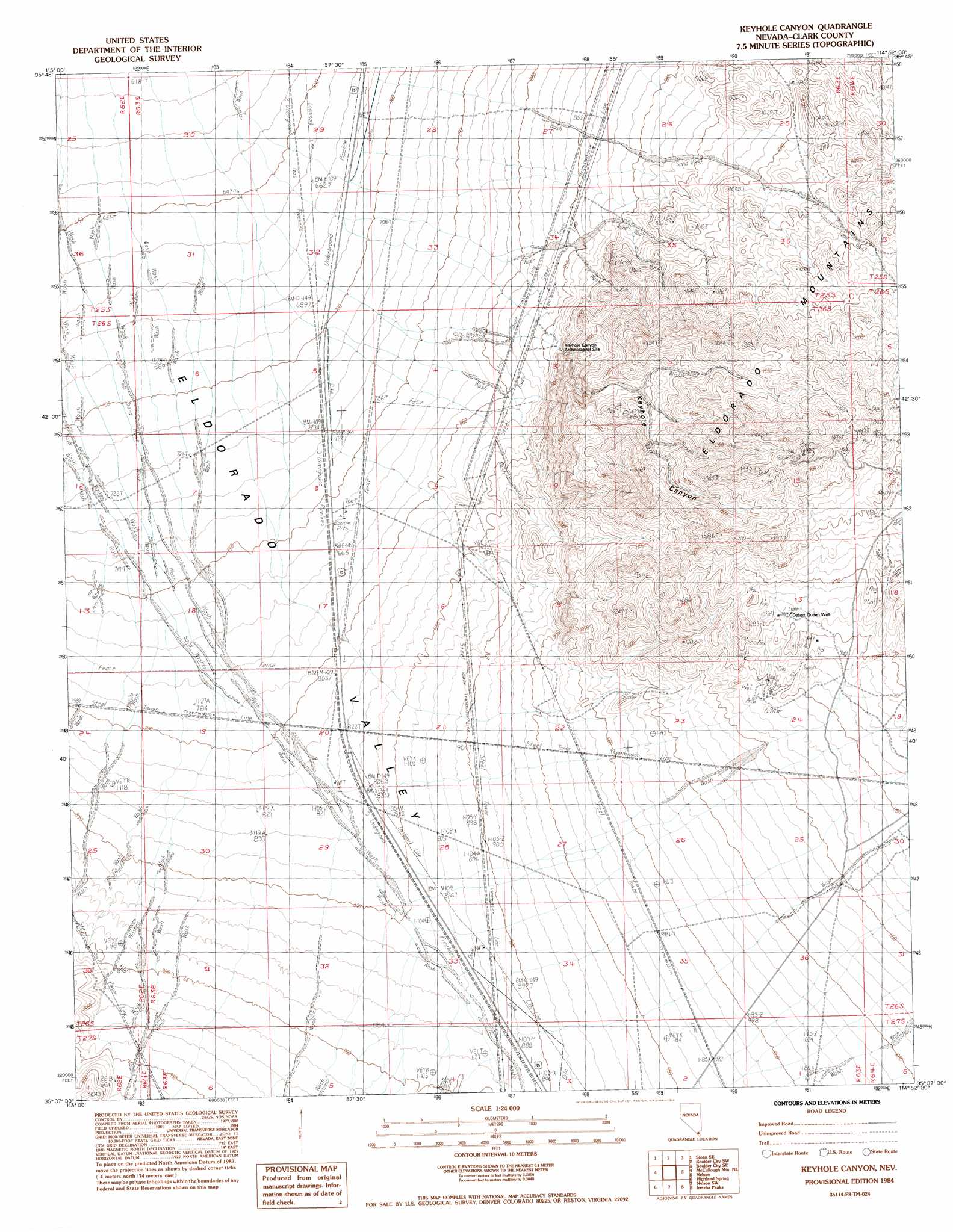
USGS Topo Quad 35114f8 - 1:24,000 scale
| Topo Map Name: | Keyhole Canyon |
| USGS Topo Quad ID: | 35114f8 |
| Print Size: | ca. 21 1/4" wide x 27" high |
| Southeast Coordinates: | 35.625° N latitude / 114.875° W longitude |
| Map Center Coordinates: | 35.6875° N latitude / 114.9375° W longitude |
| U.S. State: | NV |
| Filename: | o35114f8.jpg |
| Download Map JPG Image: | Keyhole Canyon topo map 1:24,000 scale |
| Map Type: | Topographic |
| Topo Series: | 7.5´ |
| Map Scale: | 1:24,000 |
| Source of Map Images: | United States Geological Survey (USGS) |
| Alternate Map Versions: |
Keyhole Canyon NV 1984, updated 1984 Download PDF Buy paper map Keyhole Canyon NV 2012 Download PDF Buy paper map Keyhole Canyon NV 2014 Download PDF Buy paper map |
1:24,000 Topo Quads surrounding Keyhole Canyon
Sloan |
Sloan Ne |
Boulder City Nw |
Boulder City |
Ringbolt Rapids |
Hidden Valley |
Sloan Se |
Boulder City Sw |
Boulder City Se |
Willow Beach |
Mccullough Pass |
Mccullough Mountain Ne |
Keyhole Canyon |
Nelson |
Fire Mountain |
Mccullough Mountain |
Highland Spring |
Nelson Sw |
Ireteba Peaks |
Mount Davis |
Crescent Peak |
Hopps Well |
Searchlight |
Fourth Of July Mountain |
Spirit Mountain Nw |
> Back to 35114e1 at 1:100,000 scale
> Back to 35114a1 at 1:250,000 scale
> Back to U.S. Topo Maps home
Keyhole Canyon topo map: Gazetteer
Keyhole Canyon: Parks
Highland Range Crucial Bighorn Habitat Area elevation 916m 3005′Keyhole Canyon: Springs
Water Plug Number Two Spring elevation 1340m 4396′Keyhole Canyon: Valleys
Keyhole Canyon elevation 883m 2896′Keyhole Canyon: Wells
Desert Queen Well elevation 1201m 3940′Keyhole Canyon digital topo map on disk
Buy this Keyhole Canyon topo map showing relief, roads, GPS coordinates and other geographical features, as a high-resolution digital map file on DVD:
Southern Sierra Nevada, California & Southern Nevada
Buy digital topo maps: Southern Sierra Nevada, California & Southern Nevada