Boulder City Topo Map Nevada
To zoom in, hover over the map of Boulder City
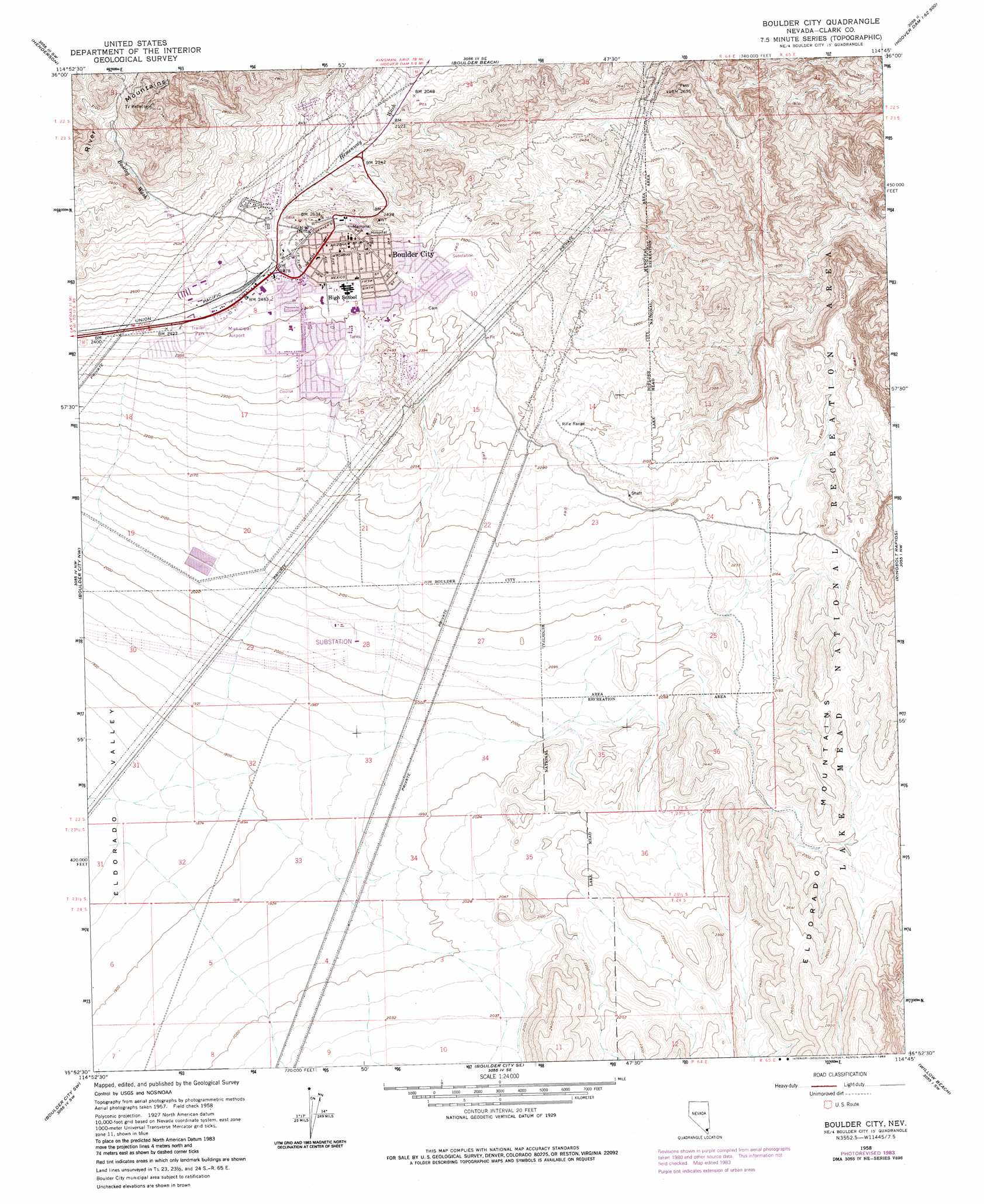
USGS Topo Quad 35114h7 - 1:24,000 scale
| Topo Map Name: | Boulder City |
| USGS Topo Quad ID: | 35114h7 |
| Print Size: | ca. 21 1/4" wide x 27" high |
| Southeast Coordinates: | 35.875° N latitude / 114.75° W longitude |
| Map Center Coordinates: | 35.9375° N latitude / 114.8125° W longitude |
| U.S. State: | NV |
| Filename: | o35114h7.jpg |
| Download Map JPG Image: | Boulder City topo map 1:24,000 scale |
| Map Type: | Topographic |
| Topo Series: | 7.5´ |
| Map Scale: | 1:24,000 |
| Source of Map Images: | United States Geological Survey (USGS) |
| Alternate Map Versions: |
Boulder City NV 1958, updated 1959 Download PDF Buy paper map Boulder City NV 1958, updated 1976 Download PDF Buy paper map Boulder City NV 1958, updated 1983 Download PDF Buy paper map Boulder City NV 2012 Download PDF Buy paper map Boulder City NV 2015 Download PDF Buy paper map |
1:24,000 Topo Quads surrounding Boulder City
Las Vegas Ne |
Frenchman Mountain |
Government Wash |
Callville Bay |
Boulder Canyon |
Las Vegas Se |
Henderson |
Boulder Beach |
Hoover Dam |
Petroglyph Wash |
Sloan Ne |
Boulder City Nw |
Boulder City |
Ringbolt Rapids |
Mount Wilson |
Sloan Se |
Boulder City Sw |
Boulder City Se |
Willow Beach |
Housholder Pass |
Mccullough Mountain Ne |
Keyhole Canyon |
Nelson |
Fire Mountain |
Mohave Mine |
> Back to 35114e1 at 1:100,000 scale
> Back to 35114a1 at 1:250,000 scale
> Back to U.S. Topo Maps home
Boulder City topo map: Gazetteer
Boulder City: Airports
Boulder City Municipal Airport elevation 733m 2404′Mead Substation Heliport elevation 627m 2057′
Boulder City: Arroyos
North Fork Quail Wash elevation 564m 1850′South Fork Quail Wash elevation 726m 2381′
Boulder City: Gaps
Hemenway Pass elevation 641m 2103′Boulder City: Islands
Lone Rock elevation 396m 1299′Boulder City: Populated Places
Boulder City elevation 765m 2509′McKeeversville (historical) elevation 735m 2411′
Boulder City: Post Offices
Boulder City Post Office elevation 765m 2509′Boulder City: Streams
Bootleg Wash elevation 827m 2713′Boulder City: Summits
Camp Knob elevation 763m 2503′The Knoll elevation 680m 2230′
Boulder City: Valleys
Bootleg Canyon elevation 818m 2683′North Fork Boy Scout Canyon elevation 594m 1948′
South Fork Boy Scout Canyon elevation 523m 1715′
Boulder City digital topo map on disk
Buy this Boulder City topo map showing relief, roads, GPS coordinates and other geographical features, as a high-resolution digital map file on DVD:
Southern Sierra Nevada, California & Southern Nevada
Buy digital topo maps: Southern Sierra Nevada, California & Southern Nevada