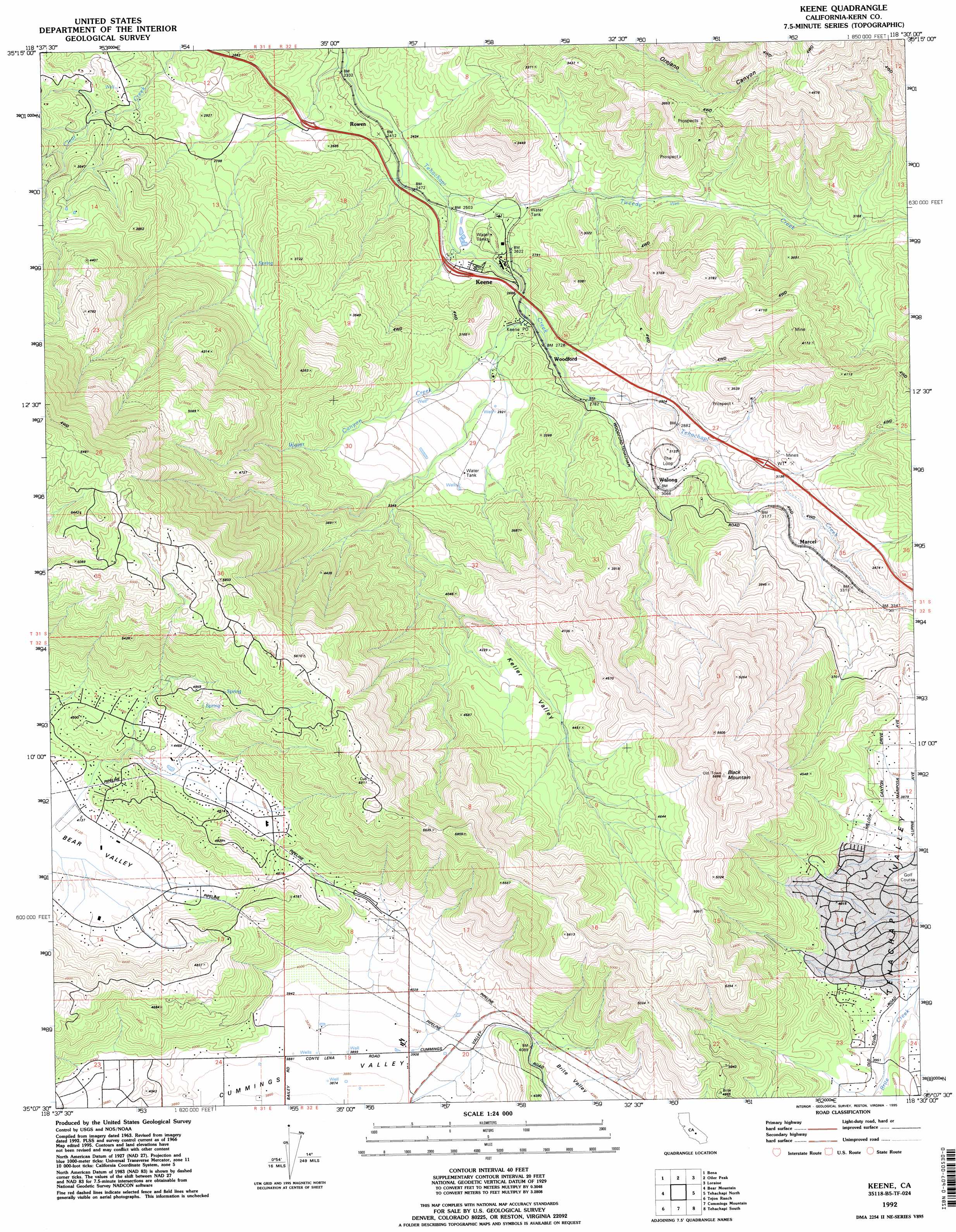
Keene Topo Map California
To zoom in, hover over the map of Keene
USGS Topo Quad 35118b5 - 1:24,000 scale
| Topo Map Name: | Keene |
| USGS Topo Quad ID: | 35118b5 |
| Print Size: | ca. 21 1/4" wide x 27" high |
| Southeast Coordinates: | 35.125° N latitude / 118.5° W longitude |
| Map Center Coordinates: | 35.1875° N latitude / 118.5625° W longitude |
| U.S. State: | CA |
| Filename: | o35118b5.jpg |
| Download Map JPG Image: | Keene topo map 1:24,000 scale |
| Map Type: | Topographic |
| Topo Series: | 7.5´ |
| Map Scale: | 1:24,000 |
| Source of Map Images: | United States Geological Survey (USGS) |
| Alternate Map Versions: |
Keene CA 1966, updated 1967 Download PDF Buy paper map Keene CA 1966, updated 1981 Download PDF Buy paper map Keene CA 1992, updated 1995 Download PDF Buy paper map Keene CA 2012 Download PDF Buy paper map Keene CA 2015 Download PDF Buy paper map |
1:24,000 Topo Quads surrounding Keene
Rio Bravo Ranch |
Mount Adelaide |
Breckenridge Mountain |
Piute Peak |
Claraville |
Edison |
Bena |
Oiler Peak |
Loraine |
Emerald Mountain |
Arvin |
Bear Mountain |
Keene |
Tehachapi North |
Tehachapi Ne |
Tejon Hills |
Tejon Ranch |
Cummings Mountain |
Tehachapi South |
Monolith |
Pastoria Creek |
Winters Ridge |
Liebre Twins |
Tylerhorse Canyon |
Willow Springs |
> Back to 35118a1 at 1:100,000 scale
> Back to 35118a1 at 1:250,000 scale
> Back to U.S. Topo Maps home
Keene topo map: Gazetteer
Keene: Populated Places
El Rita elevation 821m 2693′Keene elevation 793m 2601′
Marcel elevation 989m 3244′
Rowen elevation 730m 2395′
Walong elevation 932m 3057′
Woodford elevation 837m 2746′
Keene: Post Offices
Keene Post Office elevation 821m 2693′Keene: Streams
Tweedy Creek elevation 743m 2437′Water Canyon Creek elevation 806m 2644′
Keene: Summits
Black Mountain elevation 1731m 5679′Keene: Valleys
Keller Valley elevation 1018m 3339′Keene digital topo map on disk
Buy this Keene topo map showing relief, roads, GPS coordinates and other geographical features, as a high-resolution digital map file on DVD:
Southern Sierra Nevada, California & Southern Nevada
Buy digital topo maps: Southern Sierra Nevada, California & Southern Nevada