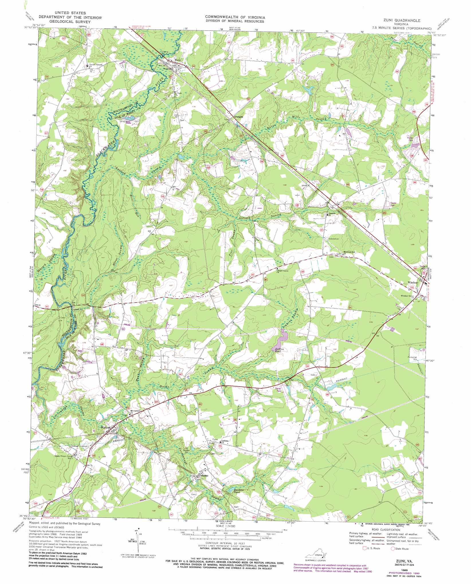
Zuni Topo Map Virginia
To zoom in, hover over the map of Zuni
USGS Topo Quad 36076g7 - 1:24,000 scale
| Topo Map Name: | Zuni |
| USGS Topo Quad ID: | 36076g7 |
| Print Size: | ca. 21 1/4" wide x 27" high |
| Southeast Coordinates: | 36.75° N latitude / 76.75° W longitude |
| Map Center Coordinates: | 36.8125° N latitude / 76.8125° W longitude |
| U.S. State: | VA |
| Filename: | o36076g7.jpg |
| Download Map JPG Image: | Zuni topo map 1:24,000 scale |
| Map Type: | Topographic |
| Topo Series: | 7.5´ |
| Map Scale: | 1:24,000 |
| Source of Map Images: | United States Geological Survey (USGS) |
| Alternate Map Versions: |
Zuni VA 1944, updated 1961 Download PDF Buy paper map Zuni VA 1969, updated 1971 Download PDF Buy paper map Zuni VA 1969, updated 1984 Download PDF Buy paper map Zuni VA 1969, updated 1990 Download PDF Buy paper map Zuni VA 2010 Download PDF Buy paper map Zuni VA 2013 Download PDF Buy paper map Zuni VA 2016 Download PDF Buy paper map |
1:24,000 Topo Quads surrounding Zuni
Waverly |
Dendron |
Runnymede |
Bacons Castle |
Mulberry Island |
Manry |
Ivor |
Raynor |
Smithfield |
Benns Church |
Vicksville |
Sedley |
Zuni |
Windsor |
Chuckatuck |
Courtland |
Franklin |
Holland |
Buckhorn |
Suffolk |
Sunbeam |
Riverdale |
Gates |
Whaleyville |
Corapeake |
> Back to 36076e1 at 1:100,000 scale
> Back to 36076a1 at 1:250,000 scale
> Back to U.S. Topo Maps home
Zuni topo map: Gazetteer
Zuni: Bridges
Blackwater Bridge elevation 1m 3′Zuni: Dams
Jenkins Dam elevation 15m 49′Zuni: Lakes
Dardens Pond elevation 13m 42′Zuni: Populated Places
Clyde's Dale Mobile Community elevation 21m 68′Collosse elevation 18m 59′
Dwight elevation 20m 65′
Leland Duck's Trailer Park elevation 24m 78′
Oaks Mobile Estates elevation 19m 62′
Rhodes elevation 24m 78′
Turner elevation 21m 68′
Walters elevation 17m 55′
Whitleys Crossroads elevation 25m 82′
Zuni elevation 12m 39′
Zuni: Post Offices
Zuni Post Office elevation 12m 39′Zuni: Reservoirs
Jenkins Pond elevation 15m 49′Zuni: Streams
Antioch Swamp elevation 0m 0′Bows and Arrows Swamp elevation 14m 45′
Britt Run elevation 4m 13′
Burnt Mills Swamp elevation 7m 22′
Corrowaugh Swamp elevation 1m 3′
Ducks Swamp elevation 7m 22′
Hunters Swamp elevation 7m 22′
Jenkins Swamp elevation 10m 32′
Pine Swamp elevation 11m 36′
Seacock Swamp elevation 1m 3′
Tucker Swamp elevation 6m 19′
Zuni: Swamps
Horse Swamp elevation 1m 3′Zuni digital topo map on disk
Buy this Zuni topo map showing relief, roads, GPS coordinates and other geographical features, as a high-resolution digital map file on DVD:
Atlantic Coast (NY, NJ, PA, DE, MD, VA, NC)
Buy digital topo maps: Atlantic Coast (NY, NJ, PA, DE, MD, VA, NC)
 map DVD")