Ossipee Topo Map North Carolina
To zoom in, hover over the map of Ossipee
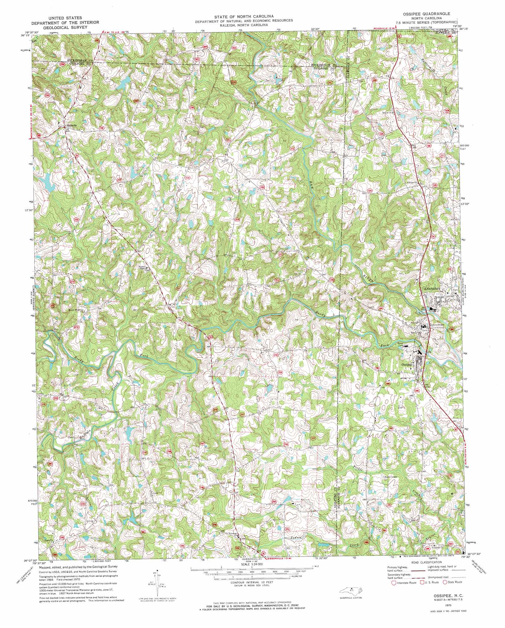
USGS Topo Quad 36079b5 - 1:24,000 scale
| Topo Map Name: | Ossipee |
| USGS Topo Quad ID: | 36079b5 |
| Print Size: | ca. 21 1/4" wide x 27" high |
| Southeast Coordinates: | 36.125° N latitude / 79.5° W longitude |
| Map Center Coordinates: | 36.1875° N latitude / 79.5625° W longitude |
| U.S. State: | NC |
| Filename: | o36079b5.jpg |
| Download Map JPG Image: | Ossipee topo map 1:24,000 scale |
| Map Type: | Topographic |
| Topo Series: | 7.5´ |
| Map Scale: | 1:24,000 |
| Source of Map Images: | United States Geological Survey (USGS) |
| Alternate Map Versions: |
Ossipee NC 1970, updated 1973 Download PDF Buy paper map Ossipee NC 2010 Download PDF Buy paper map Ossipee NC 2013 Download PDF Buy paper map Ossipee NC 2016 Download PDF Buy paper map |
1:24,000 Topo Quads surrounding Ossipee
Southwest Eden |
Southeast Eden |
Ruffin |
Park Spring |
Yanceyville |
Bethany |
Reidsville |
Williamsburg |
Cherry Grove |
Anderson |
Lake Brandt |
Browns Summit |
Ossipee |
Lake Burlington |
Burlington Ne |
Greensboro |
Mcleansville |
Gibsonville |
Burlington |
Mebane |
Pleasant Garden |
Climax |
Kimesville |
Snow Camp |
Saxapahaw |
> Back to 36079a1 at 1:100,000 scale
> Back to 36078a1 at 1:250,000 scale
> Back to U.S. Topo Maps home
Ossipee topo map: Gazetteer
Ossipee: Dams
Buckhorn Lake Dam elevation 226m 741′Pritchett Lake Dam elevation 217m 711′
Whitesell Lake Lower Dam elevation 202m 662′
Whitesell Lake Upper Dam elevation 214m 702′
Ossipee: Populated Places
Altamahaw elevation 193m 633′Osceola elevation 252m 826′
Ossipee elevation 188m 616′
Ossipee: Reservoirs
Buckhorn Lake elevation 226m 741′Pritchett Lake elevation 217m 711′
Whitesell Lake Number One elevation 202m 662′
Whitesell Lake Number Two elevation 214m 702′
Ossipee: Streams
Buffalo Creek elevation 192m 629′Reedy Fork elevation 178m 583′
Tickle Creek elevation 177m 580′
Ossipee digital topo map on disk
Buy this Ossipee topo map showing relief, roads, GPS coordinates and other geographical features, as a high-resolution digital map file on DVD:
Western Virginia & Southern West Virginia
Buy digital topo maps: Western Virginia & Southern West Virginia