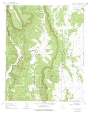
Servilleta Plaza Topo Map New Mexico
To zoom in, hover over the map of Servilleta Plaza
USGS Topo Quad 36105d8 - 1:24,000 scale
| Topo Map Name: | Servilleta Plaza |
| USGS Topo Quad ID: | 36105d8 |
| Print Size: | ca. 21 1/4" wide x 27" high |
| Southeast Coordinates: | 36.375° N latitude / 105.875° W longitude |
| Map Center Coordinates: | 36.4375° N latitude / 105.9375° W longitude |
| U.S. State: | NM |
| Filename: | o36105d8.jpg |
| Download Map JPG Image: | Servilleta Plaza topo map 1:24,000 scale |
| Map Type: | Topographic |
| Topo Series: | 7.5´ |
| Map Scale: | 1:24,000 |
| Source of Map Images: | United States Geological Survey (USGS) |
| Alternate Map Versions: |
Servilleta Plaza NM 1961, updated 1963 Download PDF Buy paper map Servilleta Plaza NM 1961, updated 1975 Download PDF Buy paper map Servilleta Plaza NM 1995, updated 1998 Download PDF Buy paper map Servilleta Plaza NM 2011 Download PDF Buy paper map Servilleta Plaza NM 2013 Download PDF Buy paper map |
| FStopo: | US Forest Service topo Servilleta Plaza is available: Download FStopo PDF Download FStopo TIF |
1:24,000 Topo Quads surrounding Servilleta Plaza
> Back to 36105a1 at 1:100,000 scale
> Back to 36104a1 at 1:250,000 scale
> Back to U.S. Topo Maps home
Servilleta Plaza topo map: Gazetteer
Servilleta Plaza: Cliffs
Comanche Rim elevation 2251m 7385′Servilleta Plaza: Lakes
Indian Lake elevation 2288m 7506′Servilleta Plaza: Mines
Blowout Number 3 Mine elevation 2404m 7887′Laura Crystal elevation 2153m 7063′
Riverside One Through Four elevation 2129m 6984′
Servilleta Plaza: Reservoirs
Bailey Tank elevation 2246m 7368′Corner Tank elevation 2249m 7378′
Darkey Tank elevation 2225m 7299′
Drake Tank elevation 2274m 7460′
Mojno Tank elevation 2315m 7595′
Negro Tank elevation 2239m 7345′
Peña tank elevation 2326m 7631′
Petaca Tanke elevation 2397m 7864′
Railroad Tank elevation 2301m 7549′
Servilleta Tank elevation 2131m 6991′
Servilleta Plaza: Summits
Cerro Mojino elevation 2418m 7933′Servilleta Plaza: Wells
Comanche Water Well elevation 2199m 7214′Comanche Well elevation 2199m 7214′
Servilleta Plaza digital topo map on disk
Buy this Servilleta Plaza topo map showing relief, roads, GPS coordinates and other geographical features, as a high-resolution digital map file on DVD:


