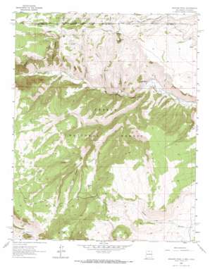
Bighorn Peak Topo Map New Mexico
To zoom in, hover over the map of Bighorn Peak
USGS Topo Quad 36106h2 - 1:24,000 scale
| Topo Map Name: | Bighorn Peak |
| USGS Topo Quad ID: | 36106h2 |
| Print Size: | ca. 21 1/4" wide x 27" high |
| Southeast Coordinates: | 36.875° N latitude / 106.125° W longitude |
| Map Center Coordinates: | 36.9375° N latitude / 106.1875° W longitude |
| U.S. States: | NM, CO |
| Filename: | o36106h2.jpg |
| Download Map JPG Image: | Bighorn Peak topo map 1:24,000 scale |
| Map Type: | Topographic |
| Topo Series: | 7.5´ |
| Map Scale: | 1:24,000 |
| Source of Map Images: | United States Geological Survey (USGS) |
| Alternate Map Versions: |
Bighorn Peak NM 1963, updated 1967 Download PDF Buy paper map Bighorn Peak NM 1963, updated 1967 Download PDF Buy paper map Bighorn Peak NM 1995, updated 1998 Download PDF Buy paper map Bighorn Peak NM 2011 Download PDF Buy paper map Bighorn Peak NM 2013 Download PDF Buy paper map Bighorn Peak NM 2017 Download PDF Buy paper map |
| FStopo: | US Forest Service topo Bighorn Peak is available: Download FStopo PDF Download FStopo TIF |
1:24,000 Topo Quads surrounding Bighorn Peak
> Back to 36106e1 at 1:100,000 scale
> Back to 36106a1 at 1:250,000 scale
> Back to U.S. Topo Maps home
Bighorn Peak topo map: Gazetteer
Bighorn Peak: Lakes
Chino Dry Lake elevation 2680m 8792′Bighorn Peak: Populated Places
Big Horn elevation 2749m 9019′San Miguel elevation 2516m 8254′
Sublette elevation 2829m 9281′
Bighorn Peak: Reservoirs
Alive Number One Tank elevation 2878m 9442′Alive Number Two Tank elevation 2894m 9494′
Aspen Tank elevation 2806m 9206′
Bighorn Tank elevation 2700m 8858′
Camino Tank elevation 2994m 9822′
Casas Tank elevation 2860m 9383′
Cub Tank elevation 2665m 8743′
Dale Tank elevation 2599m 8526′
Duran Tank elevation 3025m 9924′
Florentino Tank elevation 2714m 8904′
Gareia Tank elevation 2691m 8828′
Hondo Number Two Tank elevation 2927m 9603′
Indian Joe Tank elevation 2790m 9153′
Julian Number Two Tank elevation 2946m 9665′
Lola Tank elevation 2976m 9763′
Louis Tank elevation 2912m 9553′
Miguel Tank elevation 2591m 8500′
Oso Tank elevation 2841m 9320′
Park Tank elevation 2852m 9356′
Pinabetal Tank elevation 2830m 9284′
Pit Tank Number One elevation 2938m 9639′
Roadside Number One Tank elevation 2870m 9416′
Roadside Number Two Tank elevation 2926m 9599′
Romero Tank elevation 2878m 9442′
Rudy Tank elevation 2952m 9685′
Valdez Tank elevation 2682m 8799′
Valdez Tank elevation 2946m 9665′
Bighorn Peak: Springs
Atencio Spring elevation 2769m 9084′Ojito Spring elevation 2889m 9478′
Oso Spring elevation 2863m 9393′
Bighorn Peak: Streams
Cañada de Oso elevation 2579m 8461′Cañada Jarosita elevation 2562m 8405′
Cañada Tanques elevation 2648m 8687′
Lola Creek elevation 2508m 8228′
Bighorn Peak: Summits
Banco Julian elevation 3174m 10413′Bighorn Peak elevation 2880m 9448′
Bighorn Peak: Valleys
Cañon Atencio elevation 2556m 8385′Cañon Florentino elevation 2538m 8326′
Cañon Hondo elevation 2561m 8402′
Bighorn Peak digital topo map on disk
Buy this Bighorn Peak topo map showing relief, roads, GPS coordinates and other geographical features, as a high-resolution digital map file on DVD:


