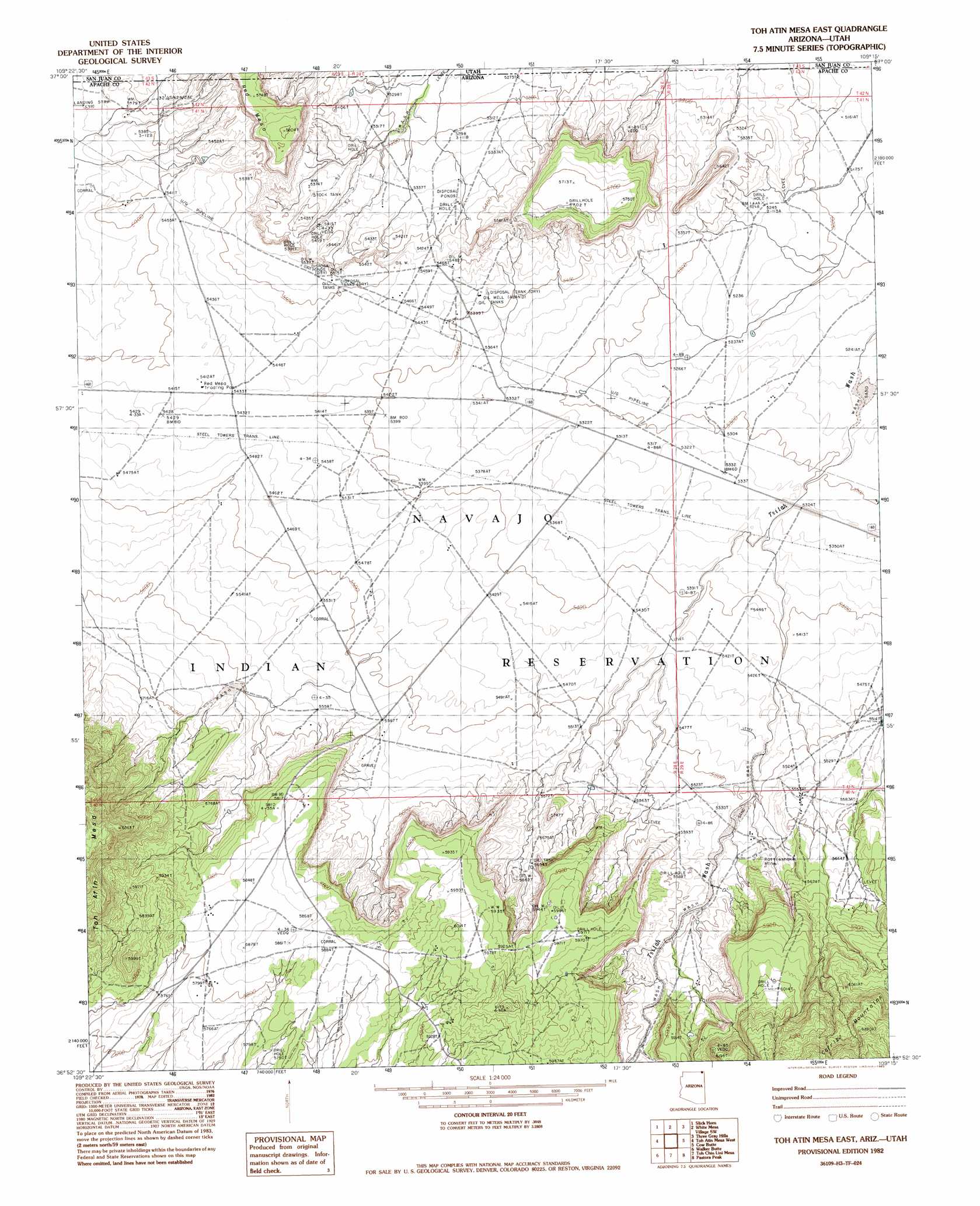
Toh Atin Mesa East Topo Map Arizona
To zoom in, hover over the map of Toh Atin Mesa East
USGS Topo Quad 36109h3 - 1:24,000 scale
| Topo Map Name: | Toh Atin Mesa East |
| USGS Topo Quad ID: | 36109h3 |
| Print Size: | ca. 21 1/4" wide x 27" high |
| Southeast Coordinates: | 36.875° N latitude / 109.25° W longitude |
| Map Center Coordinates: | 36.9375° N latitude / 109.3125° W longitude |
| U.S. States: | AZ, UT |
| Filename: | o36109h3.jpg |
| Download Map JPG Image: | Toh Atin Mesa East topo map 1:24,000 scale |
| Map Type: | Topographic |
| Topo Series: | 7.5´ |
| Map Scale: | 1:24,000 |
| Source of Map Images: | United States Geological Survey (USGS) |
| Alternate Map Versions: |
Dinne Mesa NE AZ 1953, updated 1954 Download PDF Buy paper map Toh Atin Mesa East AZ 1982, updated 1983 Download PDF Buy paper map Toh Atin Mesa East AZ 2011 Download PDF Buy paper map Toh Atin Mesa East AZ 2011 Download PDF Buy paper map Toh Atin Mesa East AZ 2014 Download PDF Buy paper map |
1:24,000 Topo Quads surrounding Toh Atin Mesa East
White Rock Point |
Hogan Mesa |
White Mesa Village |
Aneth |
Peters Nipple |
Boundary Butte |
Gray Spot Rock |
White Mesa Village Se |
Yellow Rock Point West |
Aneth Se |
Walker Creek Reservoir |
Toh Atin Mesa West |
Toh Atin Mesa East |
Cow Butte |
Teec Nos Pos |
Hogansaani Spring |
Walker Butte |
Toh Chin Lini Mesa |
Pastora Peak |
Beclabito |
Dancing Rocks |
White Area Canyon |
Kinusta Mesa |
Boiling Over Well |
Horse Mesa |
> Back to 36109e1 at 1:100,000 scale
> Back to 36108a1 at 1:250,000 scale
> Back to U.S. Topo Maps home
Toh Atin Mesa East topo map: Gazetteer
Toh Atin Mesa East: Mines
Rattlesnake Mine elevation 1695m 5561′Toh Atin Mesa East: Populated Places
Red Mesa elevation 1637m 5370′Toh Atin Mesa East: Summits
Dry Mesa elevation 1796m 5892′Red Mesa elevation 1753m 5751′
Red Mesa elevation 1767m 5797′
Toh Atin Mesa East digital topo map on disk
Buy this Toh Atin Mesa East topo map showing relief, roads, GPS coordinates and other geographical features, as a high-resolution digital map file on DVD: