Cedar Tree Bench Topo Map Arizona
To zoom in, hover over the map of Cedar Tree Bench
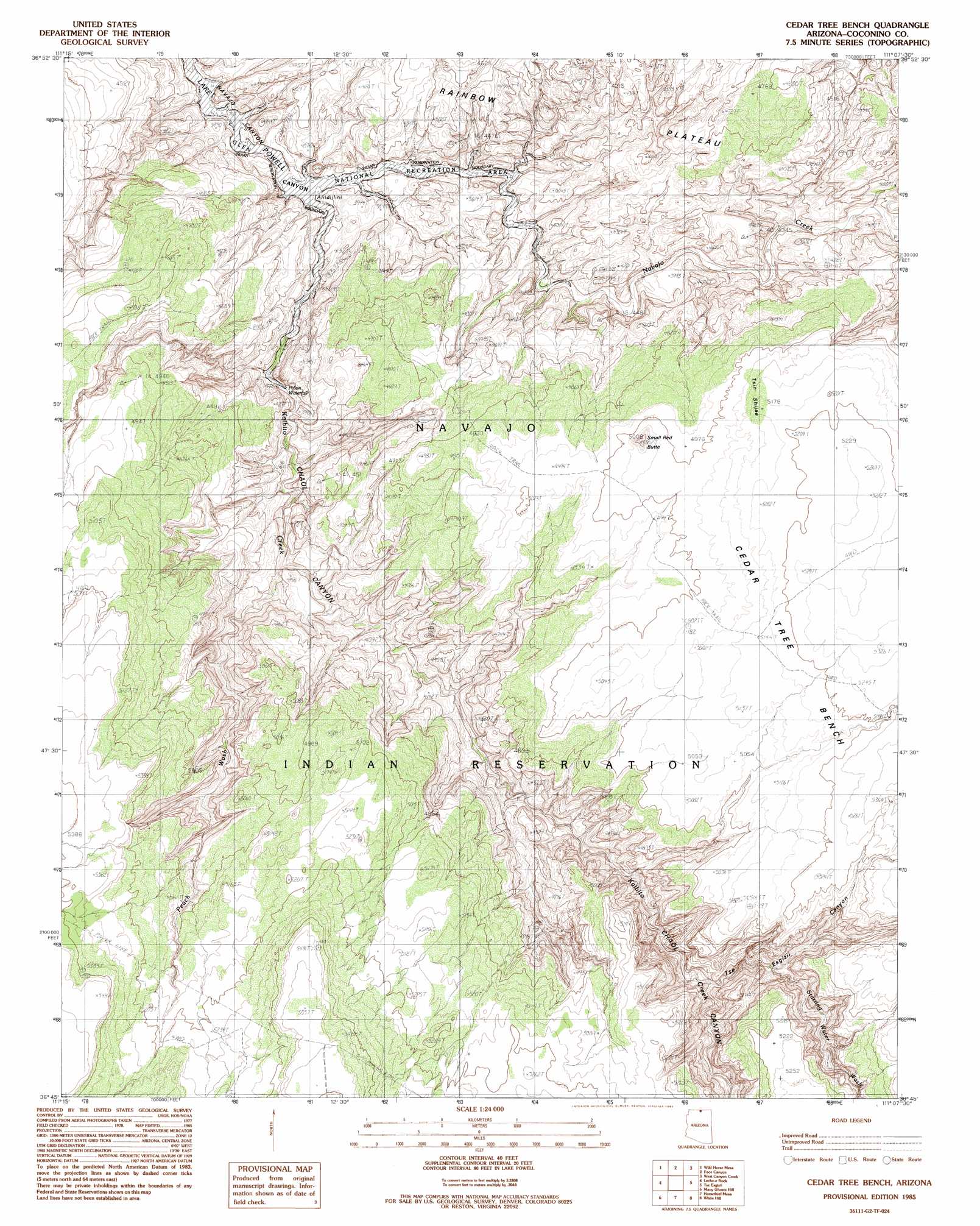
USGS Topo Quad 36111g2 - 1:24,000 scale
| Topo Map Name: | Cedar Tree Bench |
| USGS Topo Quad ID: | 36111g2 |
| Print Size: | ca. 21 1/4" wide x 27" high |
| Southeast Coordinates: | 36.75° N latitude / 111.125° W longitude |
| Map Center Coordinates: | 36.8125° N latitude / 111.1875° W longitude |
| U.S. State: | AZ |
| Filename: | o36111g2.jpg |
| Download Map JPG Image: | Cedar Tree Bench topo map 1:24,000 scale |
| Map Type: | Topographic |
| Topo Series: | 7.5´ |
| Map Scale: | 1:24,000 |
| Source of Map Images: | United States Geological Survey (USGS) |
| Alternate Map Versions: |
Cedar Tree Bench AZ 1985, updated 1985 Download PDF Buy paper map Cedar Tree Bench AZ 2011 Download PDF Buy paper map Cedar Tree Bench AZ 2014 Download PDF Buy paper map |
1:24,000 Topo Quads surrounding Cedar Tree Bench
Warm Creek Bay |
Gunsight Butte |
Gregory Butte |
Cathedral Canyon |
Rainbow Bridge |
Page |
Wild Horse Mesa |
Face Canyon |
West Canyon Creek |
Chaiyahi Flat |
White Dome |
Leche-E Rock |
Cedar Tree Bench |
Tse Esgizii |
Chaiyahi Rim Sw |
Dead Monkey Ridge |
Many Ghosts Hill |
Horsethief Mesa |
White Hill |
Two Red Mesas |
Dove Spring |
Dove Spring Se |
Arrowhead Mesa |
Kaibito |
Square Butte |
> Back to 36111e1 at 1:100,000 scale
> Back to 36110a1 at 1:250,000 scale
> Back to U.S. Topo Maps home
Cedar Tree Bench topo map: Gazetteer
Cedar Tree Bench: Benches
Cedar Tree Bench elevation 1593m 5226′Cedar Tree Bench: Streams
Kaibito Creek elevation 1129m 3704′Peach Wash elevation 1194m 3917′
Sand Wash elevation 0m 0′
Starting Water Wash elevation 1277m 4189′
Cedar Tree Bench: Summits
Small Butte elevation 1572m 5157′Cedar Tree Bench: Valleys
Chaol Canyon elevation 1132m 3713′Cedar Tree Bench digital topo map on disk
Buy this Cedar Tree Bench topo map showing relief, roads, GPS coordinates and other geographical features, as a high-resolution digital map file on DVD: