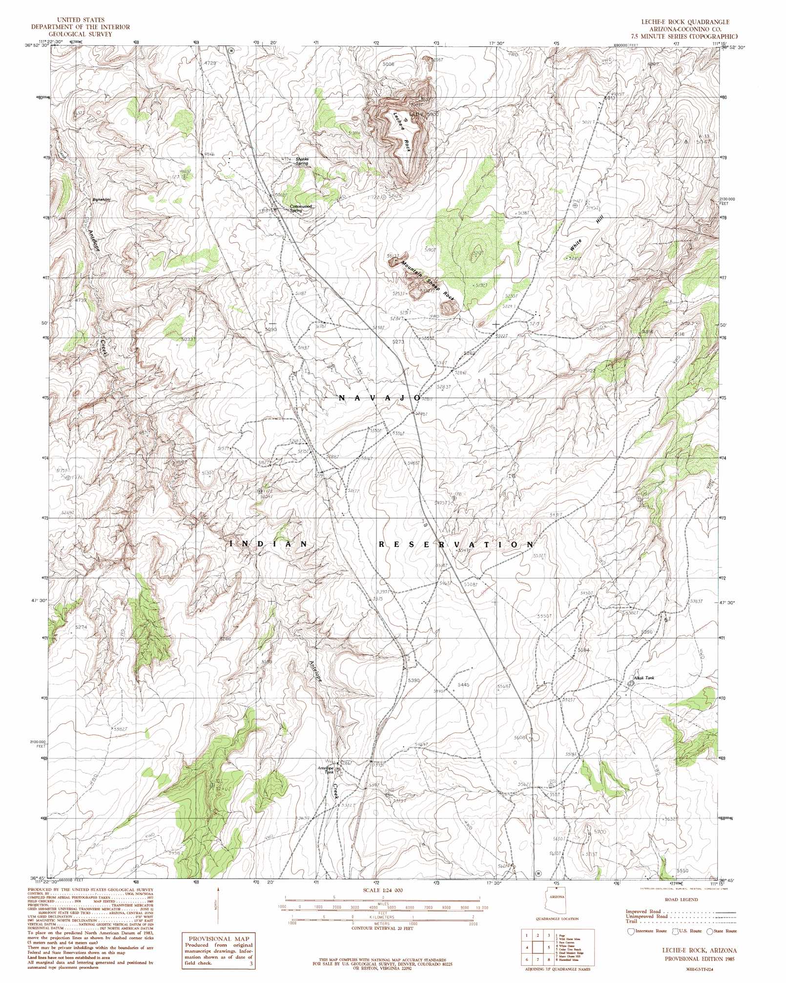
Leche-E Rock Topo Map Arizona
To zoom in, hover over the map of Leche-E Rock
USGS Topo Quad 36111g3 - 1:24,000 scale
| Topo Map Name: | Leche-E Rock |
| USGS Topo Quad ID: | 36111g3 |
| Print Size: | ca. 21 1/4" wide x 27" high |
| Southeast Coordinates: | 36.75° N latitude / 111.25° W longitude |
| Map Center Coordinates: | 36.8125° N latitude / 111.3125° W longitude |
| U.S. State: | AZ |
| Filename: | o36111g3.jpg |
| Download Map JPG Image: | Leche-E Rock topo map 1:24,000 scale |
| Map Type: | Topographic |
| Topo Series: | 7.5´ |
| Map Scale: | 1:24,000 |
| Source of Map Images: | United States Geological Survey (USGS) |
| Alternate Map Versions: |
Leche-E Rock AZ 1985, updated 1985 Download PDF Buy paper map LeChee Rock AZ 2011 Download PDF Buy paper map LeChee Rock AZ 2014 Download PDF Buy paper map |
1:24,000 Topo Quads surrounding Leche-E Rock
Lone Rock |
Warm Creek Bay |
Gunsight Butte |
Gregory Butte |
Cathedral Canyon |
Ferry Swale |
Page |
Wild Horse Mesa |
Face Canyon |
West Canyon Creek |
Lees Ferry |
White Dome |
Leche-E Rock |
Cedar Tree Bench |
Tse Esgizii |
Explosive Rock |
Dead Monkey Ridge |
Many Ghosts Hill |
Horsethief Mesa |
White Hill |
Cedar Tree Hills |
Dove Spring |
Dove Spring Se |
Arrowhead Mesa |
Kaibito |
> Back to 36111e1 at 1:100,000 scale
> Back to 36110a1 at 1:250,000 scale
> Back to U.S. Topo Maps home
Leche-E Rock topo map: Gazetteer
Leche-E Rock: Pillars
LeChee Rock elevation 1797m 5895′Leche-E Rock: Reservoirs
Alkali Tank elevation 1658m 5439′Antelope Tank elevation 1616m 5301′
Leche-E Rock: Summits
Betay elevation 1676m 5498′Nurusse elevation 1662m 5452′
Leche-E Rock digital topo map on disk
Buy this Leche-E Rock topo map showing relief, roads, GPS coordinates and other geographical features, as a high-resolution digital map file on DVD: