East Of Echo Canyon Topo Map California
To zoom in, hover over the map of East Of Echo Canyon
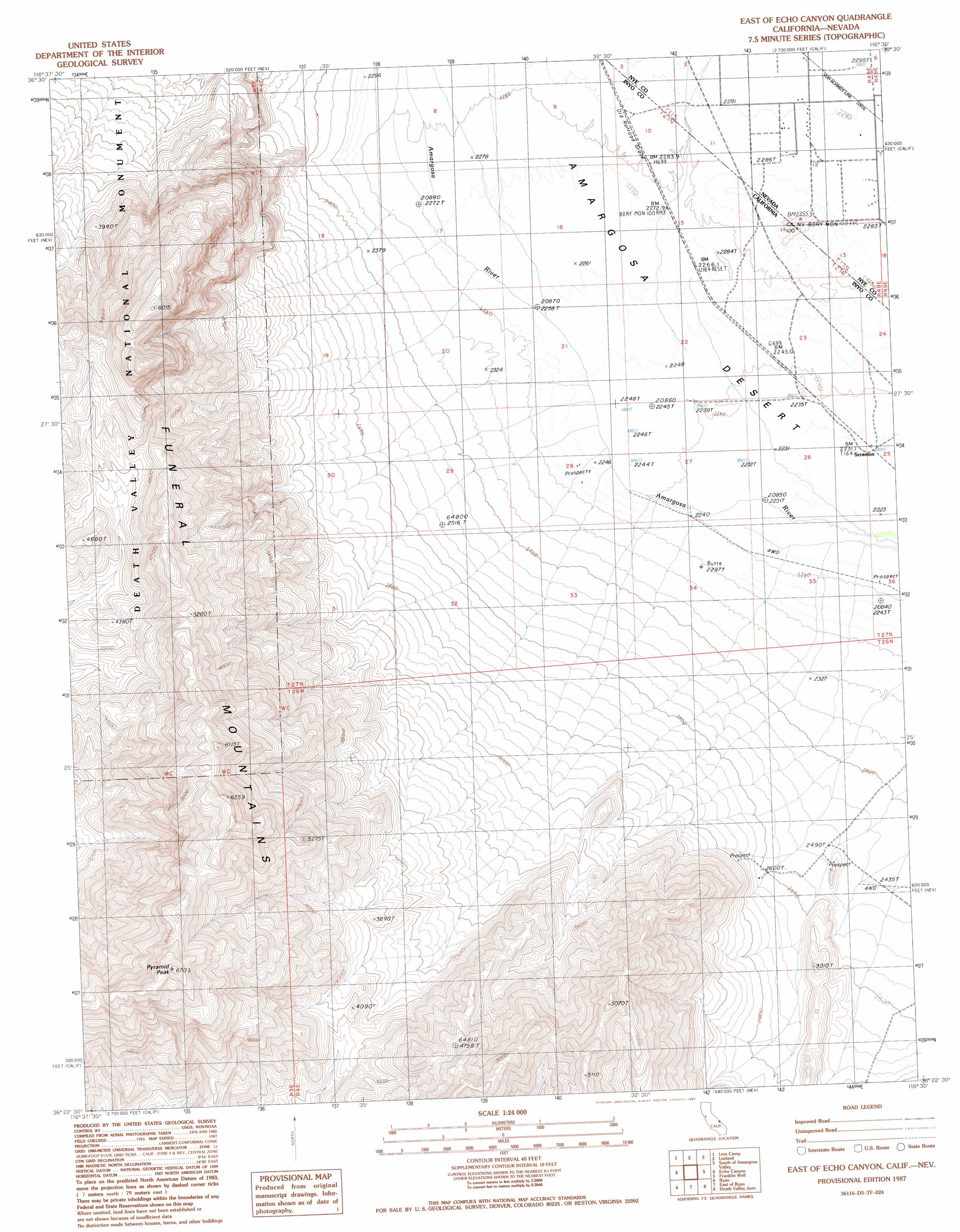
USGS Topo Quad 36116d5 - 1:24,000 scale
| Topo Map Name: | East Of Echo Canyon |
| USGS Topo Quad ID: | 36116d5 |
| Print Size: | ca. 21 1/4" wide x 27" high |
| Southeast Coordinates: | 36.375° N latitude / 116.5° W longitude |
| Map Center Coordinates: | 36.4375° N latitude / 116.5625° W longitude |
| U.S. States: | CA, NV |
| Filename: | o36116d5.jpg |
| Download Map JPG Image: | East Of Echo Canyon topo map 1:24,000 scale |
| Map Type: | Topographic |
| Topo Series: | 7.5´ |
| Map Scale: | 1:24,000 |
| Source of Map Images: | United States Geological Survey (USGS) |
| Alternate Map Versions: |
East of Echo Canyon CA 1987, updated 1987 Download PDF Buy paper map East of Echo Canyon CA 2012 Download PDF Buy paper map East of Echo Canyon CA 2015 Download PDF Buy paper map |
1:24,000 Topo Quads surrounding East Of Echo Canyon
East Of Chloride City |
Ashton |
Big Dune |
Lathrop Wells |
Striped Hills |
Nevares Peak |
Lees Camp |
Leeland |
South Of Amargosa Valley |
Skeleton Hills |
Furnace Creek |
Echo Canyon |
East Of Echo Canyon |
Franklin Well |
Devils Hole |
Devils Golf Course |
Ryan |
East Of Ryan |
Death Valley Junction |
Bole Spring |
Badwater |
Dantes View |
Greenwater Canyon |
West Of Eagle Mountain |
Eagle Mountain |
> Back to 36116a1 at 1:100,000 scale
> Back to 36116a1 at 1:250,000 scale
> Back to U.S. Topo Maps home
East Of Echo Canyon topo map: Gazetteer
East Of Echo Canyon: Populated Places
Scranton elevation 681m 2234′East Of Echo Canyon: Ranges
Funeral Mountains elevation 2039m 6689′East Of Echo Canyon: Streams
Fortymile Wash elevation 687m 2253′East Of Echo Canyon: Summits
Pyramid Peak elevation 2039m 6689′East Of Echo Canyon digital topo map on disk
Buy this East Of Echo Canyon topo map showing relief, roads, GPS coordinates and other geographical features, as a high-resolution digital map file on DVD:
Southern Sierra Nevada, California & Southern Nevada
Buy digital topo maps: Southern Sierra Nevada, California & Southern Nevada