Mine Mountain Topo Map Nevada
To zoom in, hover over the map of Mine Mountain
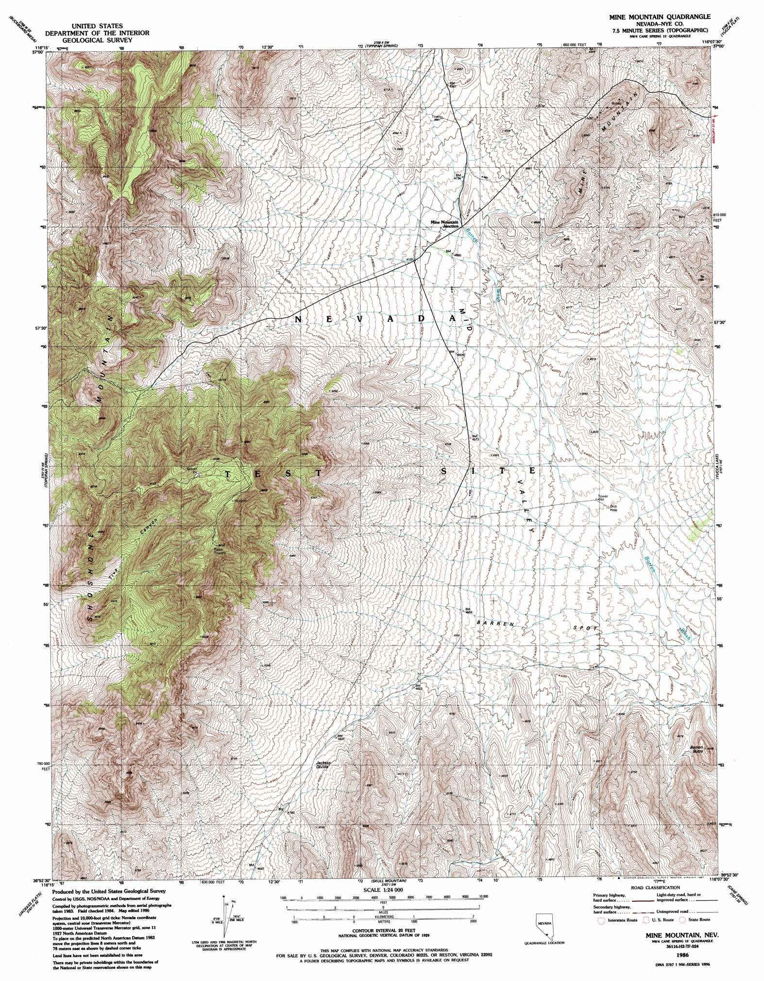
USGS Topo Quad 36116h2 - 1:24,000 scale
| Topo Map Name: | Mine Mountain |
| USGS Topo Quad ID: | 36116h2 |
| Print Size: | ca. 21 1/4" wide x 27" high |
| Southeast Coordinates: | 36.875° N latitude / 116.125° W longitude |
| Map Center Coordinates: | 36.9375° N latitude / 116.1875° W longitude |
| U.S. State: | NV |
| Filename: | o36116h2.jpg |
| Download Map JPG Image: | Mine Mountain topo map 1:24,000 scale |
| Map Type: | Topographic |
| Topo Series: | 7.5´ |
| Map Scale: | 1:24,000 |
| Source of Map Images: | United States Geological Survey (USGS) |
| Alternate Map Versions: |
Mine Mountain NV 1961, updated 1962 Download PDF Buy paper map Mine Mountain NV 1961, updated 1978 Download PDF Buy paper map Mine Mountain NV 1961, updated 1984 Download PDF Buy paper map Mine Mountain NV 1986, updated 1987 Download PDF Buy paper map |
1:24,000 Topo Quads surrounding Mine Mountain
Scrugham Peak |
Ammonia Tanks |
Rainier Mesa |
Oak Spring |
Jangle Ridge |
Timber Mountain |
Buckboard Mesa |
Tippipah Spring |
Yucca Flat |
Paiute Ridge |
Topopah Springs Nw |
Topopah Spring |
Mine Mountain |
Yucca Lake |
Plutonium Valley |
Busted Butte |
Jackass Flats |
Skull Mountain |
Cane Spring |
Frenchman Lake |
Lathrop Wells |
Striped Hills |
Specter Range Nw |
Camp Desert Rock |
Mercury |
> Back to 36116e1 at 1:100,000 scale
> Back to 36116a1 at 1:250,000 scale
> Back to U.S. Topo Maps home
Mine Mountain topo map: Gazetteer
Mine Mountain: Flats
Barren Spot elevation 1336m 4383′Mine Mountain: Gaps
Jackass Divide elevation 1484m 4868′Mine Mountain: Mines
Mercury Mine elevation 1630m 5347′Mine Mountain: Ranges
Shoshone Mountain elevation 2083m 6833′Mine Mountain: Summits
Barren Butte elevation 1369m 4491′Mine Mountain elevation 1640m 5380′
Mine Mountain: Valleys
Mid Valley elevation 1260m 4133′Mine Mountain digital topo map on disk
Buy this Mine Mountain topo map showing relief, roads, GPS coordinates and other geographical features, as a high-resolution digital map file on DVD:
Southern Sierra Nevada, California & Southern Nevada
Buy digital topo maps: Southern Sierra Nevada, California & Southern Nevada