Gonzales Topo Map California
To zoom in, hover over the map of Gonzales
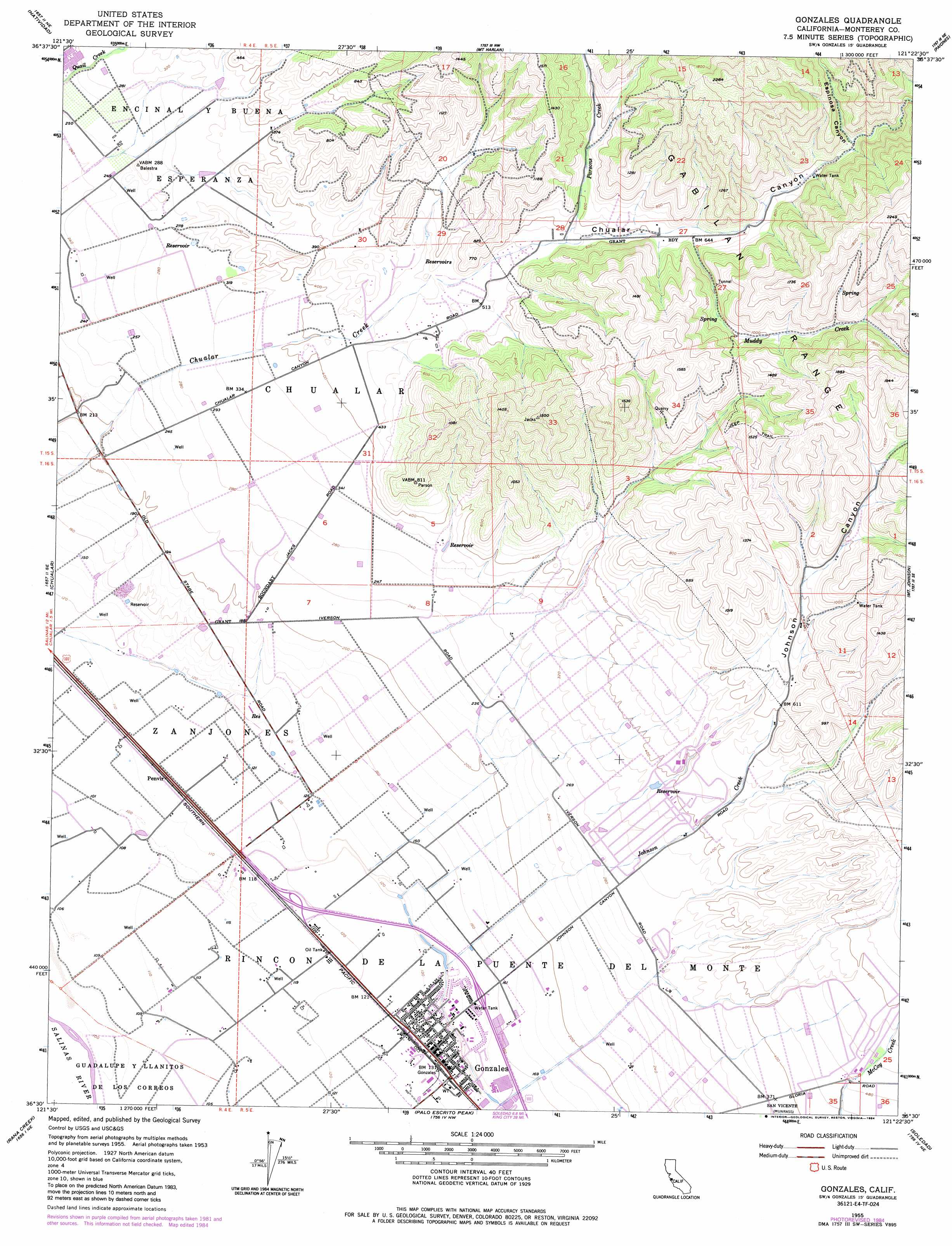
USGS Topo Quad 36121e4 - 1:24,000 scale
| Topo Map Name: | Gonzales |
| USGS Topo Quad ID: | 36121e4 |
| Print Size: | ca. 21 1/4" wide x 27" high |
| Southeast Coordinates: | 36.5° N latitude / 121.375° W longitude |
| Map Center Coordinates: | 36.5625° N latitude / 121.4375° W longitude |
| U.S. State: | CA |
| Filename: | o36121e4.jpg |
| Download Map JPG Image: | Gonzales topo map 1:24,000 scale |
| Map Type: | Topographic |
| Topo Series: | 7.5´ |
| Map Scale: | 1:24,000 |
| Source of Map Images: | United States Geological Survey (USGS) |
| Alternate Map Versions: |
Gonzales CA 1955, updated 1957 Download PDF Buy paper map Gonzales CA 1955, updated 1970 Download PDF Buy paper map Gonzales CA 1955, updated 1981 Download PDF Buy paper map Gonzales CA 1955, updated 1984 Download PDF Buy paper map Gonzales CA 2012 Download PDF Buy paper map Gonzales CA 2015 Download PDF Buy paper map |
1:24,000 Topo Quads surrounding Gonzales
Prunedale |
San Juan Bautista |
Hollister |
Tres Pinos |
Quien Sabe Valley |
Salinas |
Natividad |
Mount Harlan |
Paicines |
Cherry Peak |
Spreckels |
Chualar |
Gonzales |
Mount Johnson |
Bickmore Canyon |
Carmel Valley |
Rana Creek |
Palo Escrito Peak |
Soledad |
North Chalone Peak |
Ventana Cones |
Chews Ridge |
Sycamore Flat |
Paraiso Springs |
Greenfield |
> Back to 36121e1 at 1:100,000 scale
> Back to 36120a1 at 1:250,000 scale
> Back to U.S. Topo Maps home
Gonzales topo map: Gazetteer
Gonzales: Parks
Centennial Park elevation 42m 137′Central Park elevation 40m 131′
Gonzales Union High School Stadium elevation 42m 137′
Gonzales: Populated Places
Dean elevation 38m 124′Gabilan (historical) elevation 34m 111′
Gonzales elevation 41m 134′
Penvir elevation 35m 114′
Gonzales: Post Offices
Gonzales Post Office elevation 41m 134′Gonzales: Streams
Johnson Creek elevation 39m 127′Muddy Creek elevation 206m 675′
Parsons Creek elevation 167m 547′
Gonzales: Valleys
Chualar Canyon elevation 157m 515′Espinosa Canyon elevation 259m 849′
Johnson Canyon elevation 128m 419′
Gonzales digital topo map on disk
Buy this Gonzales topo map showing relief, roads, GPS coordinates and other geographical features, as a high-resolution digital map file on DVD: