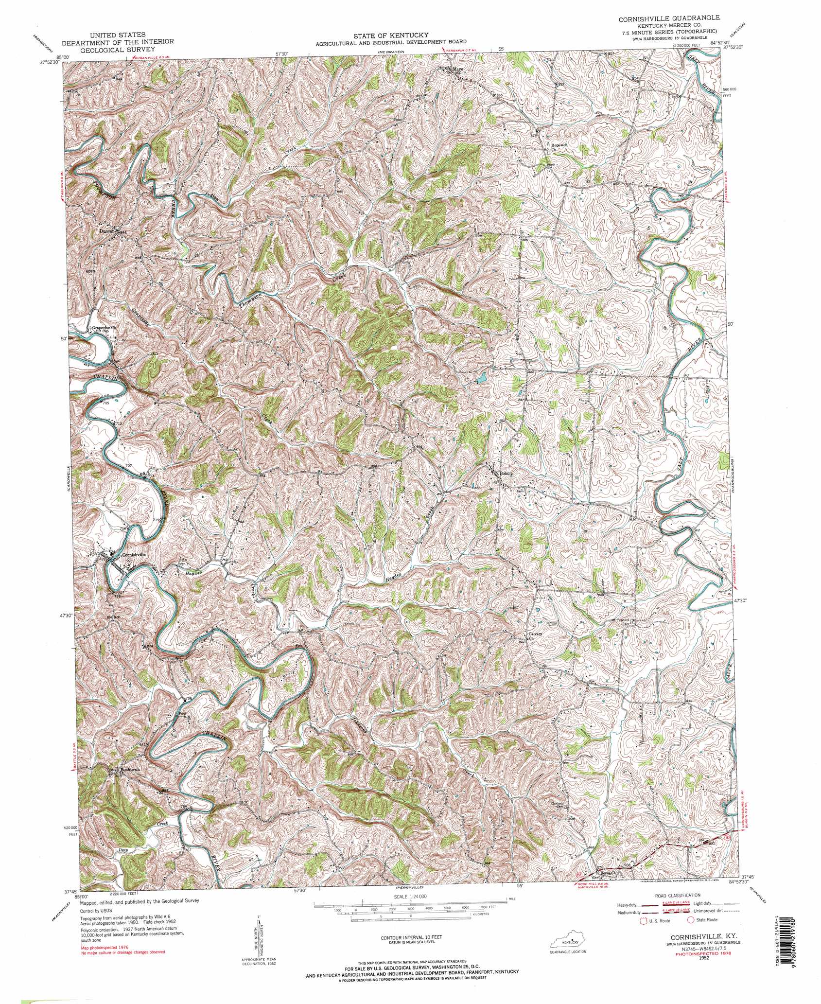
Cornishville Topo Map Kentucky
To zoom in, hover over the map of Cornishville
USGS Topo Quad 37084g8 - 1:24,000 scale
| Topo Map Name: | Cornishville |
| USGS Topo Quad ID: | 37084g8 |
| Print Size: | ca. 21 1/4" wide x 27" high |
| Southeast Coordinates: | 37.75° N latitude / 84.875° W longitude |
| Map Center Coordinates: | 37.8125° N latitude / 84.9375° W longitude |
| U.S. State: | KY |
| Filename: | o37084g8.jpg |
| Download Map JPG Image: | Cornishville topo map 1:24,000 scale |
| Map Type: | Topographic |
| Topo Series: | 7.5´ |
| Map Scale: | 1:24,000 |
| Source of Map Images: | United States Geological Survey (USGS) |
| Alternate Map Versions: |
Cornishville KY 1952, updated 1953 Download PDF Buy paper map Cornishville KY 1952, updated 1976 Download PDF Buy paper map Cornishville KY 2010 Download PDF Buy paper map Cornishville KY 2013 Download PDF Buy paper map Cornishville KY 2016 Download PDF Buy paper map |
1:24,000 Topo Quads surrounding Cornishville
Mount Eden |
Glensboro |
Lawrenceburg |
Tyrone |
Versailles |
Chaplin |
Ashbrook |
Mcbrayer |
Salvisa |
Keene |
Brush Grove |
Cardwell |
Cornishville |
Harrodsburg |
Wilmore |
Springfield |
Mackville |
Perryville |
Danville |
Bryantsville |
Lebanon East |
Gravel Switch |
Parksville |
Junction City |
Stanford |
> Back to 37084e1 at 1:100,000 scale
> Back to 37084a1 at 1:250,000 scale
> Back to U.S. Topo Maps home
Cornishville topo map: Gazetteer
Cornishville: Populated Places
Bohon elevation 272m 892′Bushtown elevation 267m 875′
Cornishville elevation 222m 728′
Duncan elevation 255m 836′
Grapevine (historical) elevation 212m 695′
Liberty (historical) elevation 261m 856′
Mayo elevation 273m 895′
Oakland (historical) elevation 284m 931′
Cornishville: Post Offices
Bohon Post Office (historical) elevation 271m 889′Cornishville Post Office (historical) elevation 216m 708′
Counter Post Office (historical) elevation 258m 846′
Duncan Post Office (historical) elevation 258m 846′
Mayo Post Office (historical) elevation 276m 905′
Cornishville: Streams
Deep Creek elevation 223m 731′Grapevine Creek elevation 210m 688′
Hayden Creek elevation 218m 715′
Indian Creek elevation 215m 705′
Johnsons Creek elevation 221m 725′
Little Indian Creek elevation 213m 698′
Trace Branch elevation 222m 728′
Cornishville digital topo map on disk
Buy this Cornishville topo map showing relief, roads, GPS coordinates and other geographical features, as a high-resolution digital map file on DVD: