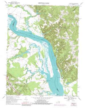
Champlain Topo Map Virginia
To zoom in, hover over the map of Champlain
USGS Topo Quad 38076a8 - 1:24,000 scale
| Topo Map Name: | Champlain |
| USGS Topo Quad ID: | 38076a8 |
| Print Size: | ca. 21 1/4" wide x 27" high |
| Southeast Coordinates: | 38° N latitude / 76.875° W longitude |
| Map Center Coordinates: | 38.0625° N latitude / 76.9375° W longitude |
| U.S. State: | VA |
| Filename: | o38076a8.jpg |
| Download Map JPG Image: | Champlain topo map 1:24,000 scale |
| Map Type: | Topographic |
| Topo Series: | 7.5´ |
| Map Scale: | 1:24,000 |
| Source of Map Images: | United States Geological Survey (USGS) |
| Alternate Map Versions: |
Champlain VA 1943, updated 1961 Download PDF Buy paper map Champlain VA 1968, updated 1971 Download PDF Buy paper map Champlain VA 1968, updated 1974 Download PDF Buy paper map Champlain VA 1968, updated 1984 Download PDF Buy paper map Champlain VA 1968, updated 1989 Download PDF Buy paper map Champlain VA 2010 Download PDF Buy paper map Champlain VA 2013 Download PDF Buy paper map Champlain VA 2016 Download PDF Buy paper map |
1:24,000 Topo Quads surrounding Champlain
> Back to 38076a1 at 1:100,000 scale
> Back to 38076a1 at 1:250,000 scale
> Back to U.S. Topo Maps home
Champlain topo map: Gazetteer
Champlain: Capes
Blandfield Point elevation 0m 0′Bottoms Neck elevation 3m 9′
Island Point elevation 0m 0′
Lawson Neck elevation 7m 22′
Thomas Neck elevation 4m 13′
Champlain: Channels
Layton Reach elevation 0m 0′Champlain: Cliffs
Fones Cliffs elevation 12m 39′Champlain: Dams
Horners Dam elevation 7m 22′Hundley Dam elevation 1m 3′
Champlain: Islands
Lukes Island elevation 24m 78′Paynes Island elevation 3m 9′
Champlain: Populated Places
Champlain elevation 46m 150′China Hill elevation 53m 173′
Foneswood elevation 49m 160′
Horners elevation 15m 49′
Layton elevation 7m 22′
Leedstown elevation 3m 9′
Lukes Island (historical) elevation 46m 150′
Oak Row elevation 47m 154′
Peeds elevation 50m 164′
Singerly elevation 52m 170′
Champlain: Post Offices
Chance Post Office (historical) elevation 14m 45′Champlain: Reservoirs
Horners Pond elevation 7m 22′Hundley Pond elevation 1m 3′
Smoots Pond (historical) elevation 39m 127′
Champlain: Ridges
Pea Ridge elevation 40m 131′Champlain: Streams
Beaverdam Creek elevation 11m 36′Beverly Marsh Creek elevation 2m 6′
Brick Hill Creek elevation 3m 9′
Bridge Creek elevation 3m 9′
Brockenbrough Creek elevation 4m 13′
Burnett Creek elevation 1m 3′
Clift Creek elevation 1m 3′
Colemans Creek elevation 3m 9′
Farmers Hall Creek elevation 1m 3′
Garlands Creek elevation 1m 3′
Handpole Creek elevation 5m 16′
Jones Creek elevation 0m 0′
Marriner Run elevation 24m 78′
Mill Swamp elevation 0m 0′
Mud Hole Swamp elevation 3m 9′
Occupacia Creek elevation 0m 0′
Peedee Creek elevation 0m 0′
Rouzie Swamp elevation 7m 22′
Sluice Creek elevation 0m 0′
Smith Mount Branch elevation 17m 55′
Smoots Mill Run elevation 6m 19′
Waverly Branch elevation 7m 22′
Wilna Creek elevation 1m 3′
Champlain: Summits
Bald Eagle Hill elevation 48m 157′China Hill elevation 55m 180′
Smith Mount Hill elevation 49m 160′
Waverly Hill elevation 45m 147′
Champlain: Swamps
Beverly Marsh elevation 5m 16′Hutchinson Swamp elevation 2m 6′
Margaret Lee Swamp elevation 1m 3′
Otterburn Marsh elevation 2m 6′
Champlain digital topo map on disk
Buy this Champlain topo map showing relief, roads, GPS coordinates and other geographical features, as a high-resolution digital map file on DVD:
Atlantic Coast (NY, NJ, PA, DE, MD, VA, NC)
Buy digital topo maps: Atlantic Coast (NY, NJ, PA, DE, MD, VA, NC)


