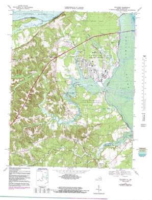
Dahlgren Topo Map Virginia
To zoom in, hover over the map of Dahlgren
USGS Topo Quad 38077c1 - 1:24,000 scale
| Topo Map Name: | Dahlgren |
| USGS Topo Quad ID: | 38077c1 |
| Print Size: | ca. 21 1/4" wide x 27" high |
| Southeast Coordinates: | 38.25° N latitude / 77° W longitude |
| Map Center Coordinates: | 38.3125° N latitude / 77.0625° W longitude |
| U.S. States: | VA, MD |
| Filename: | o38077c1.jpg |
| Download Map JPG Image: | Dahlgren topo map 1:24,000 scale |
| Map Type: | Topographic |
| Topo Series: | 7.5´ |
| Map Scale: | 1:24,000 |
| Source of Map Images: | United States Geological Survey (USGS) |
| Alternate Map Versions: |
Dahlgren VA 1955, updated 1956 Download PDF Buy paper map Dahlgren VA 1968, updated 1972 Download PDF Buy paper map Dahlgren VA 1968, updated 1984 Download PDF Buy paper map Dahlgren VA 2011 Download PDF Buy paper map Dahlgren VA 2013 Download PDF Buy paper map Dahlgren VA 2016 Download PDF Buy paper map |
1:24,000 Topo Quads surrounding Dahlgren
> Back to 38077a1 at 1:100,000 scale
> Back to 38076a1 at 1:250,000 scale
> Back to U.S. Topo Maps home
Dahlgren topo map: Gazetteer
Dahlgren: Bridges
Harry W Nice Memorial Bridge elevation 0m 0′Dahlgren: Capes
Baber Point elevation 0m 0′Howland Point elevation 0m 0′
King George Point elevation 0m 0′
Long Point elevation 4m 13′
Persimmon Point elevation 0m 0′
Pumpkin Neck elevation 33m 108′
Stony Point elevation 6m 19′
Stuart Point elevation 0m 0′
Dahlgren: Dams
United States Naval Proving Grounds Dam elevation 8m 26′Dahlgren: Flats
Tetotum Flats elevation 5m 16′Dahlgren: Islands
Wood Island elevation 0m 0′Dahlgren: Populated Places
Alden elevation 32m 104′Allnut elevation 45m 147′
Carruthers Corner elevation 45m 147′
Chestnut Hill elevation 46m 150′
Dahlgren elevation 6m 19′
Hooes elevation 7m 22′
Maple Grove elevation 19m 62′
Ninde elevation 44m 144′
Owens elevation 45m 147′
Tetotum elevation 50m 164′
Dahlgren: Post Offices
Dahlgren Post Office elevation 6m 19′Dahlgren: Reservoirs
Hideaway Pond elevation 1m 3′United States Naval Proving Grounds Pond elevation 8m 26′
Dahlgren: Streams
Chotank Creek elevation 0m 0′Deep Creek elevation 1m 3′
Gambo Creek elevation 1m 3′
Pepper Mill Creek elevation 3m 9′
Pine Hill Creek elevation 1m 3′
Poplar Neck Creek elevation -3m -10′
Upper Machodoc Creek elevation 0m 0′
Williams Creek elevation 0m 0′
Dahlgren: Swamps
Black Marsh elevation 4m 13′Dahlgren digital topo map on disk
Buy this Dahlgren topo map showing relief, roads, GPS coordinates and other geographical features, as a high-resolution digital map file on DVD:
Atlantic Coast (NY, NJ, PA, DE, MD, VA, NC)
Buy digital topo maps: Atlantic Coast (NY, NJ, PA, DE, MD, VA, NC)


