Huntingburg Topo Map Indiana
To zoom in, hover over the map of Huntingburg
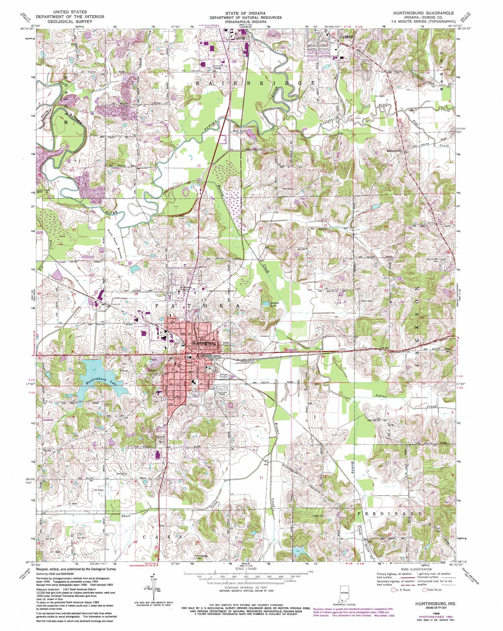
USGS Topo Quad 38086c8 - 1:24,000 scale
| Topo Map Name: | Huntingburg |
| USGS Topo Quad ID: | 38086c8 |
| Print Size: | ca. 21 1/4" wide x 27" high |
| Southeast Coordinates: | 38.25° N latitude / 86.875° W longitude |
| Map Center Coordinates: | 38.3125° N latitude / 86.9375° W longitude |
| U.S. State: | IN |
| Filename: | o38086c8.jpg |
| Download Map JPG Image: | Huntingburg topo map 1:24,000 scale |
| Map Type: | Topographic |
| Topo Series: | 7.5´ |
| Map Scale: | 1:24,000 |
| Source of Map Images: | United States Geological Survey (USGS) |
| Alternate Map Versions: |
Huntingburg IN 1954, updated 1956 Download PDF Buy paper map Huntingburg IN 1954, updated 1963 Download PDF Buy paper map Huntingburg IN 1969, updated 1971 Download PDF Buy paper map Huntingburg IN 1969, updated 1981 Download PDF Buy paper map Huntingburg IN 1969, updated 1990 Download PDF Buy paper map Huntingburg IN 2010 Download PDF Buy paper map Huntingburg IN 2013 Download PDF Buy paper map Huntingburg IN 2016 Download PDF Buy paper map |
1:24,000 Topo Quads surrounding Huntingburg
Sandy Hook |
Glendale |
Alfordsville |
Rusk |
Hillham |
Winslow |
Otwell |
Jasper |
Dubois |
Cuzco |
Augusta |
Velpen |
Huntingburg |
Saint Anthony |
Birdseye |
Folsomville |
Holland |
Dale |
Saint Meinrad |
Bristow |
De Gonia Springs |
Chrisney |
Santa Claus |
Fulda |
Gatchel |
> Back to 38086a1 at 1:100,000 scale
> Back to 38086a1 at 1:250,000 scale
> Back to U.S. Topo Maps home
Huntingburg topo map: Gazetteer
Huntingburg: Bends
Duck Pond Bottom elevation 134m 439′Huntingburg: Dams
Huntingburg City Lake Dam elevation 146m 479′Huntingburg Conservation Club Dam elevation 150m 492′
Huntingburg: Lakes
Knebel Lake elevation 140m 459′Huntingburg: Populated Places
Huntingburg elevation 149m 488′Maltersville elevation 152m 498′
Huntingburg: Reservoirs
Huntingburg Conservation Club Lake elevation 150m 492′Huntingburg Lake elevation 146m 479′
Huntingburg: Ridges
Devils Backbone elevation 137m 449′Huntingburg: Streams
Bruner Creek elevation 136m 446′Dick Creek elevation 135m 442′
Ell Creek elevation 134m 439′
Flat Creek elevation 137m 449′
Green Creek elevation 141m 462′
Hall Creek elevation 137m 449′
Hunley Creek elevation 137m 449′
Indian Creek elevation 137m 449′
Jahn Creek elevation 137m 449′
Short Creek elevation 137m 449′
Straight River elevation 133m 436′
Huntingburg digital topo map on disk
Buy this Huntingburg topo map showing relief, roads, GPS coordinates and other geographical features, as a high-resolution digital map file on DVD: