Ina Topo Map Illinois
To zoom in, hover over the map of Ina
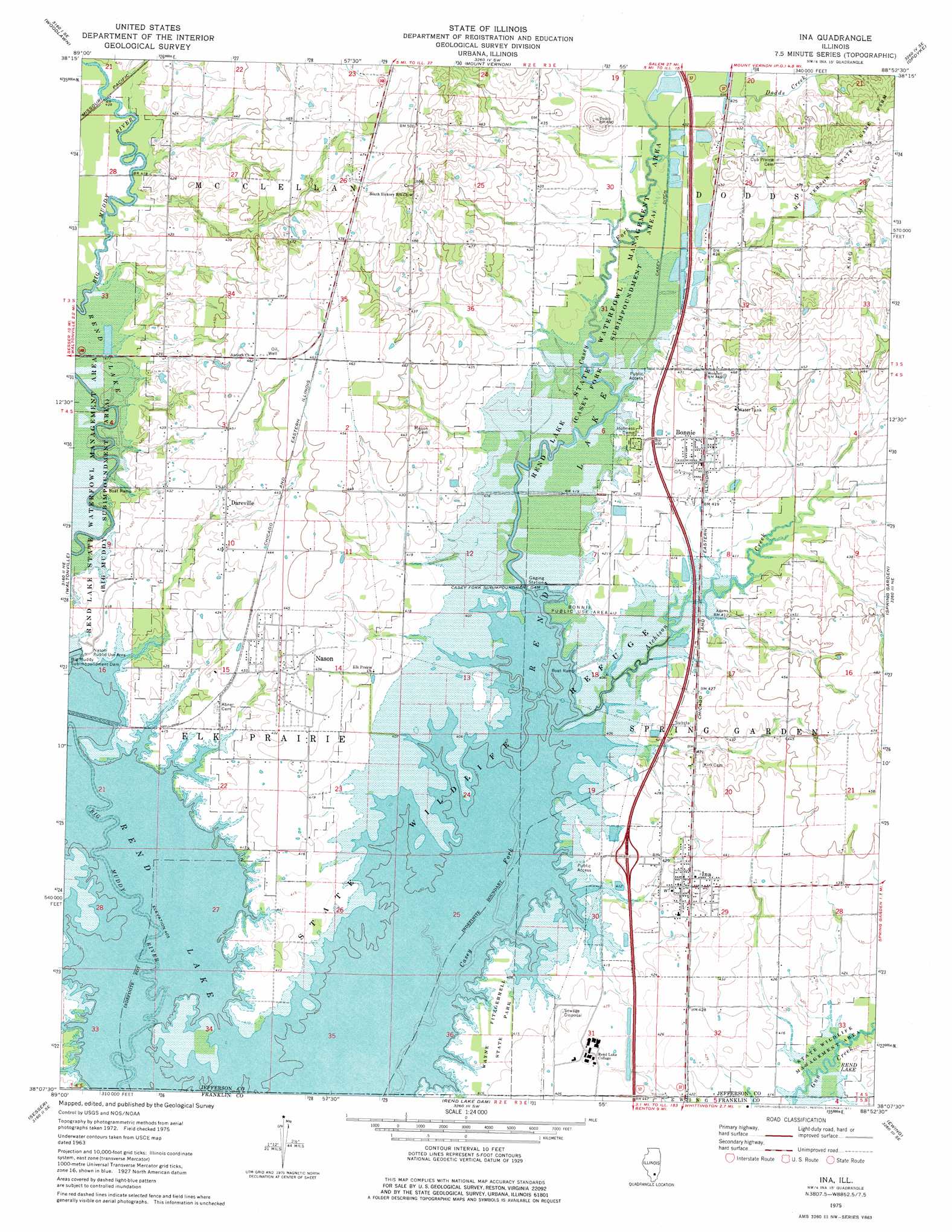
USGS Topo Quad 38088b8 - 1:24,000 scale
| Topo Map Name: | Ina |
| USGS Topo Quad ID: | 38088b8 |
| Print Size: | ca. 21 1/4" wide x 27" high |
| Southeast Coordinates: | 38.125° N latitude / 88.875° W longitude |
| Map Center Coordinates: | 38.1875° N latitude / 88.9375° W longitude |
| U.S. State: | IL |
| Filename: | o38088b8.jpg |
| Download Map JPG Image: | Ina topo map 1:24,000 scale |
| Map Type: | Topographic |
| Topo Series: | 7.5´ |
| Map Scale: | 1:24,000 |
| Source of Map Images: | United States Geological Survey (USGS) |
| Alternate Map Versions: |
Ina IL 1975, updated 1977 Download PDF Buy paper map Ina IL 1998, updated 2000 Download PDF Buy paper map Ina IL 2012 Download PDF Buy paper map Ina IL 2015 Download PDF Buy paper map |
1:24,000 Topo Quads surrounding Ina
Irvington |
Walnut Hill |
Kell |
Harmony |
Shields |
Ashley |
Woodlawn |
Mount Vernon |
Opdyke |
Bluford |
Tamaroa |
Waltonville |
Ina |
Spring Garden |
Dahlgren |
Du Quoin |
Sesser |
Rend Lake Dam |
Ewing |
Macedonia |
Elkville |
Christopher |
West Frankfort |
Thompsonville |
Akin |
> Back to 38088a1 at 1:100,000 scale
> Back to 38088a1 at 1:250,000 scale
> Back to U.S. Topo Maps home
Ina topo map: Gazetteer
Ina: Airports
Davy Jones Airport elevation 148m 485′Ina: Canals
Casey Ditch elevation 125m 410′Ina: Crossings
Interchange 83 elevation 132m 433′Ina: Dams
Casey Fork Subimpoundment Dam elevation 124m 406′Ina: Parks
Bonnie Public Use Area elevation 124m 406′Mount Vernon State Game Farm elevation 149m 488′
Rend Lake State Wildlife Refuge elevation 124m 406′
Ina: Populated Places
Bonnie elevation 130m 426′Dareville elevation 131m 429′
Ina elevation 131m 429′
Nason elevation 133m 436′
Ina: Streams
Atchison Creek elevation 123m 403′Dodds Creek elevation 124m 406′
Ina digital topo map on disk
Buy this Ina topo map showing relief, roads, GPS coordinates and other geographical features, as a high-resolution digital map file on DVD: