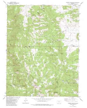
Cameron Mountain Topo Map Colorado
To zoom in, hover over the map of Cameron Mountain
USGS Topo Quad 38105f8 - 1:24,000 scale
| Topo Map Name: | Cameron Mountain |
| USGS Topo Quad ID: | 38105f8 |
| Print Size: | ca. 21 1/4" wide x 27" high |
| Southeast Coordinates: | 38.625° N latitude / 105.875° W longitude |
| Map Center Coordinates: | 38.6875° N latitude / 105.9375° W longitude |
| U.S. State: | CO |
| Filename: | o38105f8.jpg |
| Download Map JPG Image: | Cameron Mountain topo map 1:24,000 scale |
| Map Type: | Topographic |
| Topo Series: | 7.5´ |
| Map Scale: | 1:24,000 |
| Source of Map Images: | United States Geological Survey (USGS) |
| Alternate Map Versions: |
Cameron Mountain CO 1983, updated 1983 Download PDF Buy paper map Cameron Mountain CO 1994, updated 1998 Download PDF Buy paper map Cameron Mountain CO 2011 Download PDF Buy paper map Cameron Mountain CO 2013 Download PDF Buy paper map Cameron Mountain CO 2016 Download PDF Buy paper map |
| FStopo: | US Forest Service topo Cameron Mountain is available: Download FStopo PDF Download FStopo TIF |
1:24,000 Topo Quads surrounding Cameron Mountain
> Back to 38105e1 at 1:100,000 scale
> Back to 38104a1 at 1:250,000 scale
> Back to U.S. Topo Maps home
Cameron Mountain topo map: Gazetteer
Cameron Mountain: Flats
Coons Park elevation 2916m 9566′Herring Park elevation 2778m 9114′
Cameron Mountain: Mines
Allard Beryllium Mine elevation 2651m 8697′Buckley Hill Mine elevation 2651m 8697′
Free Town Lode Mine elevation 2990m 9809′
Golden Wonder Mine elevation 2720m 8923′
Last Chance Prospect Mine elevation 2760m 9055′
M and W Mine elevation 2651m 8697′
Midwest Quarry elevation 3245m 10646′
Turret Independence Mine elevation 2651m 8697′
Cameron Mountain: Populated Places
Futurity elevation 2976m 9763′Turret elevation 2599m 8526′
Whitehorn elevation 2846m 9337′
Cameron Mountain: Ridges
Aspen Ridge elevation 3261m 10698′Graphite Ridge elevation 3025m 9924′
Cameron Mountain: Springs
Cable Spring elevation 2891m 9484′Hollenbeck Spring elevation 3054m 10019′
Manoa Springs elevation 2877m 9438′
Rock Spring elevation 2991m 9812′
Sawmill Spring elevation 2868m 9409′
School Section Spring elevation 3002m 9849′
Cameron Mountain: Summits
Bull Hill elevation 3084m 10118′Calumet Mountain elevation 2954m 9691′
Cameron Mountain elevation 3331m 10928′
Creep Mountain elevation 3103m 10180′
Green Mountain elevation 3124m 10249′
The Mascot elevation 3126m 10255′
Cameron Mountain: Valleys
Cable Gulch elevation 2794m 9166′Calf Gulch elevation 2772m 9094′
Cals Fork Gulch elevation 3102m 10177′
Cow Gulch elevation 2766m 9074′
Futurity Gulch elevation 2855m 9366′
Little Bull Gulch elevation 2833m 9294′
Cameron Mountain digital topo map on disk
Buy this Cameron Mountain topo map showing relief, roads, GPS coordinates and other geographical features, as a high-resolution digital map file on DVD:


