Waugh Mountain Topo Map Colorado
To zoom in, hover over the map of Waugh Mountain
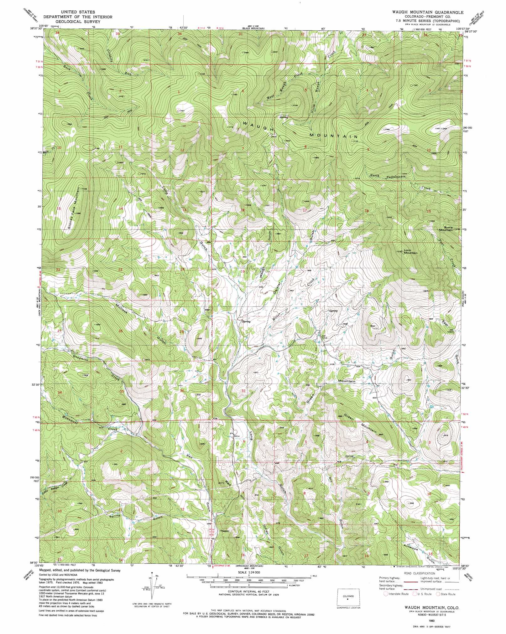
USGS Topo Quad 38105e6 - 1:24,000 scale
| Topo Map Name: | Waugh Mountain |
| USGS Topo Quad ID: | 38105e6 |
| Print Size: | ca. 21 1/4" wide x 27" high |
| Southeast Coordinates: | 38.5° N latitude / 105.625° W longitude |
| Map Center Coordinates: | 38.5625° N latitude / 105.6875° W longitude |
| U.S. State: | CO |
| Filename: | o38105e6.jpg |
| Download Map JPG Image: | Waugh Mountain topo map 1:24,000 scale |
| Map Type: | Topographic |
| Topo Series: | 7.5´ |
| Map Scale: | 1:24,000 |
| Source of Map Images: | United States Geological Survey (USGS) |
| Alternate Map Versions: |
Waugh Mountain CO 1983, updated 1983 Download PDF Buy paper map Waugh Mountain CO 2010 Download PDF Buy paper map Waugh Mountain CO 2013 Download PDF Buy paper map Waugh Mountain CO 2016 Download PDF Buy paper map |
1:24,000 Topo Quads surrounding Waugh Mountain
Castle Rock Gulch |
Agate Mountain |
Dicks Peak |
Thirtynine Mile Mountain |
Witcher Mountain |
Cameron Mountain |
Gribbles Park |
Black Mountain |
Thirtyone Mile Mountain |
Cover Mountain |
Salida East |
Jack Hall Mountain |
Waugh Mountain |
Hall Gulch |
Gribble Mountain |
Wellsville |
Howard |
Arkansas Mountain |
Echo |
Mcintyre Hills |
Bushnell Peak |
Coaldale |
Cotopaxi |
Hillside |
Iron Mountain |
> Back to 38105e1 at 1:100,000 scale
> Back to 38104a1 at 1:250,000 scale
> Back to U.S. Topo Maps home
Waugh Mountain topo map: Gazetteer
Waugh Mountain: Streams
Miller Creek elevation 2717m 8914′Quagmire Creek elevation 2726m 8943′
West Waugh Creek elevation 2950m 9678′
Waugh Mountain: Summits
Burris Mountain elevation 3262m 10702′Green Mountain elevation 3002m 9849′
Loco Mountain elevation 3415m 11204′
North Burno Mountain elevation 2730m 8956′
Red Hill elevation 2748m 9015′
Stoney Face Mountain elevation 3465m 11368′
Waugh Mountain elevation 3564m 11692′
Waugh Mountain: Valleys
Dry Gulch elevation 2555m 8382′Galster Gulch elevation 2740m 8989′
Green Mountain Gulch elevation 2618m 8589′
Mullock Gulch elevation 2702m 8864′
Spring Gulch elevation 2582m 8471′
Waugh Gulch elevation 2764m 9068′
Waugh Mountain digital topo map on disk
Buy this Waugh Mountain topo map showing relief, roads, GPS coordinates and other geographical features, as a high-resolution digital map file on DVD: