Sargents Mesa Topo Map Colorado
To zoom in, hover over the map of Sargents Mesa
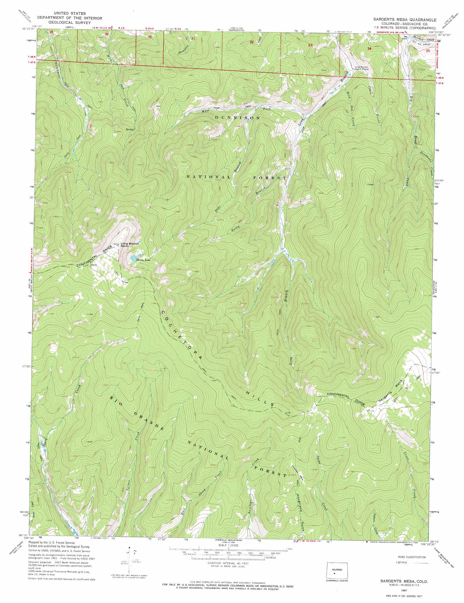
USGS Topo Quad 38106c4 - 1:24,000 scale
| Topo Map Name: | Sargents Mesa |
| USGS Topo Quad ID: | 38106c4 |
| Print Size: | ca. 21 1/4" wide x 27" high |
| Southeast Coordinates: | 38.25° N latitude / 106.375° W longitude |
| Map Center Coordinates: | 38.3125° N latitude / 106.4375° W longitude |
| U.S. State: | CO |
| Filename: | o38106c4.jpg |
| Download Map JPG Image: | Sargents Mesa topo map 1:24,000 scale |
| Map Type: | Topographic |
| Topo Series: | 7.5´ |
| Map Scale: | 1:24,000 |
| Source of Map Images: | United States Geological Survey (USGS) |
| Alternate Map Versions: |
Sargents Mesa CO 1967, updated 1969 Download PDF Buy paper map Sargents Mesa CO 1967, updated 1969 Download PDF Buy paper map Sargents Mesa CO 2001, updated 2005 Download PDF Buy paper map Sargents Mesa CO 2011 Download PDF Buy paper map Sargents Mesa CO 2013 Download PDF Buy paper map Sargents Mesa CO 2016 Download PDF Buy paper map |
| FStopo: | US Forest Service topo Sargents Mesa is available: Download FStopo PDF Download FStopo TIF |
1:24,000 Topo Quads surrounding Sargents Mesa
Parlin |
Pitkin |
Whitepine |
Garfield |
Maysville |
Houston Gulch |
Doyleville |
Sargents |
Pahlone Peak |
Mount Ouray |
Razor Creek Dome |
West Baldy |
Sargents Mesa |
Chester |
Bonanza |
Cochetopa Park |
North Pass |
Trickle Mountain |
Lake Mountain Ne |
Klondike Mine |
Saguache Park |
Grouse Creek |
Lake Mountain |
Laughlin Gulch |
Saguache |
> Back to 38106a1 at 1:100,000 scale
> Back to 38106a1 at 1:250,000 scale
> Back to U.S. Topo Maps home
Sargents Mesa topo map: Gazetteer
Sargents Mesa: Flats
Firebox Park elevation 3242m 10636′Sargents Mesa: Lakes
Baldy Lake elevation 3434m 11266′Sargents Mesa: Streams
Baldy Branch elevation 2726m 8943′Big Bend Creek elevation 2642m 8667′
Clair Creek elevation 2641m 8664′
Deadmans Creek elevation 2800m 9186′
Lake Branch elevation 2744m 9002′
West Fork Long Branch Tomichi Creek elevation 2679m 8789′
Wild Dog Creek elevation 2652m 8700′
Sargents Mesa: Summits
Long Branch Baldy elevation 3649m 11971′Sargents Mesa elevation 3575m 11729′
Sargents Mesa digital topo map on disk
Buy this Sargents Mesa topo map showing relief, roads, GPS coordinates and other geographical features, as a high-resolution digital map file on DVD: