Bear Canyon Topo Map Utah
To zoom in, hover over the map of Bear Canyon
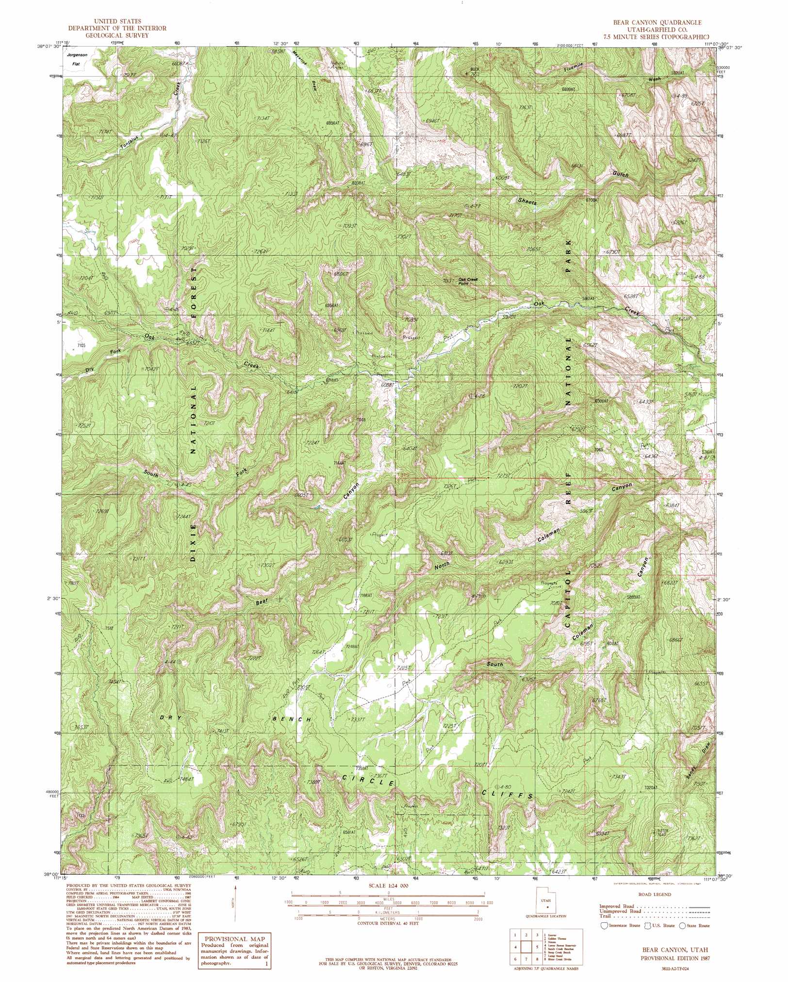
USGS Topo Quad 38111a2 - 1:24,000 scale
| Topo Map Name: | Bear Canyon |
| USGS Topo Quad ID: | 38111a2 |
| Print Size: | ca. 21 1/4" wide x 27" high |
| Southeast Coordinates: | 38° N latitude / 111.125° W longitude |
| Map Center Coordinates: | 38.0625° N latitude / 111.1875° W longitude |
| U.S. State: | UT |
| Filename: | o38111a2.jpg |
| Download Map JPG Image: | Bear Canyon topo map 1:24,000 scale |
| Map Type: | Topographic |
| Topo Series: | 7.5´ |
| Map Scale: | 1:24,000 |
| Source of Map Images: | United States Geological Survey (USGS) |
| Alternate Map Versions: |
Notom 4 SW UT 1952, updated 1954 Download PDF Buy paper map Bear Canyon UT 1987, updated 1987 Download PDF Buy paper map Bear Canyon UT 2002, updated 2005 Download PDF Buy paper map Bear Canyon UT 2011 Download PDF Buy paper map Bear Canyon UT 2014 Download PDF Buy paper map |
| FStopo: | US Forest Service topo Bear Canyon is available: Download FStopo PDF Download FStopo TIF |
1:24,000 Topo Quads surrounding Bear Canyon
Torrey |
Twin Rocks |
Fruita |
Caineville |
Town Point |
Blind Lake |
Grover |
Golden Throne |
Notom |
Stevens Mesa |
Deer Creek Lake |
Lower Bowns Reservoir |
Bear Canyon |
Sandy Creek Benches |
Steele Butte |
Boulder Town |
Steep Creek Bench |
Lamp Stand |
Bitter Creek Divide |
Cave Flat |
Calf Creek |
King Bench |
Pioneer Mesa |
Wagon Box Mesa |
The Post |
> Back to 38111a1 at 1:100,000 scale
> Back to 38110a1 at 1:250,000 scale
> Back to U.S. Topo Maps home
Bear Canyon topo map: Gazetteer
Bear Canyon: Benches
Dry Bench elevation 2224m 7296′Bear Canyon: Streams
Dry Fork elevation 2026m 6646′South Fork Oak Creek elevation 1910m 6266′
Bear Canyon: Summits
Nicks Peak elevation 2035m 6676′Oak Creek Point elevation 2140m 7020′
The Salmon elevation 2166m 7106′
Bear Canyon: Valleys
Bear Canyon elevation 1870m 6135′Rainbow Draw elevation 1839m 6033′
Salt Lick Draw elevation 2089m 6853′
Bear Canyon digital topo map on disk
Buy this Bear Canyon topo map showing relief, roads, GPS coordinates and other geographical features, as a high-resolution digital map file on DVD: