Mcintyre Summit Topo Map Nevada
To zoom in, hover over the map of Mcintyre Summit
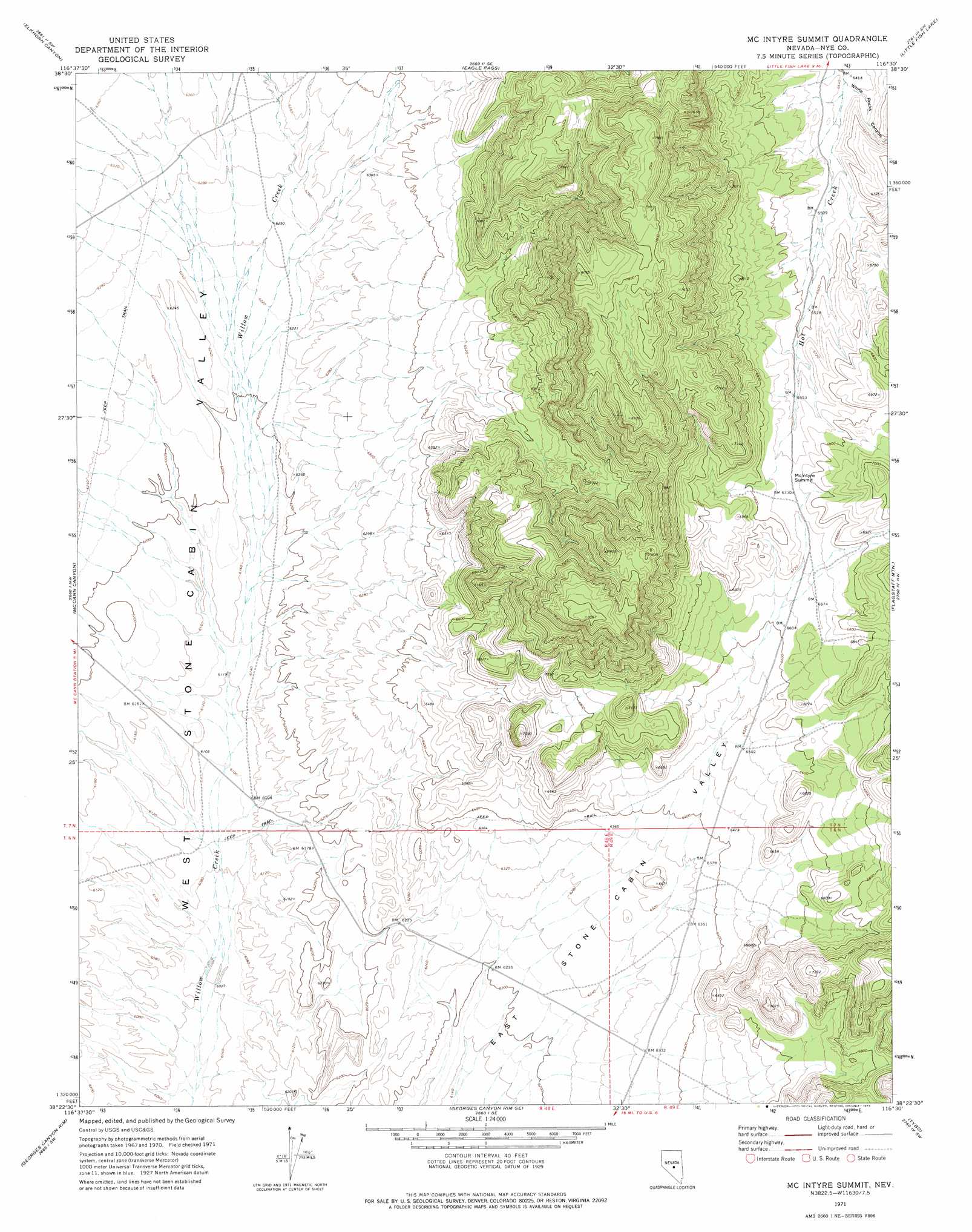
USGS Topo Quad 38116d5 - 1:24,000 scale
| Topo Map Name: | Mcintyre Summit |
| USGS Topo Quad ID: | 38116d5 |
| Print Size: | ca. 21 1/4" wide x 27" high |
| Southeast Coordinates: | 38.375° N latitude / 116.5° W longitude |
| Map Center Coordinates: | 38.4375° N latitude / 116.5625° W longitude |
| U.S. State: | NV |
| Filename: | o38116d5.jpg |
| Download Map JPG Image: | Mcintyre Summit topo map 1:24,000 scale |
| Map Type: | Topographic |
| Topo Series: | 7.5´ |
| Map Scale: | 1:24,000 |
| Source of Map Images: | United States Geological Survey (USGS) |
| Alternate Map Versions: |
McIntyre Summit NV 1971, updated 1974 Download PDF Buy paper map McIntyre Summit NV 2012 Download PDF Buy paper map McIntyre Summit NV 2014 Download PDF Buy paper map |
| FStopo: | US Forest Service topo McIntyre Summit is available: Download FStopo PDF Download FStopo TIF |
1:24,000 Topo Quads surrounding Mcintyre Summit
Corcoran Canyon |
Barley Creek |
Green Monster Canyon |
Upper Fish Lake |
Morey Peak |
Belmont East |
Elkhorn Canyon |
Eagle Pass |
Little Fish Lake |
Hobble Canyon |
Big Ten Peak East |
Mccann Canyon |
Mcintyre Summit |
Flagstaff Mountain |
Blue Jay Spring |
Saulsbury Basin |
Georges Canyon Rim |
Georges Canyon Rim Se |
Tybo |
Tybo Well |
Mud Spring |
Stone Cabin Ranch |
Stone Cabin Ranch Ne |
Warm Springs Summit |
Warm Springs |
> Back to 38116a1 at 1:100,000 scale
> Back to 38116a1 at 1:250,000 scale
> Back to U.S. Topo Maps home
Mcintyre Summit topo map: Gazetteer
Mcintyre Summit: Gaps
McIntyre Summit elevation 2056m 6745′Mcintyre Summit: Valleys
White Rocks Canyon elevation 1962m 6437′Mcintyre Summit digital topo map on disk
Buy this Mcintyre Summit topo map showing relief, roads, GPS coordinates and other geographical features, as a high-resolution digital map file on DVD: