Pleasant Grove Topo Map California
To zoom in, hover over the map of Pleasant Grove
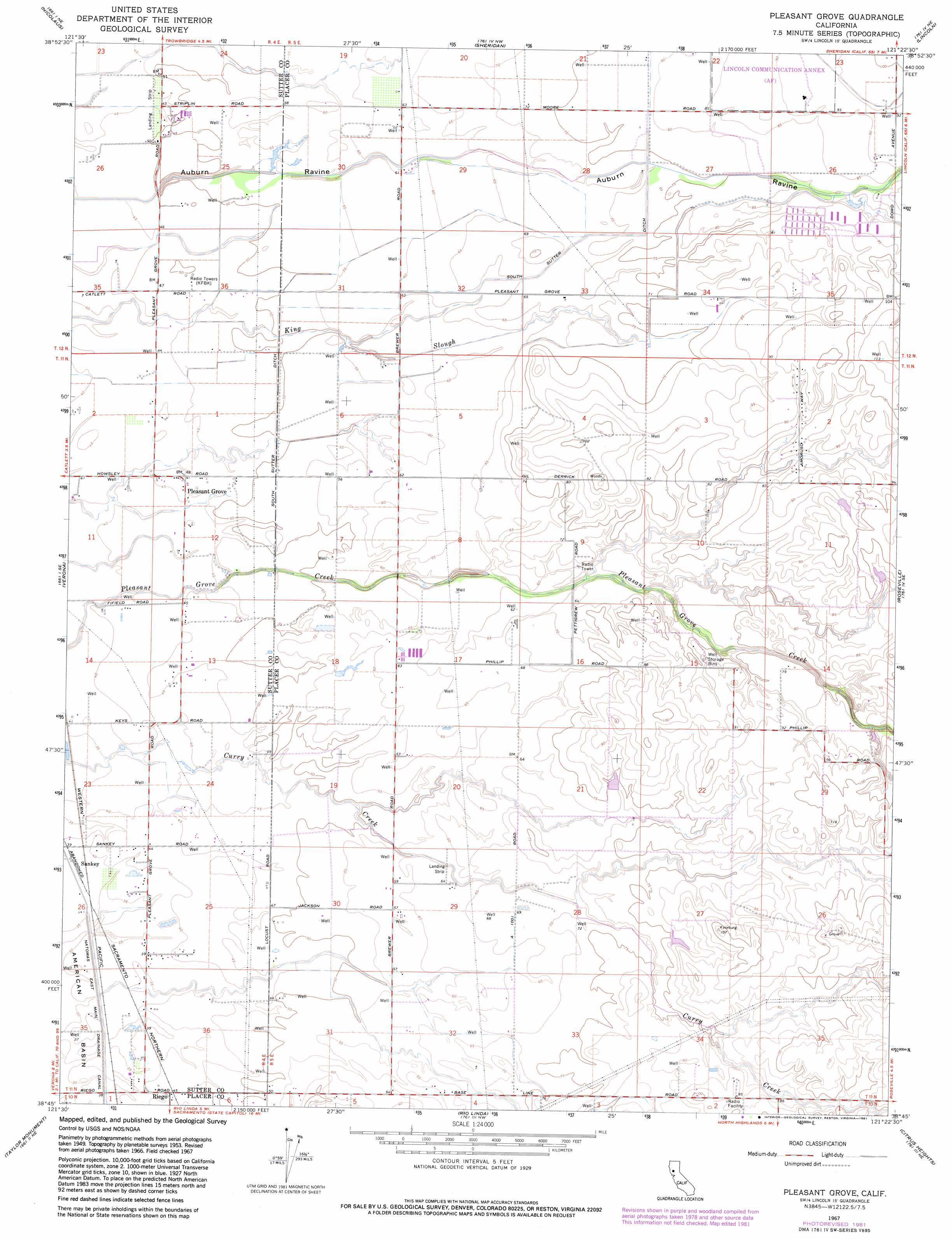
USGS Topo Quad 38121g4 - 1:24,000 scale
| Topo Map Name: | Pleasant Grove |
| USGS Topo Quad ID: | 38121g4 |
| Print Size: | ca. 21 1/4" wide x 27" high |
| Southeast Coordinates: | 38.75° N latitude / 121.375° W longitude |
| Map Center Coordinates: | 38.8125° N latitude / 121.4375° W longitude |
| U.S. State: | CA |
| Filename: | o38121g4.jpg |
| Download Map JPG Image: | Pleasant Grove topo map 1:24,000 scale |
| Map Type: | Topographic |
| Topo Series: | 7.5´ |
| Map Scale: | 1:24,000 |
| Source of Map Images: | United States Geological Survey (USGS) |
| Alternate Map Versions: |
Pleasant Grove CA 1953, updated 1954 Download PDF Buy paper map Pleasant Grove CA 1953, updated 1962 Download PDF Buy paper map Pleasant Grove CA 1967, updated 1968 Download PDF Buy paper map Pleasant Grove CA 1967, updated 1981 Download PDF Buy paper map Pleasant Grove CA 2012 Download PDF Buy paper map Pleasant Grove CA 2015 Download PDF Buy paper map |
1:24,000 Topo Quads surrounding Pleasant Grove
Gilsizer Slough |
Olivehurst |
Wheatland |
Camp Far West |
Wolf |
Sutter Causeway |
Nicolaus |
Sheridan |
Lincoln |
Gold Hill |
Knights Landing |
Verona |
Pleasant Grove |
Roseville |
Rocklin |
Grays Bend |
Taylor Monument |
Rio Linda |
Citrus Heights |
Folsom |
Davis |
Sacramento West |
Sacramento East |
Carmichael |
Buffalo Creek |
> Back to 38121e1 at 1:100,000 scale
> Back to 38120a1 at 1:250,000 scale
> Back to U.S. Topo Maps home
Pleasant Grove topo map: Gazetteer
Pleasant Grove: Airports
Van Dyke Strip elevation 16m 52′Pleasant Grove: Canals
South Sutter Ditch elevation 22m 72′Pleasant Grove: Populated Places
Pleasant Grove elevation 15m 49′Sankey elevation 12m 39′
Pleasant Grove digital topo map on disk
Buy this Pleasant Grove topo map showing relief, roads, GPS coordinates and other geographical features, as a high-resolution digital map file on DVD: