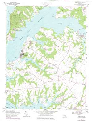
Earleville Topo Map Maryland
To zoom in, hover over the map of Earleville
USGS Topo Quad 39075d8 - 1:24,000 scale
| Topo Map Name: | Earleville |
| USGS Topo Quad ID: | 39075d8 |
| Print Size: | ca. 21 1/4" wide x 27" high |
| Southeast Coordinates: | 39.375° N latitude / 75.875° W longitude |
| Map Center Coordinates: | 39.4375° N latitude / 75.9375° W longitude |
| U.S. State: | MD |
| Filename: | o39075d8.jpg |
| Download Map JPG Image: | Earleville topo map 1:24,000 scale |
| Map Type: | Topographic |
| Topo Series: | 7.5´ |
| Map Scale: | 1:24,000 |
| Source of Map Images: | United States Geological Survey (USGS) |
| Alternate Map Versions: |
Earleville MD 1958, updated 1959 Download PDF Buy paper map Earleville MD 1958, updated 1977 Download PDF Buy paper map Earleville MD 2011 Download PDF Buy paper map Earleville MD 2014 Download PDF Buy paper map Earleville MD 2016 Download PDF Buy paper map |
1:24,000 Topo Quads surrounding Earleville
> Back to 39075a1 at 1:100,000 scale
> Back to 39074a1 at 1:250,000 scale
> Back to U.S. Topo Maps home
Earleville topo map: Gazetteer
Earleville: Airports
Hexton Farms Airport elevation 17m 55′Earleville: Bays
Rogues Harbor elevation 0m 0′Veazey Cove elevation 0m 0′
Earleville: Bridges
Scotchmans Creek Bridge elevation 0m 0′Earleville: Capes
Arnold Point elevation 2m 6′Battery Point elevation 5m 16′
Greenbush Point elevation 1m 3′
Grove Neck elevation 25m 82′
Huckleberry Point elevation 0m 0′
Jacobs Nose elevation 2m 6′
Little Hack Point elevation 4m 13′
Long Point elevation 1m 3′
Old Hack Point elevation 0m 0′
Parlor Point elevation 4m 13′
Pearce Neck elevation 24m 78′
Pond Neck elevation 24m 78′
Queens Point elevation 1m 3′
Rich Point elevation 4m 13′
Rocky Point elevation 11m 36′
Sassafras Neck elevation 18m 59′
Stony Point elevation 10m 32′
Stony Point elevation 1m 3′
Thackery Point elevation 10m 32′
Timber Neck elevation 39m 127′
Timber Point elevation 6m 19′
Town Point elevation 7m 22′
Town Point Neck elevation 20m 65′
Veazey Neck elevation 3m 9′
Wroth Point elevation 0m 0′
Earleville: Cliffs
White Banks elevation 16m 52′Earleville: Dams
Frazers Lake Dam elevation 2m 6′Panagopulos Farm Pond Dam elevation 9m 29′
Pearce Creek Disposal Area Dam elevation 12m 39′
Earleville: Islands
Knight Island elevation 20m 65′Earleville: Lakes
Mill Pond elevation 1m 3′Earleville: Parks
Earleville Wildlife Management Area elevation 16m 52′Elk Neck State Park elevation 36m 118′
Stemmers Run Wildlife Management Area (historical) elevation 11m 36′
Earleville: Populated Places
Battery Point Farms elevation 11m 36′Bay View Estates elevation 6m 19′
Bohemia Acres elevation 21m 68′
Cassidy Wharf elevation 0m 0′
Crawford Acres (historical) elevation 23m 75′
Earleville elevation 26m 85′
Green Briar elevation 16m 52′
Hack Point elevation 7m 22′
Hacks Point Acres elevation 7m 22′
Honeysuckle Knoll elevation 7m 22′
Indian Acres elevation 16m 52′
John Town elevation 25m 82′
Mount Harmon elevation 11m 36′
Scotchmans Glen elevation 24m 78′
Snow Hill (historical) elevation 22m 72′
Sunset Point elevation 16m 52′
The Woods of Town Point elevation 7m 22′
Tower Point elevation 20m 65′
Town Point elevation 19m 62′
Two Rivers elevation 14m 45′
West View Shores elevation 10m 32′
White Crystal Beach elevation 9m 29′
Earleville: Post Offices
Earleville Post Office elevation 25m 82′Earleville: Reservoirs
Pearce Creek Disposal Area Lake elevation 12m 39′Earleville: Streams
Antler Creek elevation 2m 6′Back Creek elevation 1m 3′
Back Creek elevation 1m 3′
Back Creek elevation 0m 0′
Bohemia River elevation 0m 0′
Cabin John Creek elevation 0m 0′
Cox Creek elevation 0m 0′
Dowdel Creek elevation 0m 0′
Downs Branch elevation 0m 0′
Foreman Creek elevation 0m 0′
Goldsmiths Branch elevation 0m 0′
McGill Creek elevation 0m 0′
Morgan Creek elevation 1m 3′
Pearce Creek elevation 0m 0′
Pooles Creek elevation 0m 0′
Sweet Potato Creek elevation 0m 0′
Wapiti Creek elevation 1m 3′
Earleville: Summits
Mauldin Mountain elevation 80m 262′Earleville digital topo map on disk
Buy this Earleville topo map showing relief, roads, GPS coordinates and other geographical features, as a high-resolution digital map file on DVD:
Atlantic Coast (NY, NJ, PA, DE, MD, VA, NC)
Buy digital topo maps: Atlantic Coast (NY, NJ, PA, DE, MD, VA, NC)


