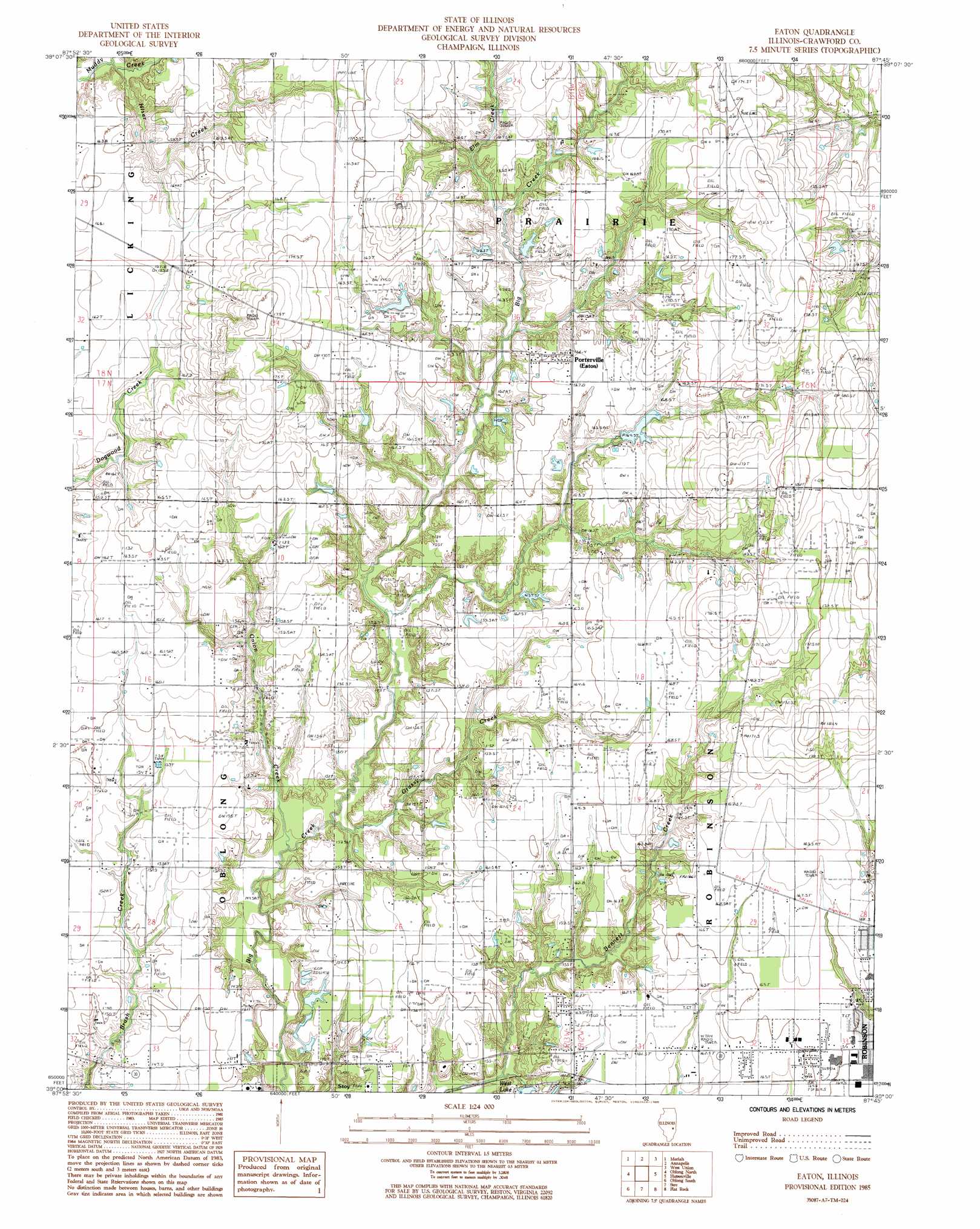
Eaton Topo Map Illinois
To zoom in, hover over the map of Eaton
USGS Topo Quad 39087a7 - 1:24,000 scale
| Topo Map Name: | Eaton |
| USGS Topo Quad ID: | 39087a7 |
| Print Size: | ca. 21 1/4" wide x 27" high |
| Southeast Coordinates: | 39° N latitude / 87.75° W longitude |
| Map Center Coordinates: | 39.0625° N latitude / 87.8125° W longitude |
| U.S. State: | IL |
| Filename: | o39087a7.jpg |
| Download Map JPG Image: | Eaton topo map 1:24,000 scale |
| Map Type: | Topographic |
| Topo Series: | 7.5´ |
| Map Scale: | 1:24,000 |
| Source of Map Images: | United States Geological Survey (USGS) |
| Alternate Map Versions: |
Eaton IL 1985, updated 1985 Download PDF Buy paper map Porterville IL 1998, updated 2002 Download PDF Buy paper map Porterville IL 2012 Download PDF Buy paper map Porterville IL 2015 Download PDF Buy paper map |
1:24,000 Topo Quads surrounding Eaton
Union Center |
Casey |
Clark Center |
Snyder |
Hutton |
Hazel Dell |
Moriah |
Annapolis |
West Union |
Fairbanks |
Yale |
Oblong North |
Eaton |
Hutsonville |
Merom |
Sainte Marie |
Oblong South |
Stoy |
Flat Rock |
Heathsville |
Dundas |
Landes |
Chauncey |
Birds |
Russellville |
> Back to 39087a1 at 1:100,000 scale
> Back to 39086a1 at 1:250,000 scale
> Back to U.S. Topo Maps home
Eaton topo map: Gazetteer
Eaton: Airports
Crawford Memorial Hospital Heliport elevation 169m 554′Eaton: Dams
Athey Lake Dam elevation 165m 541′Burcham Pond Dam elevation 159m 521′
Ridgeway Lake Dam elevation 163m 534′
West Lake Dam elevation 154m 505′
Eaton: Oilfields
Robinson Oil Field elevation 157m 515′Eaton: Populated Places
Porterville elevation 164m 538′Eaton: Post Offices
Eaton Post Office (historical) elevation 164m 538′Eaton: Reservoirs
Athey Lake elevation 165m 541′Burcham Pond elevation 159m 521′
Ridgeway Lake elevation 163m 534′
West Lake elevation 154m 505′
Eaton: Streams
Elm Creek elevation 159m 521′Grassy Creek elevation 144m 472′
Hiser Creek elevation 156m 511′
Maple Creek elevation 156m 511′
Onion Creek elevation 144m 472′
Eaton digital topo map on disk
Buy this Eaton topo map showing relief, roads, GPS coordinates and other geographical features, as a high-resolution digital map file on DVD:
Northern Illinois, Northern Indiana & Southwestern Michigan
Buy digital topo maps: Northern Illinois, Northern Indiana & Southwestern Michigan