Hutsonville Topo Map Illinois
To zoom in, hover over the map of Hutsonville
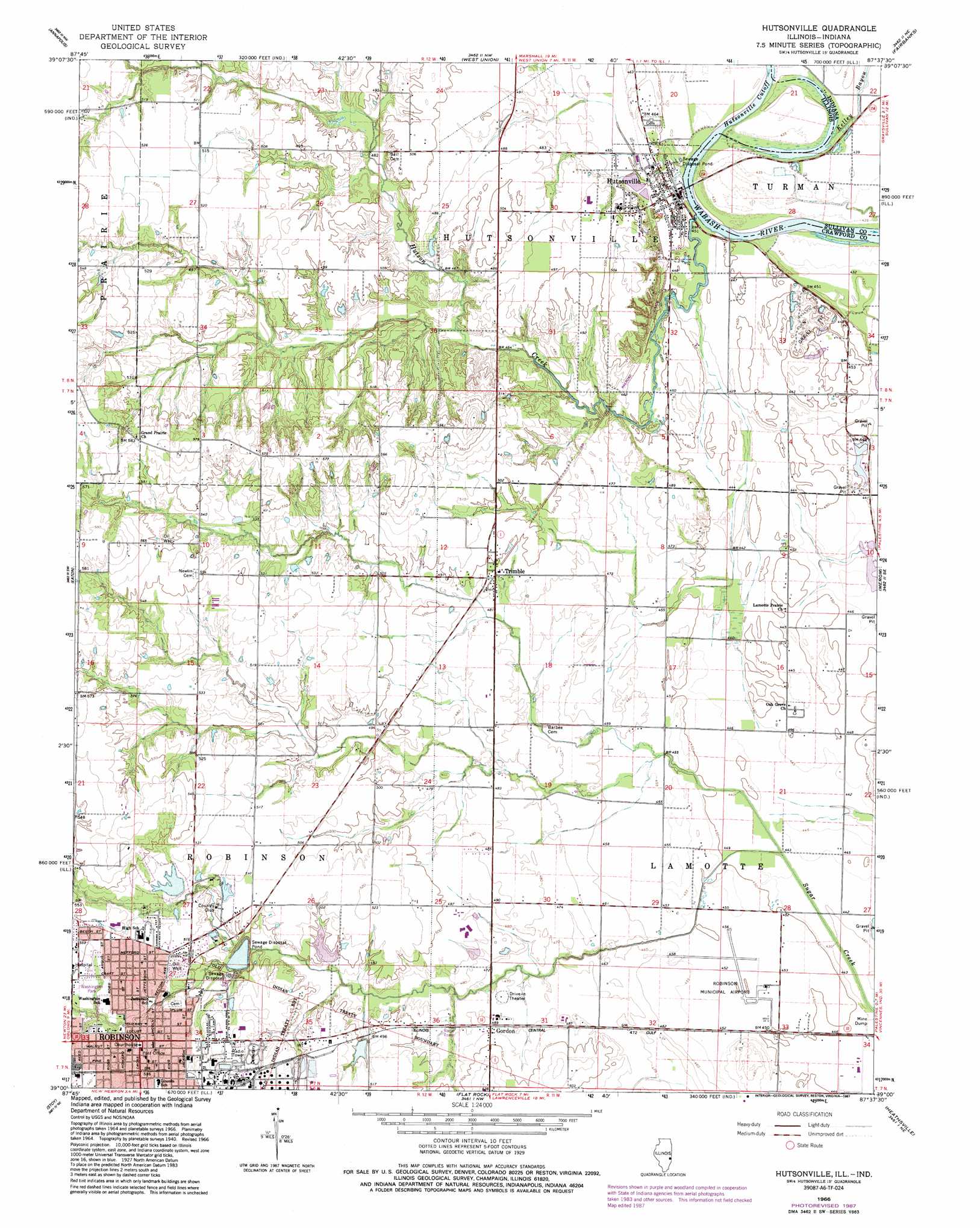
USGS Topo Quad 39087a6 - 1:24,000 scale
| Topo Map Name: | Hutsonville |
| USGS Topo Quad ID: | 39087a6 |
| Print Size: | ca. 21 1/4" wide x 27" high |
| Southeast Coordinates: | 39° N latitude / 87.625° W longitude |
| Map Center Coordinates: | 39.0625° N latitude / 87.6875° W longitude |
| U.S. States: | IL, IN |
| Filename: | o39087a6.jpg |
| Download Map JPG Image: | Hutsonville topo map 1:24,000 scale |
| Map Type: | Topographic |
| Topo Series: | 7.5´ |
| Map Scale: | 1:24,000 |
| Source of Map Images: | United States Geological Survey (USGS) |
| Alternate Map Versions: |
Hutsonville IL 1966, updated 1967 Download PDF Buy paper map Hutsonville IL 1966, updated 1987 Download PDF Buy paper map Hutsonville IL 2011 Download PDF Buy paper map Hutsonville IL 2012 Download PDF Buy paper map Hutsonville IL 2015 Download PDF Buy paper map |
1:24,000 Topo Quads surrounding Hutsonville
Casey |
Clark Center |
Snyder |
Hutton |
Pimento |
Moriah |
Annapolis |
West Union |
Fairbanks |
Shelburn |
Oblong North |
Eaton |
Hutsonville |
Merom |
Sullivan |
Oblong South |
Stoy |
Flat Rock |
Heathsville |
Carlisle |
Landes |
Chauncey |
Birds |
Russellville |
Oaktown |
> Back to 39087a1 at 1:100,000 scale
> Back to 39086a1 at 1:250,000 scale
> Back to U.S. Topo Maps home
Hutsonville topo map: Gazetteer
Hutsonville: Airports
Robinson Municipal Airport elevation 138m 452′Hutsonville: Bridges
Hutsonville Bridge elevation 128m 419′Hutsonville: Channels
Hutsonville Cut Off elevation 128m 419′Hutsonville: Crossings
Hutsonville Ferry (historical) elevation 128m 419′Hutsonville: Dams
Allen Lake Dam elevation 157m 515′Newlin Lake Dam elevation 158m 518′
Hutsonville: Parks
Crawford County State Fish and Wildlife Area elevation 146m 479′Washington Park elevation 162m 531′
Hutsonville: Populated Places
Gordon elevation 148m 485′Hutsonville elevation 133m 436′
Robinson elevation 162m 531′
Trimble elevation 150m 492′
Hutsonville: Post Offices
Robinson Post Office elevation 162m 531′Rose Creek Post Office (historical) elevation 131m 429′
Hutsonville: Reservoirs
Allen Lake elevation 157m 515′Newlin Lake elevation 158m 518′
Hutsonville: Streams
Hutson Creek elevation 128m 419′Kelley Bayou elevation 131m 429′
Hutsonville digital topo map on disk
Buy this Hutsonville topo map showing relief, roads, GPS coordinates and other geographical features, as a high-resolution digital map file on DVD:
Northern Illinois, Northern Indiana & Southwestern Michigan
Buy digital topo maps: Northern Illinois, Northern Indiana & Southwestern Michigan