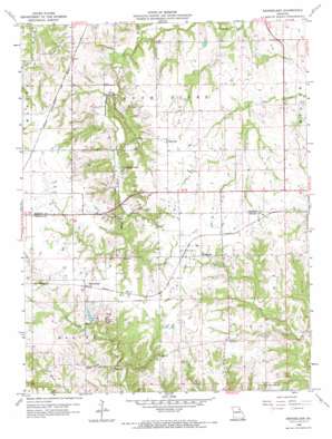
Rensselaer Topo Map Missouri
To zoom in, hover over the map of Rensselaer
USGS Topo Quad 39091f5 - 1:24,000 scale
| Topo Map Name: | Rensselaer |
| USGS Topo Quad ID: | 39091f5 |
| Print Size: | ca. 21 1/4" wide x 27" high |
| Southeast Coordinates: | 39.625° N latitude / 91.5° W longitude |
| Map Center Coordinates: | 39.6875° N latitude / 91.5625° W longitude |
| U.S. State: | MO |
| Filename: | o39091f5.jpg |
| Download Map JPG Image: | Rensselaer topo map 1:24,000 scale |
| Map Type: | Topographic |
| Topo Series: | 7.5´ |
| Map Scale: | 1:24,000 |
| Source of Map Images: | United States Geological Survey (USGS) |
| Alternate Map Versions: |
Rensselaer MO 1958, updated 1960 Download PDF Buy paper map Rensselaer MO 1958, updated 1967 Download PDF Buy paper map Rensselaer MO 2012 Download PDF Buy paper map Rensselaer MO 2015 Download PDF Buy paper map |
1:24,000 Topo Quads surrounding Rensselaer
> Back to 39091e1 at 1:100,000 scale
> Back to 39090a1 at 1:250,000 scale
> Back to U.S. Topo Maps home
Rensselaer topo map: Gazetteer
Rensselaer: Dams
Central Stone County Dam elevation 204m 669′Frankenbach Brothers Lake Dam elevation 186m 610′
Gentry Dam elevation 215m 705′
Lake Hannibal Dam elevation 209m 685′
Lake Hannibal Estates Upper Dam elevation 216m 708′
Rensselaer: Lakes
Sylvan Lake elevation 194m 636′Rensselaer: Populated Places
Barkley elevation 193m 633′Huntington elevation 222m 728′
Rensselaer elevation 213m 698′
Sheil elevation 204m 669′
West Ely elevation 219m 718′
Rensselaer: Reservoirs
Central Stone County Lake elevation 204m 669′Lake Hannibal elevation 209m 685′
Rensselaer: Streams
College Branch elevation 167m 547′Rensselaer digital topo map on disk
Buy this Rensselaer topo map showing relief, roads, GPS coordinates and other geographical features, as a high-resolution digital map file on DVD:


