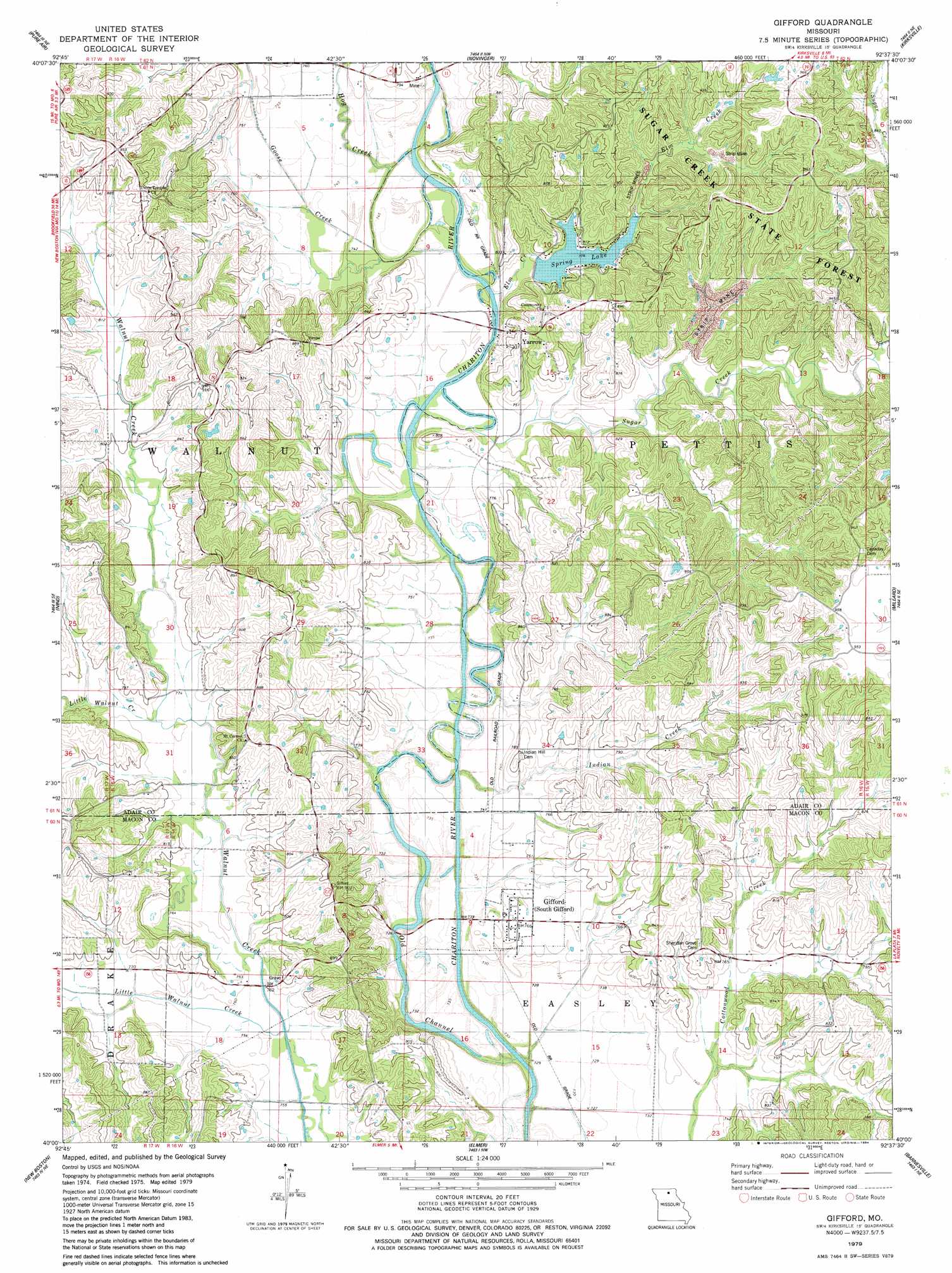
Gifford Topo Map Missouri
To zoom in, hover over the map of Gifford
USGS Topo Quad 40092a6 - 1:24,000 scale
| Topo Map Name: | Gifford |
| USGS Topo Quad ID: | 40092a6 |
| Print Size: | ca. 21 1/4" wide x 27" high |
| Southeast Coordinates: | 40° N latitude / 92.625° W longitude |
| Map Center Coordinates: | 40.0625° N latitude / 92.6875° W longitude |
| U.S. State: | MO |
| Filename: | o40092a6.jpg |
| Download Map JPG Image: | Gifford topo map 1:24,000 scale |
| Map Type: | Topographic |
| Topo Series: | 7.5´ |
| Map Scale: | 1:24,000 |
| Source of Map Images: | United States Geological Survey (USGS) |
| Alternate Map Versions: |
Gifford MO 1979, updated 1984 Download PDF Buy paper map Gifford MO 2012 Download PDF Buy paper map Gifford MO 2015 Download PDF Buy paper map |
1:24,000 Topo Quads surrounding Gifford
Green City |
Stahl |
Connelsville |
Greentop |
Willmathsville |
Mystic |
Pure Air |
Novinger |
Kirksville |
Brashear |
Winigan |
Nind |
Gifford |
Millard |
La Plata |
Bucklin Nw |
New Boston |
Elmer |
Barnesville |
Atlanta |
Bucklin |
New Cambria West |
New Cambria East |
Bevier North |
Axtell |
> Back to 40092a1 at 1:100,000 scale
> Back to 40092a1 at 1:250,000 scale
> Back to U.S. Topo Maps home
Gifford topo map: Gazetteer
Gifford: Dams
Spring Lake Dam elevation 237m 777′Gifford: Forests
Sugar Creek State Forest elevation 278m 912′Gifford: Populated Places
Gifford elevation 233m 764′Lindersville (historical) elevation 257m 843′
Simler elevation 238m 780′
Yarrow elevation 258m 846′
Gifford: Post Offices
Lindersville Post Office (historical) elevation 257m 843′Gifford: Reservoirs
Spring Lake elevation 237m 777′Gifford: Streams
Elm Creek elevation 225m 738′Goose Creek elevation 226m 741′
Hog Creek elevation 225m 738′
Indian Creek elevation 224m 734′
Little Walnut Creek elevation 236m 774′
Little Walnut Creek elevation 226m 741′
Sugar Creek elevation 223m 731′
Gifford digital topo map on disk
Buy this Gifford topo map showing relief, roads, GPS coordinates and other geographical features, as a high-resolution digital map file on DVD: