Olsen Reservoir Topo Map Utah
To zoom in, hover over the map of Olsen Reservoir
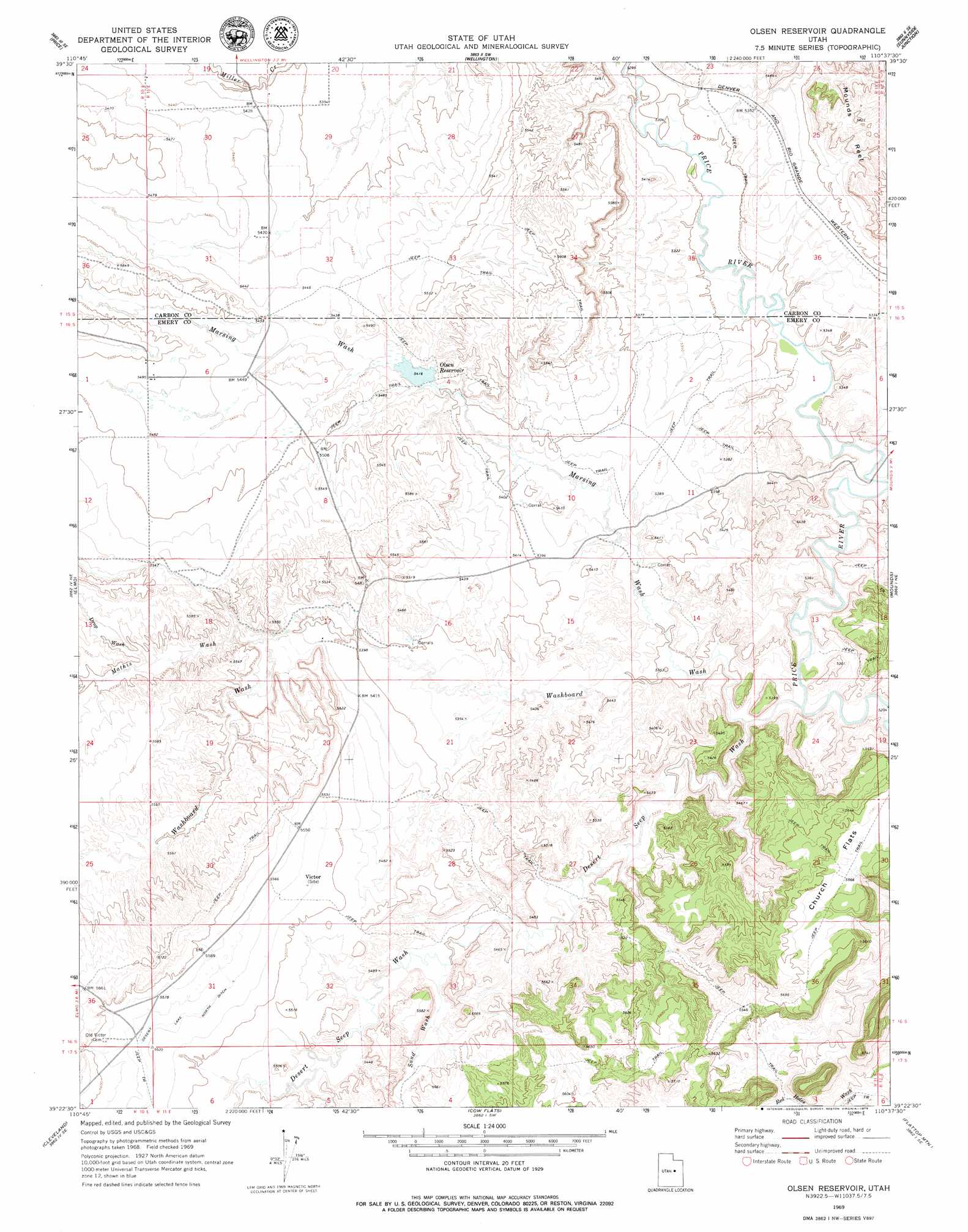
USGS Topo Quad 39110d6 - 1:24,000 scale
| Topo Map Name: | Olsen Reservoir |
| USGS Topo Quad ID: | 39110d6 |
| Print Size: | ca. 21 1/4" wide x 27" high |
| Southeast Coordinates: | 39.375° N latitude / 110.625° W longitude |
| Map Center Coordinates: | 39.4375° N latitude / 110.6875° W longitude |
| U.S. State: | UT |
| Filename: | o39110d6.jpg |
| Download Map JPG Image: | Olsen Reservoir topo map 1:24,000 scale |
| Map Type: | Topographic |
| Topo Series: | 7.5´ |
| Map Scale: | 1:24,000 |
| Source of Map Images: | United States Geological Survey (USGS) |
| Alternate Map Versions: |
Olsen Reservoir UT 1969, updated 1972 Download PDF Buy paper map Olsen Reservoir UT 1969, updated 1979 Download PDF Buy paper map Olsen Reservoir UT 2011 Download PDF Buy paper map Olsen Reservoir UT 2014 Download PDF Buy paper map |
1:24,000 Topo Quads surrounding Olsen Reservoir
Standardville |
Helper |
Deadman Canyon |
Pine Canyon |
Mount Bartles |
Pinnacle Peak |
Price |
Wellington |
Sunnyside Junction |
Sunnyside |
Poison Spring Bench |
Elmo |
Olsen Reservoir |
Mounds |
Cedar |
Huntington |
Cleveland |
Cow Flats |
Flattop Mountain |
Grassy |
Hadden Holes |
Buckhorn Reservoir |
Bob Hill Knoll |
Chimney Rock |
Dry Mesa |
> Back to 39110a1 at 1:100,000 scale
> Back to 39110a1 at 1:250,000 scale
> Back to U.S. Topo Maps home
Olsen Reservoir topo map: Gazetteer
Olsen Reservoir: Dams
Olsen Dam elevation 1634m 5360′Olsen Reservoir: Flats
Church Flats elevation 1696m 5564′Olsen Reservoir: Populated Places
Victor elevation 1684m 5524′Olsen Reservoir: Reservoirs
Olsen Reservoir elevation 1634m 5360′Olsen Reservoir elevation 1652m 5419′
Olsen Reservoir: Valleys
Desert Seep Wash elevation 1597m 5239′Drop Wash elevation 1670m 5479′
Marsing Wash elevation 1611m 5285′
Mathis Wash elevation 1653m 5423′
Red Holes Wash elevation 1635m 5364′
Sand Wash elevation 1651m 5416′
Washboard Wash elevation 1597m 5239′
Olsen Reservoir digital topo map on disk
Buy this Olsen Reservoir topo map showing relief, roads, GPS coordinates and other geographical features, as a high-resolution digital map file on DVD: