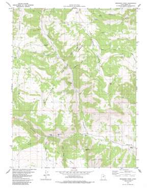
Mahogany Point Topo Map Utah
To zoom in, hover over the map of Mahogany Point
USGS Topo Quad 39111c2 - 1:24,000 scale
| Topo Map Name: | Mahogany Point |
| USGS Topo Quad ID: | 39111c2 |
| Print Size: | ca. 21 1/4" wide x 27" high |
| Southeast Coordinates: | 39.25° N latitude / 111.125° W longitude |
| Map Center Coordinates: | 39.3125° N latitude / 111.1875° W longitude |
| U.S. State: | UT |
| Filename: | o39111c2.jpg |
| Download Map JPG Image: | Mahogany Point topo map 1:24,000 scale |
| Map Type: | Topographic |
| Topo Series: | 7.5´ |
| Map Scale: | 1:24,000 |
| Source of Map Images: | United States Geological Survey (USGS) |
| Alternate Map Versions: |
Mahogany Point UT 1979, updated 1984 Download PDF Buy paper map Mahogany Point UT 2001, updated 2004 Download PDF Buy paper map Mahogany Point UT 2011 Download PDF Buy paper map Mahogany Point UT 2014 Download PDF Buy paper map |
| FStopo: | US Forest Service topo Mahogany Point is available: Download FStopo PDF Download FStopo TIF |
1:24,000 Topo Quads surrounding Mahogany Point
> Back to 39111a1 at 1:100,000 scale
> Back to 39110a1 at 1:250,000 scale
> Back to U.S. Topo Maps home
Mahogany Point topo map: Gazetteer
Mahogany Point: Lakes
Snow Lake elevation 2879m 9445′Mahogany Point: Mines
Black Diamond Mine elevation 2037m 6683′Oliphant Mine elevation 2014m 6607′
Trail Mountain Mine elevation 2230m 7316′
Mahogany Point: Springs
Elk Spring elevation 2850m 9350′North Point Spring elevation 2773m 9097′
Pine Spring elevation 3025m 9924′
Mahogany Point: Streams
Whetstone Creek elevation 2458m 8064′Mahogany Point: Summits
Mahogany Point elevation 2592m 8503′Mahogany Point: Trails
CCC Trail elevation 2556m 8385′CCC Trail elevation 2494m 8182′
Mahogany Point: Valleys
Clay Banks Swale elevation 1968m 6456′Cox Swale elevation 2010m 6594′
Dairy Canyon elevation 2581m 8467′
Flaglake Canyon elevation 2294m 7526′
Indian Lodge Canyon elevation 2509m 8231′
Mill Canyon elevation 2585m 8480′
Reid and Nielson Swale elevation 1998m 6555′
Roans Canyon elevation 2333m 7654′
Straight Canyon elevation 1922m 6305′
Trail Canyon elevation 2392m 7847′
Mahogany Point digital topo map on disk
Buy this Mahogany Point topo map showing relief, roads, GPS coordinates and other geographical features, as a high-resolution digital map file on DVD:


