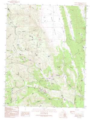
Wilbur Springs Topo Map California
To zoom in, hover over the map of Wilbur Springs
USGS Topo Quad 39122a4 - 1:24,000 scale
| Topo Map Name: | Wilbur Springs |
| USGS Topo Quad ID: | 39122a4 |
| Print Size: | ca. 21 1/4" wide x 27" high |
| Southeast Coordinates: | 39° N latitude / 122.375° W longitude |
| Map Center Coordinates: | 39.0625° N latitude / 122.4375° W longitude |
| U.S. State: | CA |
| Filename: | o39122a4.jpg |
| Download Map JPG Image: | Wilbur Springs topo map 1:24,000 scale |
| Map Type: | Topographic |
| Topo Series: | 7.5´ |
| Map Scale: | 1:24,000 |
| Source of Map Images: | United States Geological Survey (USGS) |
| Alternate Map Versions: |
Wilbur Springs CA 1989, updated 1989 Download PDF Buy paper map Wilbur Springs CA 1991, updated 1995 Download PDF Buy paper map Wilbur Springs CA 2012 Download PDF Buy paper map Wilbur Springs CA 2015 Download PDF Buy paper map |
1:24,000 Topo Quads surrounding Wilbur Springs
> Back to 39122a1 at 1:100,000 scale
> Back to 39122a1 at 1:250,000 scale
> Back to U.S. Topo Maps home
Wilbur Springs topo map: Gazetteer
Wilbur Springs: Flats
Deadshot Flat elevation 720m 2362′Destanella Flat elevation 576m 1889′
Hamilton Flat elevation 384m 1259′
Malaney Flat elevation 629m 2063′
Stag Flat elevation 348m 1141′
Widow Flats elevation 408m 1338′
Wilbur Springs: Mines
Abbott Mine elevation 626m 2053′Central Mine elevation 523m 1715′
Clyde Mine elevation 799m 2621′
Elgin Mine elevation 656m 2152′
Empire Mine elevation 452m 1482′
Manzanita Mine elevation 550m 1804′
Rathburn Mine elevation 698m 2290′
Turkey Run Mine elevation 542m 1778′
Wide Awake Mine elevation 498m 1633′
Wilbur Springs: Pillars
Eagle Rock elevation 582m 1909′Signal Rock elevation 739m 2424′
Wilbur Springs: Populated Places
Wilbur Springs elevation 442m 1450′Wilbur Springs: Ranges
Oat Hills elevation 272m 892′Wilbur Springs: Ridges
Blue Ridge elevation 577m 1893′County Line Ridge elevation 614m 2014′
Walker Ridge elevation 1066m 3497′
Wilbur Springs: Springs
Blank Spring elevation 444m 1456′Cherry Spring elevation 555m 1820′
Cold Spring elevation 1018m 3339′
Deadshot Spring elevation 720m 2362′
Eaton Springs elevation 710m 2329′
Grizzly Spring elevation 386m 1266′
Hog Spring elevation 446m 1463′
Til Jones Spring elevation 880m 2887′
Wilbur Springs: Streams
East Fork Sulphur Creek elevation 488m 1601′Freshwater Branch elevation 564m 1850′
Salt Branch elevation 518m 1699′
Sulphur Creek elevation 372m 1220′
Trout Creek elevation 396m 1299′
West Fork Sulphur Creek elevation 463m 1519′
Wilbur Springs: Summits
Cold Spring Mountain elevation 1087m 3566′Coyote Peak elevation 523m 1715′
Gibson Hill elevation 736m 2414′
Wilbur Springs: Valleys
Bear Valley elevation 403m 1322′Cain Valley elevation 397m 1302′
Deadshot Canyon elevation 443m 1453′
Gaither Canyon elevation 445m 1459′
Glory Hole Gulch elevation 545m 1788′
Grigsby Canyon elevation 605m 1984′
Hamilton Canyon elevation 397m 1302′
Little Valley elevation 319m 1046′
Lucky Canyon elevation 517m 1696′
Lynch Canyon elevation 350m 1148′
Oak Cove elevation 668m 2191′
Remington Canyon elevation 594m 1948′
Schoolhouse Canyon elevation 451m 1479′
South Rail Canyon elevation 327m 1072′
Warnick Canyon elevation 345m 1131′
Wilbur Springs digital topo map on disk
Buy this Wilbur Springs topo map showing relief, roads, GPS coordinates and other geographical features, as a high-resolution digital map file on DVD:


