Manor Slough Topo Map California
To zoom in, hover over the map of Manor Slough
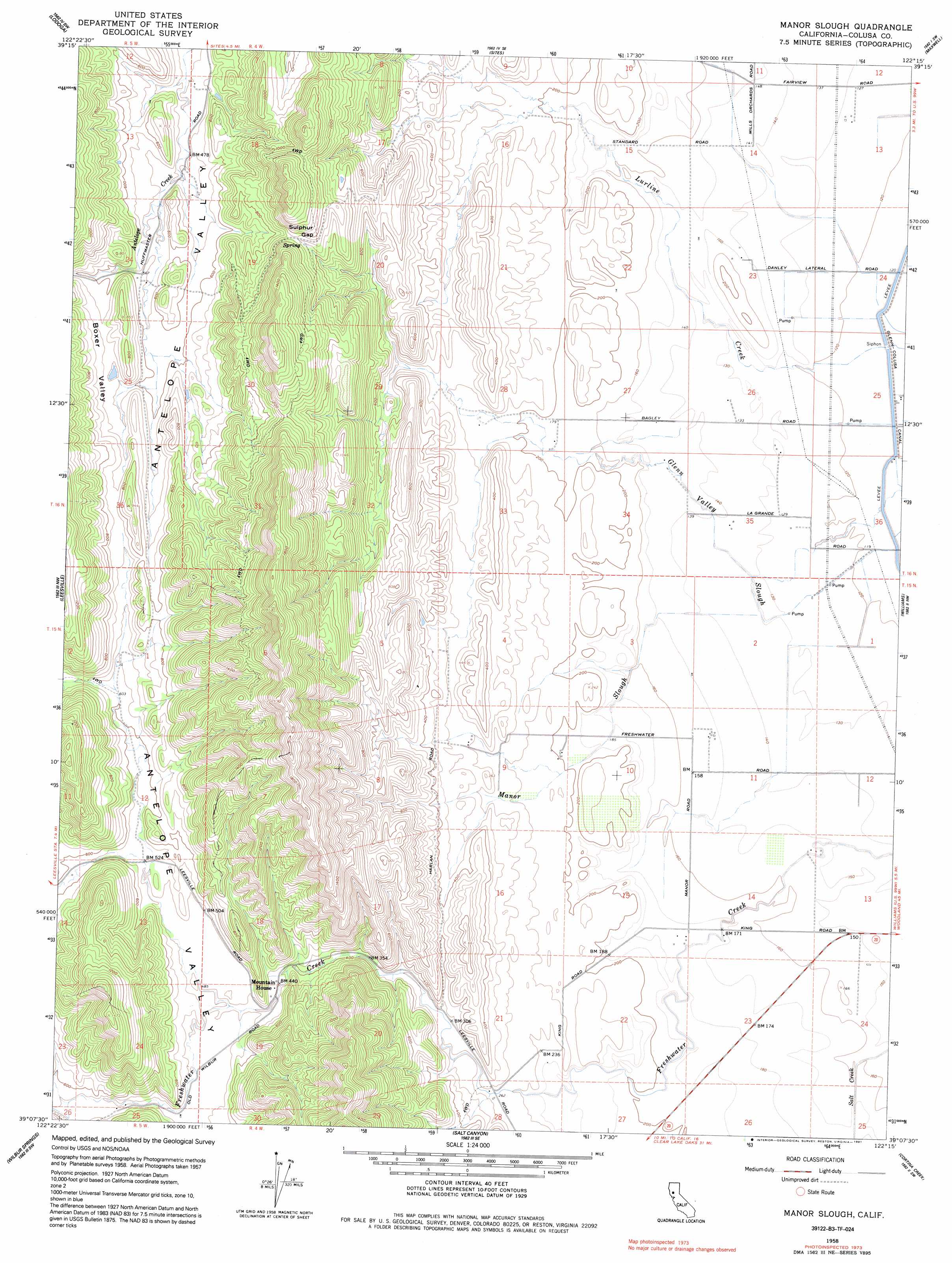
USGS Topo Quad 39122b3 - 1:24,000 scale
| Topo Map Name: | Manor Slough |
| USGS Topo Quad ID: | 39122b3 |
| Print Size: | ca. 21 1/4" wide x 27" high |
| Southeast Coordinates: | 39.125° N latitude / 122.25° W longitude |
| Map Center Coordinates: | 39.1875° N latitude / 122.3125° W longitude |
| U.S. State: | CA |
| Filename: | o39122b3.jpg |
| Download Map JPG Image: | Manor Slough topo map 1:24,000 scale |
| Map Type: | Topographic |
| Topo Series: | 7.5´ |
| Map Scale: | 1:24,000 |
| Source of Map Images: | United States Geological Survey (USGS) |
| Alternate Map Versions: |
Manor Slough CA 1958, updated 1960 Download PDF Buy paper map Manor Slough CA 1958, updated 1980 Download PDF Buy paper map Manor Slough CA 1958, updated 1985 Download PDF Buy paper map Manor Slough CA 1958, updated 1991 Download PDF Buy paper map Manor Slough CA 2012 Download PDF Buy paper map Manor Slough CA 2015 Download PDF Buy paper map |
1:24,000 Topo Quads surrounding Manor Slough
Stonyford |
Rail Canyon |
Logan Ridge |
Logandale |
Princeton |
Gilmore Peak |
Lodoga |
Sites |
Maxwell |
Moulton Weir |
Hough Springs |
Leesville |
Manor Slough |
Williams |
Colusa |
Benmore Canyon |
Wilbur Springs |
Salt Canyon |
Cortina Creek |
Arbuckle |
Lower Lake |
Wilson Valley |
Glascock Mountain |
Rumsey |
Wildwood School |
> Back to 39122a1 at 1:100,000 scale
> Back to 39122a1 at 1:250,000 scale
> Back to U.S. Topo Maps home
Manor Slough topo map: Gazetteer
Manor Slough: Gaps
Sulphur Gap elevation 290m 951′Manor Slough: Streams
Calvins Creek elevation 147m 482′Manor Slough elevation 40m 131′
Manor Slough: Valleys
Blanchard Valley elevation 190m 623′Boxer Valley elevation 184m 603′
Long Canyon elevation 134m 439′
Manor Slough digital topo map on disk
Buy this Manor Slough topo map showing relief, roads, GPS coordinates and other geographical features, as a high-resolution digital map file on DVD: