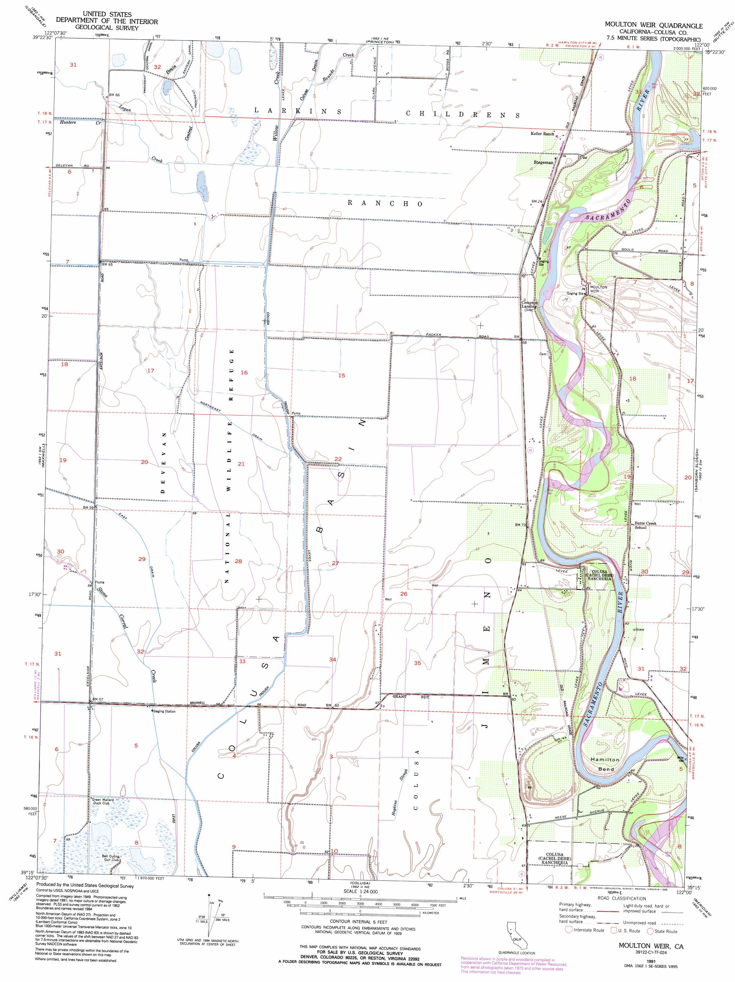
Moulton Weir Topo Map California
To zoom in, hover over the map of Moulton Weir
USGS Topo Quad 39122c1 - 1:24,000 scale
| Topo Map Name: | Moulton Weir |
| USGS Topo Quad ID: | 39122c1 |
| Print Size: | ca. 21 1/4" wide x 27" high |
| Southeast Coordinates: | 39.25° N latitude / 122° W longitude |
| Map Center Coordinates: | 39.3125° N latitude / 122.0625° W longitude |
| U.S. State: | CA |
| Filename: | o39122c1.jpg |
| Download Map JPG Image: | Moulton Weir topo map 1:24,000 scale |
| Map Type: | Topographic |
| Topo Series: | 7.5´ |
| Map Scale: | 1:24,000 |
| Source of Map Images: | United States Geological Survey (USGS) |
| Alternate Map Versions: |
Moulton Weir CA 1952, updated 1953 Download PDF Buy paper map Moulton Weir CA 1952, updated 1974 Download PDF Buy paper map Moulton Weir CA 1991, updated 1995 Download PDF Buy paper map Moulton Weir CA 2012 Download PDF Buy paper map Moulton Weir CA 2015 Download PDF Buy paper map |
1:24,000 Topo Quads surrounding Moulton Weir
Stone Valley |
Willows |
Glenn |
Llano Seco |
Nelson |
Logan Ridge |
Logandale |
Princeton |
Butte City |
West Of Biggs |
Sites |
Maxwell |
Moulton Weir |
Sanborn Slough |
Pennington |
Manor Slough |
Williams |
Colusa |
Meridian |
Sutter Buttes |
Salt Canyon |
Cortina Creek |
Arbuckle |
Grimes |
Tisdale Weir |
> Back to 39122a1 at 1:100,000 scale
> Back to 39122a1 at 1:250,000 scale
> Back to U.S. Topo Maps home
Moulton Weir topo map: Gazetteer
Moulton Weir: Airports
Gunnersfield Ranch Airport elevation 19m 62′Moulton Weir: Bends
Hamilton Bend elevation 18m 59′Moulton Weir: Canals
Colusa Trough elevation 18m 59′East Drain elevation 18m 59′
Northeast Drain elevation 18m 59′
Moulton Weir: Dams
Moulton Weir elevation 21m 68′Moulton Weir: Parks
Delevan National Wildlife Refuge elevation 19m 62′Moulton Weir: Populated Places
Colusa Rancheria elevation 18m 59′Stegeman elevation 24m 78′
Moulton Weir: Streams
Bounde Creek elevation 19m 62′Hunters Creek elevation 20m 65′
Logan Creek elevation 20m 65′
Stone Corral Creek elevation 17m 55′
Willow Creek elevation 19m 62′
Moulton Weir digital topo map on disk
Buy this Moulton Weir topo map showing relief, roads, GPS coordinates and other geographical features, as a high-resolution digital map file on DVD: