Nelson Topo Map California
To zoom in, hover over the map of Nelson
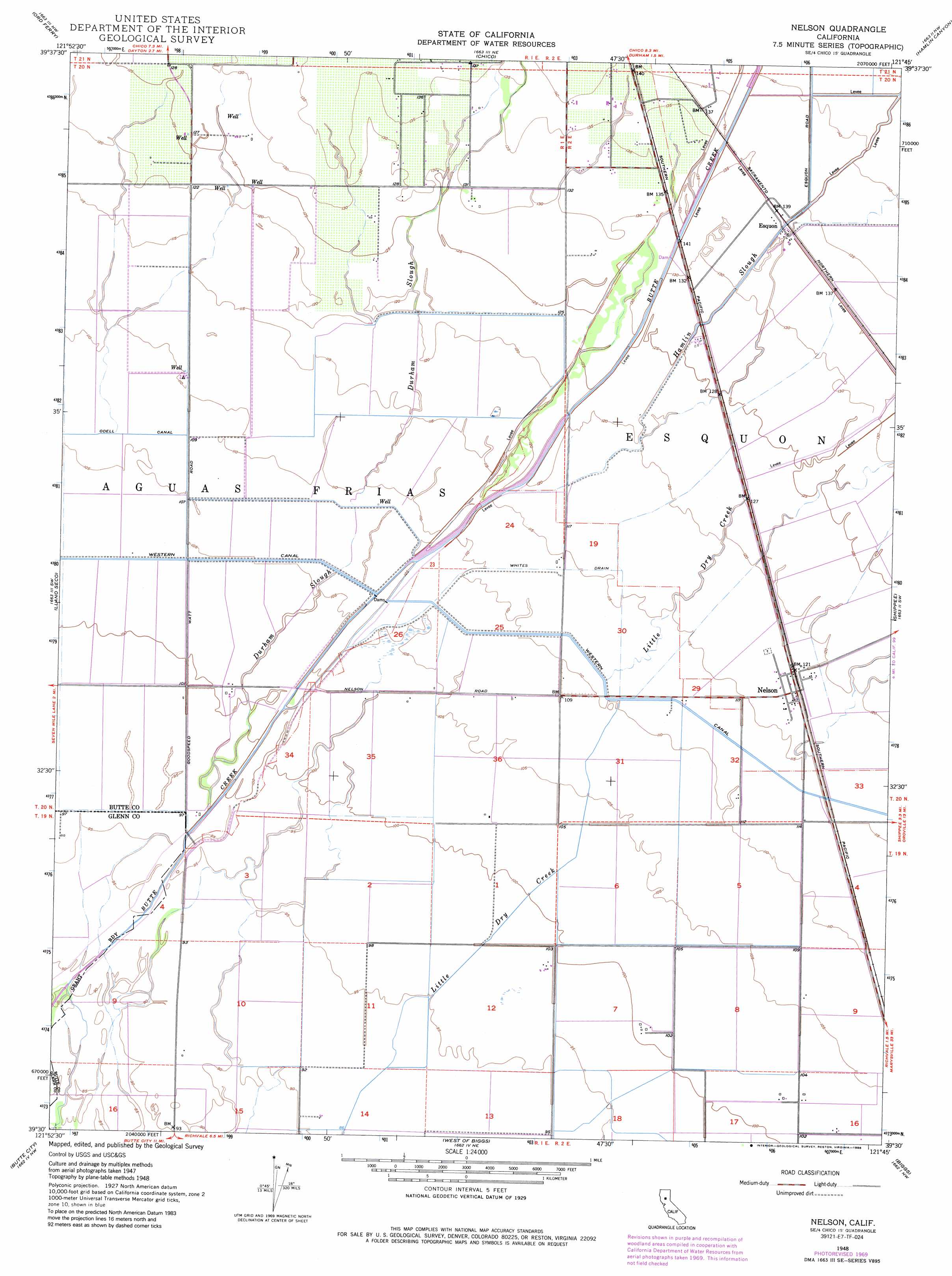
USGS Topo Quad 39121e7 - 1:24,000 scale
| Topo Map Name: | Nelson |
| USGS Topo Quad ID: | 39121e7 |
| Print Size: | ca. 21 1/4" wide x 27" high |
| Southeast Coordinates: | 39.5° N latitude / 121.75° W longitude |
| Map Center Coordinates: | 39.5625° N latitude / 121.8125° W longitude |
| U.S. State: | CA |
| Filename: | o39121e7.jpg |
| Download Map JPG Image: | Nelson topo map 1:24,000 scale |
| Map Type: | Topographic |
| Topo Series: | 7.5´ |
| Map Scale: | 1:24,000 |
| Source of Map Images: | United States Geological Survey (USGS) |
| Alternate Map Versions: |
Nelson CA 1948, updated 1957 Download PDF Buy paper map Nelson CA 1948, updated 1970 Download PDF Buy paper map Nelson CA 1948, updated 1986 Download PDF Buy paper map Nelson CA 1948, updated 1988 Download PDF Buy paper map Nelson CA 1950 Download PDF Buy paper map Nelson CA 2012 Download PDF Buy paper map Nelson CA 2015 Download PDF Buy paper map |
1:24,000 Topo Quads surrounding Nelson
Foster Island |
Nord |
Richardson Springs |
Paradise West |
Paradise East |
Hamilton City |
Ord Ferry |
Chico |
Hamlin Canyon |
Cherokee |
Glenn |
Llano Seco |
Nelson |
Shippee |
Oroville |
Princeton |
Butte City |
West Of Biggs |
Biggs |
Palermo |
Moulton Weir |
Sanborn Slough |
Pennington |
Gridley |
Honcut |
> Back to 39121e1 at 1:100,000 scale
> Back to 39120a1 at 1:250,000 scale
> Back to U.S. Topo Maps home
Nelson topo map: Gazetteer
Nelson: Canals
Western Canal elevation 33m 108′Nelson: Dams
Dam 149 elevation 45m 147′Nelson: Populated Places
Esquon elevation 41m 134′Nelson elevation 37m 121′
Nelson: Streams
Durham Slough elevation 30m 98′Hamlin Slough elevation 37m 121′
Nelson digital topo map on disk
Buy this Nelson topo map showing relief, roads, GPS coordinates and other geographical features, as a high-resolution digital map file on DVD: