London Mills Topo Map Illinois
To zoom in, hover over the map of London Mills
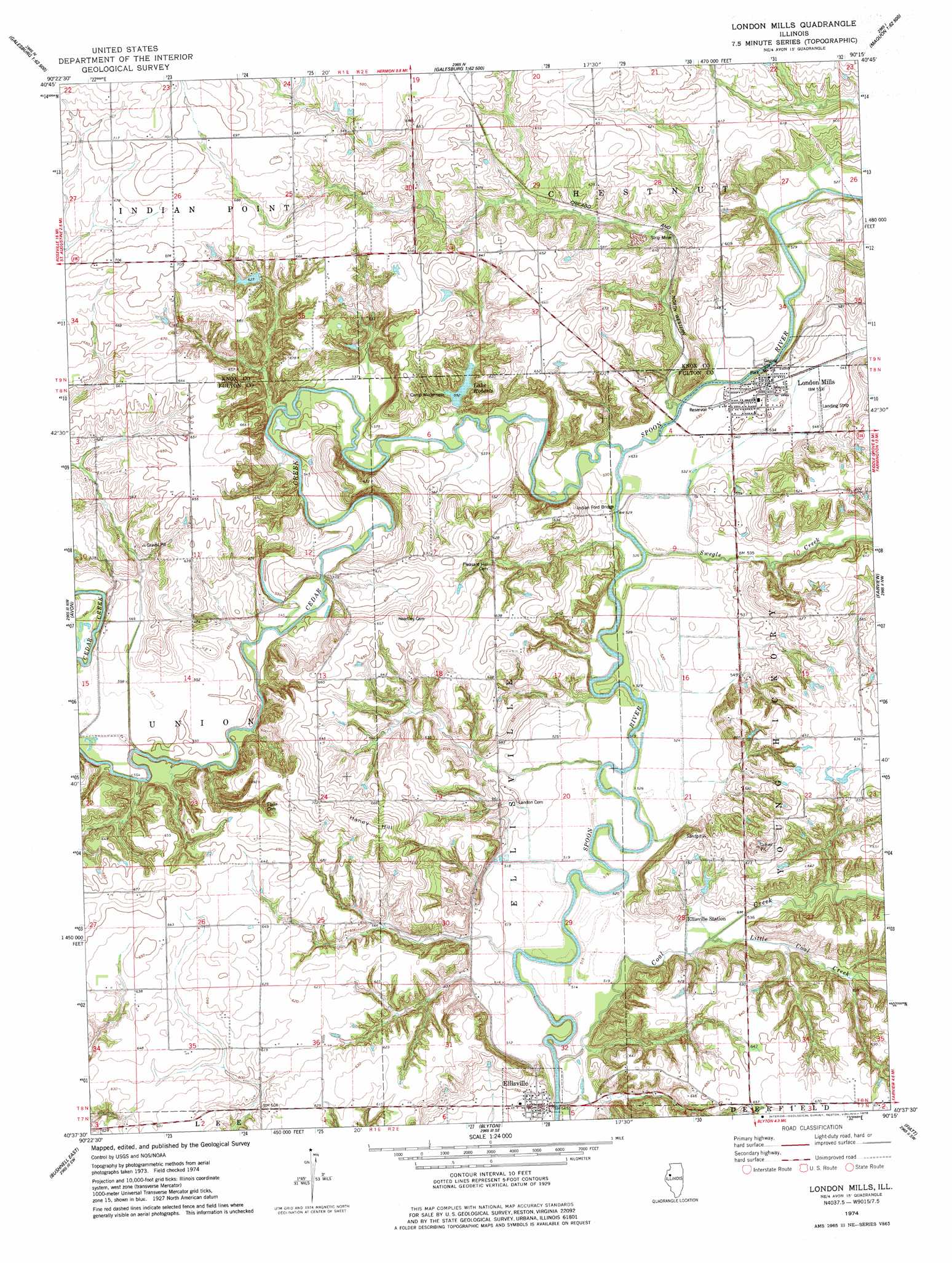
USGS Topo Quad 40090f3 - 1:24,000 scale
| Topo Map Name: | London Mills |
| USGS Topo Quad ID: | 40090f3 |
| Print Size: | ca. 21 1/4" wide x 27" high |
| Southeast Coordinates: | 40.625° N latitude / 90.25° W longitude |
| Map Center Coordinates: | 40.6875° N latitude / 90.3125° W longitude |
| U.S. State: | IL |
| Filename: | o40090f3.jpg |
| Download Map JPG Image: | London Mills topo map 1:24,000 scale |
| Map Type: | Topographic |
| Topo Series: | 7.5´ |
| Map Scale: | 1:24,000 |
| Source of Map Images: | United States Geological Survey (USGS) |
| Alternate Map Versions: |
London Mills IL 1974, updated 1978 Download PDF Buy paper map London Mills IL 2012 Download PDF Buy paper map London Mills IL 2015 Download PDF Buy paper map |
1:24,000 Topo Quads surrounding London Mills
Cameron |
Galesburg West |
Galesburg East |
Appleton |
Williamsfield |
Berwick |
Abingdon |
De Long |
Maquon |
Yates City |
Greenbush |
Avon |
London Mills |
Fairview |
Farmington West |
Bushnell West |
Bushnell East |
Blyton |
Fiatt |
Canton |
Bardolph |
Adair |
Smithfield |
Lewiston |
Saint David |
> Back to 40090e1 at 1:100,000 scale
> Back to 40090a1 at 1:250,000 scale
> Back to U.S. Topo Maps home
London Mills topo map: Gazetteer
London Mills: Bridges
Indian Ford Bridge (historical) elevation 157m 515′London Mills Bridge (historical) elevation 157m 515′
London Mills: Crossings
Indian Ford elevation 157m 515′London Mills: Dams
Knox Company Conservation Club Lake Dam elevation 198m 649′Lake Roberts Dam elevation 168m 551′
London Mills: Populated Places
Ellisville elevation 168m 551′London Mills elevation 165m 541′
Pleasant Ridge (historical) elevation 195m 639′
Troy (historical) elevation 174m 570′
London Mills: Reservoirs
Knox Company Conservation Club Lake elevation 198m 649′Lake Roberts elevation 168m 551′
London Mills: Streams
Cedar Creek elevation 156m 511′Coal Creek elevation 151m 495′
Little Coal Creek elevation 158m 518′
Swegle Creek elevation 158m 518′
London Mills: Summits
Haney Hill elevation 229m 751′London Mills digital topo map on disk
Buy this London Mills topo map showing relief, roads, GPS coordinates and other geographical features, as a high-resolution digital map file on DVD: