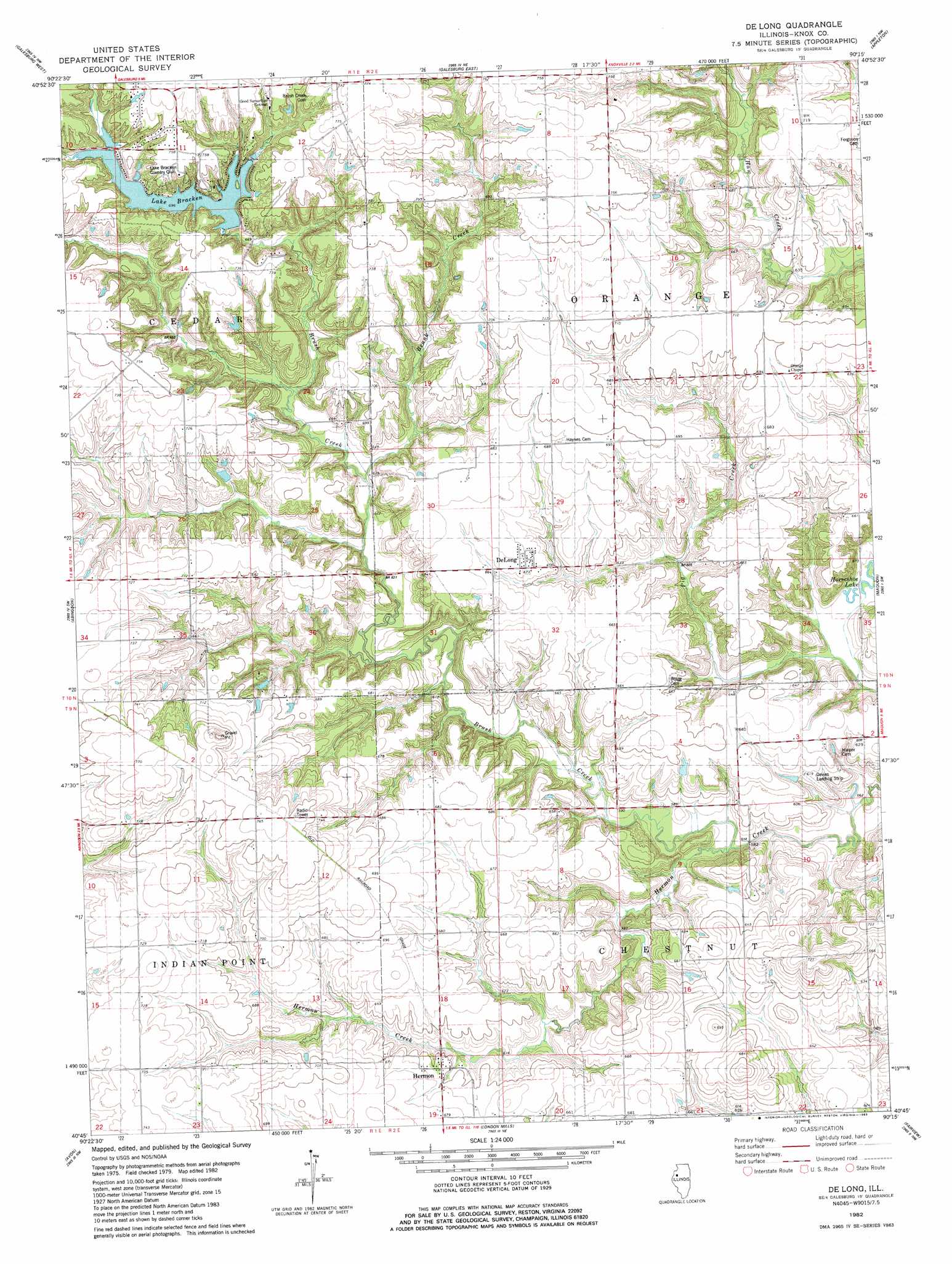
De Long Topo Map Illinois
To zoom in, hover over the map of De Long
USGS Topo Quad 40090g3 - 1:24,000 scale
| Topo Map Name: | De Long |
| USGS Topo Quad ID: | 40090g3 |
| Print Size: | ca. 21 1/4" wide x 27" high |
| Southeast Coordinates: | 40.75° N latitude / 90.25° W longitude |
| Map Center Coordinates: | 40.8125° N latitude / 90.3125° W longitude |
| U.S. State: | IL |
| Filename: | o40090g3.jpg |
| Download Map JPG Image: | De Long topo map 1:24,000 scale |
| Map Type: | Topographic |
| Topo Series: | 7.5´ |
| Map Scale: | 1:24,000 |
| Source of Map Images: | United States Geological Survey (USGS) |
| Alternate Map Versions: |
De Long IL 1982, updated 1983 Download PDF Buy paper map De Long IL 1998, updated 2001 Download PDF Buy paper map DeLong IL 2012 Download PDF Buy paper map DeLong IL 2015 Download PDF Buy paper map |
1:24,000 Topo Quads surrounding De Long
Alexis |
North Henderson |
Wataga |
Oneida |
Victoria |
Cameron |
Galesburg West |
Galesburg East |
Appleton |
Williamsfield |
Berwick |
Abingdon |
De Long |
Maquon |
Yates City |
Greenbush |
Avon |
London Mills |
Fairview |
Farmington West |
Bushnell West |
Bushnell East |
Blyton |
Fiatt |
Canton |
> Back to 40090e1 at 1:100,000 scale
> Back to 40090a1 at 1:250,000 scale
> Back to U.S. Topo Maps home
De Long topo map: Gazetteer
De Long: Airports
Davies Landing Strip elevation 188m 616′De Long: Dams
Lake Bracken Dam elevation 211m 692′De Long: Populated Places
Burnside (historical) elevation 201m 659′DeLong elevation 206m 675′
Hermon elevation 200m 656′
De Long: Post Offices
Delong Post Office (historical) elevation 206m 675′De Long: Reservoirs
Lake Bracken elevation 211m 692′De Long: Streams
Brunk Creek elevation 189m 620′Brush Creek elevation 174m 570′
De Long digital topo map on disk
Buy this De Long topo map showing relief, roads, GPS coordinates and other geographical features, as a high-resolution digital map file on DVD: