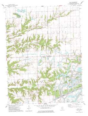
Fiatt Topo Map Illinois
To zoom in, hover over the map of Fiatt
USGS Topo Quad 40090e2 - 1:24,000 scale
| Topo Map Name: | Fiatt |
| USGS Topo Quad ID: | 40090e2 |
| Print Size: | ca. 21 1/4" wide x 27" high |
| Southeast Coordinates: | 40.5° N latitude / 90.125° W longitude |
| Map Center Coordinates: | 40.5625° N latitude / 90.1875° W longitude |
| U.S. State: | IL |
| Filename: | o40090e2.jpg |
| Download Map JPG Image: | Fiatt topo map 1:24,000 scale |
| Map Type: | Topographic |
| Topo Series: | 7.5´ |
| Map Scale: | 1:24,000 |
| Source of Map Images: | United States Geological Survey (USGS) |
| Alternate Map Versions: |
Fiatt IL 1974, updated 1978 Download PDF Buy paper map Fiatt IL 2012 Download PDF Buy paper map Fiatt IL 2015 Download PDF Buy paper map |
1:24,000 Topo Quads surrounding Fiatt
> Back to 40090e1 at 1:100,000 scale
> Back to 40090a1 at 1:250,000 scale
> Back to U.S. Topo Maps home
Fiatt topo map: Gazetteer
Fiatt: Dams
CBS Gun Club Lake Dam elevation 191m 626′Lake Marie Dam elevation 190m 623′
Long Lake Dam elevation 197m 646′
Traer Lake Dam elevation 187m 613′
Truax Lake Dam elevation 198m 649′
Wee Ma Tuk Lake Dam elevation 183m 600′
Wee-Ma-Tuk-Lake-South Dam elevation 198m 649′
Woods Lake Dam elevation 194m 636′
Fiatt: Mines
Seller Mine elevation 205m 672′Star Mine Number 1 elevation 193m 633′
Star Mine Number 2 elevation 177m 580′
Fiatt: Populated Places
Bybee elevation 208m 682′Fiatt elevation 205m 672′
Fiatt: Post Offices
Fiatt Post Office elevation 206m 675′Fiatt: Reservoirs
CBS Gun Club Lake elevation 191m 626′Fisher Lake elevation 198m 649′
Frog Lake elevation 201m 659′
Genes Pond elevation 207m 679′
Lake Louise elevation 199m 652′
Lake Marie elevation 190m 623′
Lake Wee-Ma-Tuk elevation 183m 600′
Long Lake elevation 197m 646′
Mason Lake elevation 200m 656′
Rose Lake elevation 196m 643′
Stevens Lake elevation 186m 610′
Swimming Lake elevation 184m 603′
Traer Lake elevation 187m 613′
Truax Lake elevation 198m 649′
Wee-Ma-Tuk-Lake-South elevation 198m 649′
Woods Lake elevation 194m 636′
Fiatt: Woods
Boyce Orchard elevation 199m 652′Pleasant Row Orchard elevation 202m 662′
Fiatt digital topo map on disk
Buy this Fiatt topo map showing relief, roads, GPS coordinates and other geographical features, as a high-resolution digital map file on DVD:


