Milan East Topo Map Missouri
To zoom in, hover over the map of Milan East
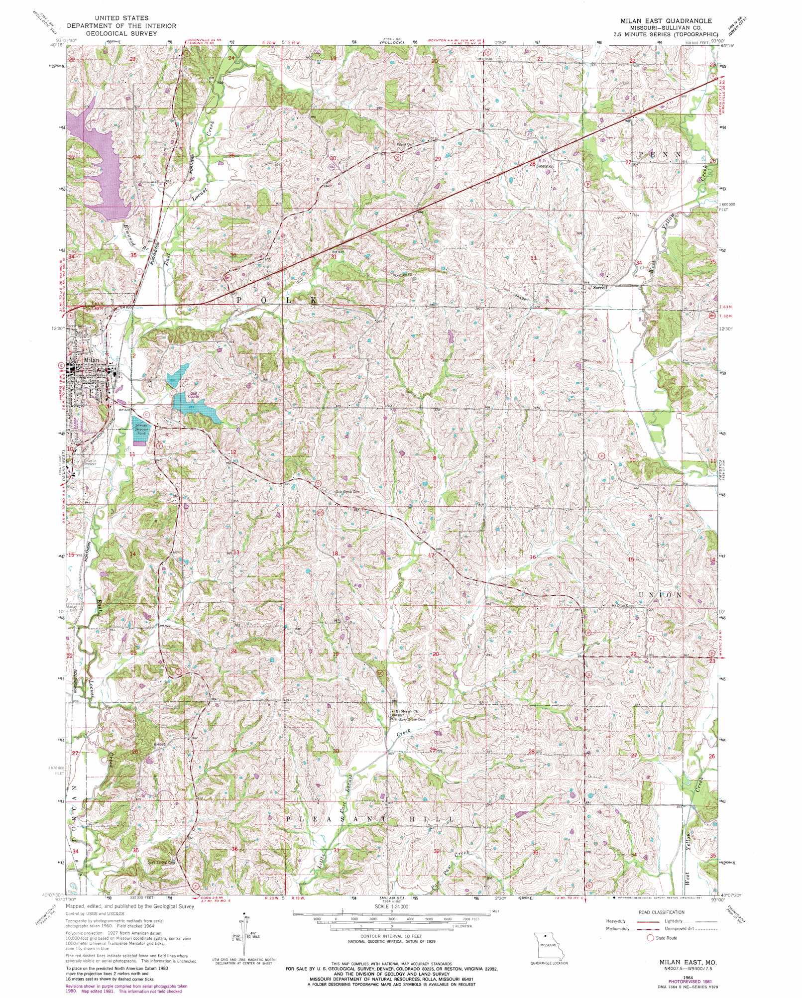
USGS Topo Quad 40093b1 - 1:24,000 scale
| Topo Map Name: | Milan East |
| USGS Topo Quad ID: | 40093b1 |
| Print Size: | ca. 21 1/4" wide x 27" high |
| Southeast Coordinates: | 40.125° N latitude / 93° W longitude |
| Map Center Coordinates: | 40.1875° N latitude / 93.0625° W longitude |
| U.S. State: | MO |
| Filename: | o40093b1.jpg |
| Download Map JPG Image: | Milan East topo map 1:24,000 scale |
| Map Type: | Topographic |
| Topo Series: | 7.5´ |
| Map Scale: | 1:24,000 |
| Source of Map Images: | United States Geological Survey (USGS) |
| Alternate Map Versions: |
Milan East MO 1964, updated 1965 Download PDF Buy paper map Milan East MO 1964, updated 1981 Download PDF Buy paper map Milan East MO 2012 Download PDF Buy paper map Milan East MO 2014 Download PDF Buy paper map |
1:24,000 Topo Quads surrounding Milan East
Lucerne |
Pollock Nw |
Unionville West |
Unionville East |
Graysville |
Harris |
Pollock Sw |
Pollock |
Green City |
Stahl |
Osgood |
Milan West |
Milan East |
Mystic |
Pure Air |
Lindley |
Browning |
Milan Se |
Winigan |
Nind |
Eversonville |
Linneus |
Shelby |
Bucklin Nw |
New Boston |
> Back to 40093a1 at 1:100,000 scale
> Back to 40092a1 at 1:250,000 scale
> Back to U.S. Topo Maps home
Milan East topo map: Gazetteer
Milan East: Dams
Elmwood City Lake Dam elevation 265m 869′Milan Lake Dam - South Dam elevation 262m 859′
Milan Lake Dam-North Dam elevation 262m 859′
Milan East: Populated Places
Sorrell elevation 281m 921′Milan East: Post Offices
Sorrell Post Office elevation 281m 921′Milan East: Reservoirs
City of Milan Lake elevation 262m 859′New Milan Reservoir elevation 265m 869′
Number 41 Lake elevation 262m 859′
Milan East: Streams
Elmwood Branch elevation 253m 830′Milan East digital topo map on disk
Buy this Milan East topo map showing relief, roads, GPS coordinates and other geographical features, as a high-resolution digital map file on DVD: