Stahl Topo Map Missouri
To zoom in, hover over the map of Stahl
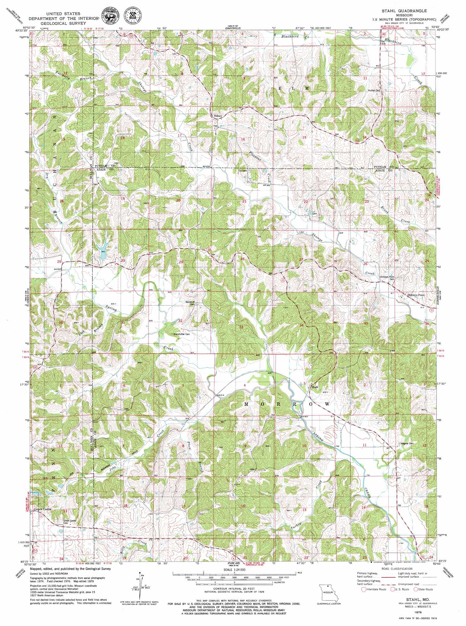
USGS Topo Quad 40092c7 - 1:24,000 scale
| Topo Map Name: | Stahl |
| USGS Topo Quad ID: | 40092c7 |
| Print Size: | ca. 21 1/4" wide x 27" high |
| Southeast Coordinates: | 40.25° N latitude / 92.75° W longitude |
| Map Center Coordinates: | 40.3125° N latitude / 92.8125° W longitude |
| U.S. State: | MO |
| Filename: | o40092c7.jpg |
| Download Map JPG Image: | Stahl topo map 1:24,000 scale |
| Map Type: | Topographic |
| Topo Series: | 7.5´ |
| Map Scale: | 1:24,000 |
| Source of Map Images: | United States Geological Survey (USGS) |
| Alternate Map Versions: |
Green City SE MO 1974, updated 1976 Download PDF Buy paper map Stahl MO 2012 Download PDF Buy paper map Stahl MO 2015 Download PDF Buy paper map |
1:24,000 Topo Quads surrounding Stahl
Lake Thunderhead |
Mendota |
Omaha |
Coatsville |
Lancaster |
Unionville West |
Unionville East |
Graysville |
Livonia |
Queen City |
Pollock |
Green City |
Stahl |
Connelsville |
Greentop |
Milan East |
Mystic |
Pure Air |
Novinger |
Kirksville |
Milan Se |
Winigan |
Nind |
Gifford |
Millard |
> Back to 40092a1 at 1:100,000 scale
> Back to 40092a1 at 1:250,000 scale
> Back to U.S. Topo Maps home
Stahl topo map: Gazetteer
Stahl: Dams
Spring Creek Ranch Dam elevation 269m 882′Stahl: Populated Places
Shibleys Point elevation 259m 849′Sidney elevation 300m 984′
Stahl elevation 263m 862′
Stahl: Reservoirs
Spring Creek Ranch Lake elevation 269m 882′Stahl: Streams
Dry Branch elevation 256m 839′Featherly Branch elevation 274m 898′
Jobs Creek elevation 244m 800′
Lick Branch elevation 254m 833′
Pleasant Creek elevation 262m 859′
Plum Branch elevation 248m 813′
Turkey Creek elevation 238m 780′
Stahl digital topo map on disk
Buy this Stahl topo map showing relief, roads, GPS coordinates and other geographical features, as a high-resolution digital map file on DVD: