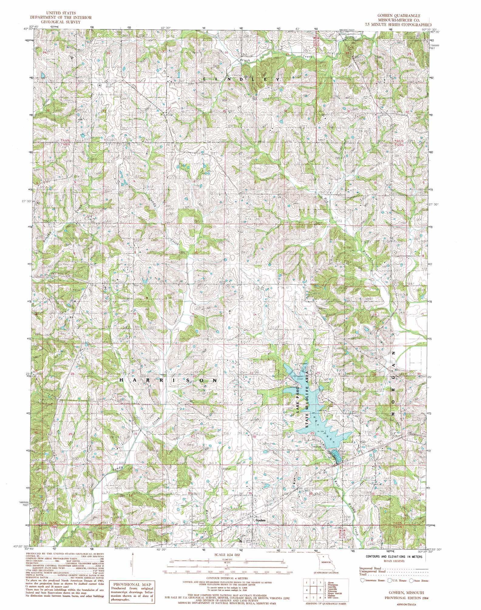
Goshen Topo Map Missouri
To zoom in, hover over the map of Goshen
USGS Topo Quad 40093d6 - 1:24,000 scale
| Topo Map Name: | Goshen |
| USGS Topo Quad ID: | 40093d6 |
| Print Size: | ca. 21 1/4" wide x 27" high |
| Southeast Coordinates: | 40.375° N latitude / 93.625° W longitude |
| Map Center Coordinates: | 40.4375° N latitude / 93.6875° W longitude |
| U.S. State: | MO |
| Filename: | o40093d6.jpg |
| Download Map JPG Image: | Goshen topo map 1:24,000 scale |
| Map Type: | Topographic |
| Topo Series: | 7.5´ |
| Map Scale: | 1:24,000 |
| Source of Map Images: | United States Geological Survey (USGS) |
| Alternate Map Versions: |
Goshen MO 1984, updated 1985 Download PDF Buy paper map Goshen MO 2012 Download PDF Buy paper map Goshen MO 2014 Download PDF Buy paper map |
1:24,000 Topo Quads surrounding Goshen
Lamoni North |
Davis City |
Leon |
Woodland |
Clio |
Lamoni South |
Akron |
Pleasanton |
Lineville |
Cleopatra |
Eagleville |
Cainsville |
Goshen |
Princeton |
Ravanna |
Gardner |
Mount Moriah |
Modena |
Mill Grove |
Half Rock |
Gilman City West |
Gilman City East |
Brimson |
Spickard |
Galt |
> Back to 40093a1 at 1:100,000 scale
> Back to 40092a1 at 1:250,000 scale
> Back to U.S. Topo Maps home
Goshen topo map: Gazetteer
Goshen: Dams
Campbell Lake Dam elevation 299m 980′Lake Paho Dam elevation 285m 935′
Goshen: Parks
Lake Paho State Wildlife Area elevation 286m 938′Goshen: Populated Places
Goshen elevation 314m 1030′Goshen: Reservoirs
Campbell Lake elevation 299m 980′Lake Paho elevation 285m 935′
Goshen digital topo map on disk
Buy this Goshen topo map showing relief, roads, GPS coordinates and other geographical features, as a high-resolution digital map file on DVD: