Sunken Lake Topo Map Colorado
To zoom in, hover over the map of Sunken Lake
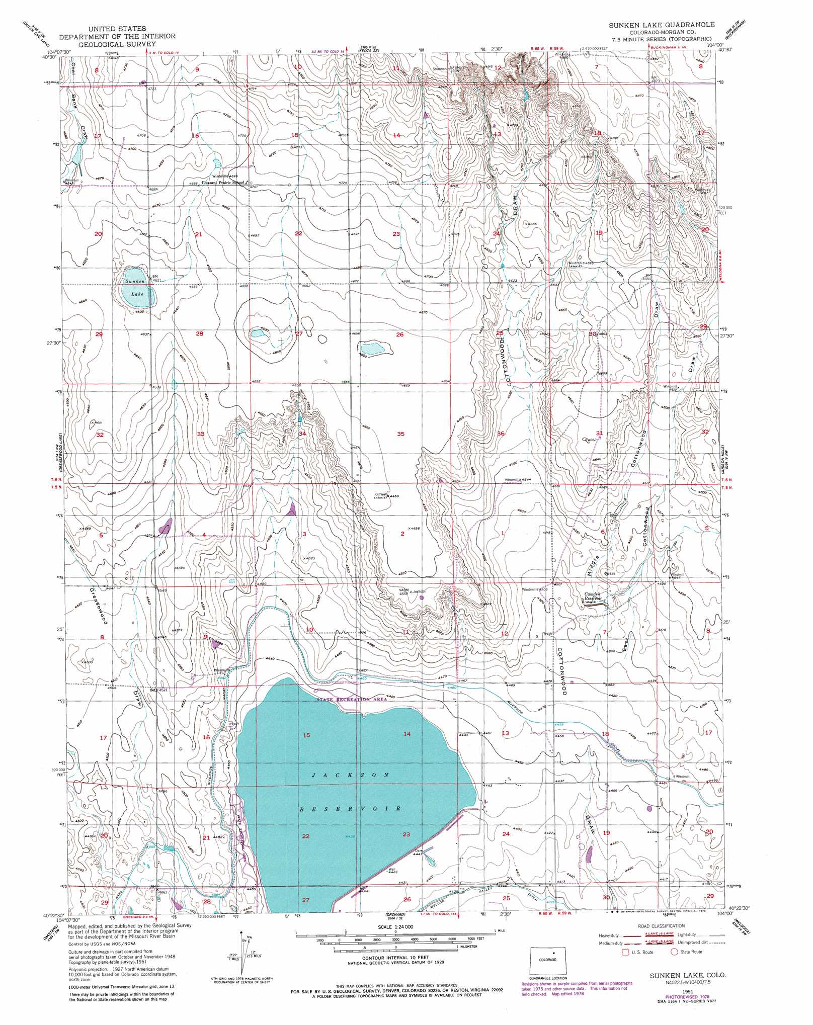
USGS Topo Quad 40104d1 - 1:24,000 scale
| Topo Map Name: | Sunken Lake |
| USGS Topo Quad ID: | 40104d1 |
| Print Size: | ca. 21 1/4" wide x 27" high |
| Southeast Coordinates: | 40.375° N latitude / 104° W longitude |
| Map Center Coordinates: | 40.4375° N latitude / 104.0625° W longitude |
| U.S. State: | CO |
| Filename: | o40104d1.jpg |
| Download Map JPG Image: | Sunken Lake topo map 1:24,000 scale |
| Map Type: | Topographic |
| Topo Series: | 7.5´ |
| Map Scale: | 1:24,000 |
| Source of Map Images: | United States Geological Survey (USGS) |
| Alternate Map Versions: |
Sunken Lake CO 1951, updated 1952 Download PDF Buy paper map Sunken Lake CO 1951, updated 1974 Download PDF Buy paper map Sunken Lake CO 2010 Download PDF Buy paper map Sunken Lake CO 2013 Download PDF Buy paper map Sunken Lake CO 2016 Download PDF Buy paper map |
1:24,000 Topo Quads surrounding Sunken Lake
Briggsdale |
Keota Nw |
Keota |
Raymer Nw |
Raymer Ne |
Fosston |
Dutch Girl Lake |
Keota Se |
Buckingham |
Raymer |
Point Of Rocks |
Greasewood Lake |
Sunken Lake |
Judson Hills |
Peace Valley School |
Dearfield |
Masters |
Orchard |
Weldona |
Fort Morgan |
Roggen |
Omar |
Wiggins |
Vallery |
Lamb |
> Back to 40104a1 at 1:100,000 scale
> Back to 40104a1 at 1:250,000 scale
> Back to U.S. Topo Maps home
Sunken Lake topo map: Gazetteer
Sunken Lake: Canals
Riverside Intake Canal elevation 1362m 4468′Sunken Lake: Dams
Wickstrom Dam elevation 1443m 4734′Sunken Lake: Lakes
Sunken Lake elevation 1413m 4635′Sunken Lake: Reservoirs
Camden Reservoir elevation 1379m 4524′Jackson Reservoir elevation 1352m 4435′
Wickstrom Reservoir elevation 1443m 4734′
Sunken Lake: Valleys
East Cottonwood Draw elevation 1370m 4494′Middle Cottonwood Draw elevation 1370m 4494′
Sunken Lake digital topo map on disk
Buy this Sunken Lake topo map showing relief, roads, GPS coordinates and other geographical features, as a high-resolution digital map file on DVD: