Greasewood Lake Topo Map Colorado
To zoom in, hover over the map of Greasewood Lake
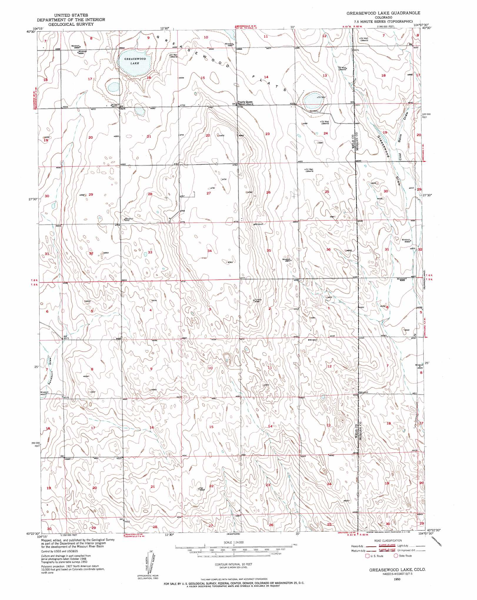
USGS Topo Quad 40104d2 - 1:24,000 scale
| Topo Map Name: | Greasewood Lake |
| USGS Topo Quad ID: | 40104d2 |
| Print Size: | ca. 21 1/4" wide x 27" high |
| Southeast Coordinates: | 40.375° N latitude / 104.125° W longitude |
| Map Center Coordinates: | 40.4375° N latitude / 104.1875° W longitude |
| U.S. State: | CO |
| Filename: | o40104d2.jpg |
| Download Map JPG Image: | Greasewood Lake topo map 1:24,000 scale |
| Map Type: | Topographic |
| Topo Series: | 7.5´ |
| Map Scale: | 1:24,000 |
| Source of Map Images: | United States Geological Survey (USGS) |
| Alternate Map Versions: |
Greasewood Lake CO 1950, updated 1952 Download PDF Buy paper map Greasewood Lake CO 2010 Download PDF Buy paper map Greasewood Lake CO 2013 Download PDF Buy paper map Greasewood Lake CO 2016 Download PDF Buy paper map |
1:24,000 Topo Quads surrounding Greasewood Lake
Baker Draw |
Briggsdale |
Keota Nw |
Keota |
Raymer Nw |
Cornish |
Fosston |
Dutch Girl Lake |
Keota Se |
Buckingham |
Barnesville |
Point Of Rocks |
Greasewood Lake |
Sunken Lake |
Judson Hills |
Hardin |
Dearfield |
Masters |
Orchard |
Weldona |
Tampa |
Roggen |
Omar |
Wiggins |
Vallery |
> Back to 40104a1 at 1:100,000 scale
> Back to 40104a1 at 1:250,000 scale
> Back to U.S. Topo Maps home
Greasewood Lake topo map: Gazetteer
Greasewood Lake: Flats
Greasewood Flats elevation 1428m 4685′Greasewood Lake: Lakes
Greasewood Lake elevation 1418m 4652′Greasewood Lake: Mines
Patterson Well Mine elevation 1432m 4698′Greasewood Lake: Valleys
Coal Bank Draw elevation 1396m 4580′Greasewood Lake digital topo map on disk
Buy this Greasewood Lake topo map showing relief, roads, GPS coordinates and other geographical features, as a high-resolution digital map file on DVD: