Cherokee Park Topo Map Colorado
To zoom in, hover over the map of Cherokee Park
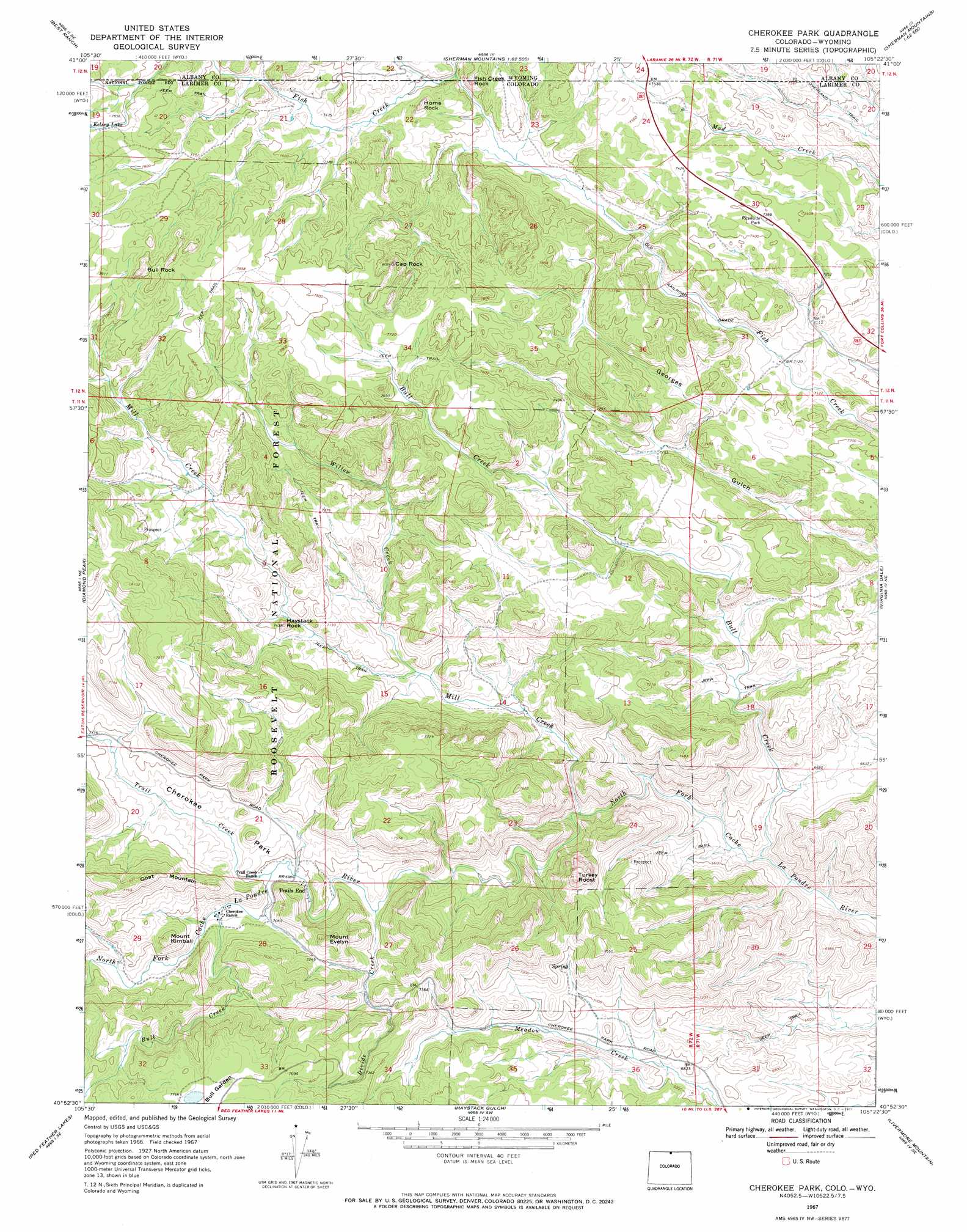
USGS Topo Quad 40105h4 - 1:24,000 scale
| Topo Map Name: | Cherokee Park |
| USGS Topo Quad ID: | 40105h4 |
| Print Size: | ca. 21 1/4" wide x 27" high |
| Southeast Coordinates: | 40.875° N latitude / 105.375° W longitude |
| Map Center Coordinates: | 40.9375° N latitude / 105.4375° W longitude |
| U.S. States: | CO, WY |
| Filename: | o40105h4.jpg |
| Download Map JPG Image: | Cherokee Park topo map 1:24,000 scale |
| Map Type: | Topographic |
| Topo Series: | 7.5´ |
| Map Scale: | 1:24,000 |
| Source of Map Images: | United States Geological Survey (USGS) |
| Alternate Map Versions: |
Cherokee Park CO 1967, updated 1971 Download PDF Buy paper map Cherokee Park CO 2011 Download PDF Buy paper map Cherokee Park CO 2013 Download PDF Buy paper map Cherokee Park CO 2016 Download PDF Buy paper map |
| FStopo: | US Forest Service topo Cherokee Park is available: Download FStopo PDF Download FStopo TIF |
1:24,000 Topo Quads surrounding Cherokee Park
Hutton Lake |
Red Buttes |
Sherman Mountains West |
Sherman Mountains East |
Hecla |
Johnson Ranch |
Best Ranch |
Dale Creek |
Buford |
Granite |
Eaton Reservoir |
Diamond Peak |
Cherokee Park |
Virginia Dale |
Table Mountain |
South Bald Mountain |
Red Feather Lakes |
Haystack Gulch |
Livermore Mountain |
Livermore |
Kinikinik |
Rustic |
Big Narrows |
Poudre Park |
Laporte |
> Back to 40105e1 at 1:100,000 scale
> Back to 40104a1 at 1:250,000 scale
> Back to U.S. Topo Maps home
Cherokee Park topo map: Gazetteer
Cherokee Park: Flats
Bull Garden elevation 2361m 7746′Cherokee Park elevation 2164m 7099′
Cherokee Park: Mines
Copper King Group elevation 2154m 7066′Copper King Group Mine elevation 2154m 7066′
Langford Copper Mine elevation 2306m 7565′
Langford of Trail Creek Iron Mine elevation 2306m 7565′
Cherokee Park: Pillars
Bull Rock elevation 2472m 8110′Cap Rock elevation 2428m 7965′
Fish Creek Rock elevation 2354m 7723′
Haystack Rock elevation 2247m 7372′
Home Rock elevation 2335m 7660′
Cherokee Park: Streams
Bull Creek elevation 2147m 7043′Devils Creek elevation 2195m 7201′
Divide Creek elevation 2102m 6896′
Fish Creek elevation 2334m 7657′
Mill Creek elevation 2026m 6646′
Trail Creek elevation 2131m 6991′
Willow Creek elevation 2104m 6902′
Cherokee Park: Summits
Goat Mountain elevation 2370m 7775′Mount Evelyn elevation 2295m 7529′
Mount Kimball elevation 2306m 7565′
Turkey Roost elevation 2357m 7732′
Cherokee Park digital topo map on disk
Buy this Cherokee Park topo map showing relief, roads, GPS coordinates and other geographical features, as a high-resolution digital map file on DVD: