Myton Sw Topo Map Utah
To zoom in, hover over the map of Myton Sw
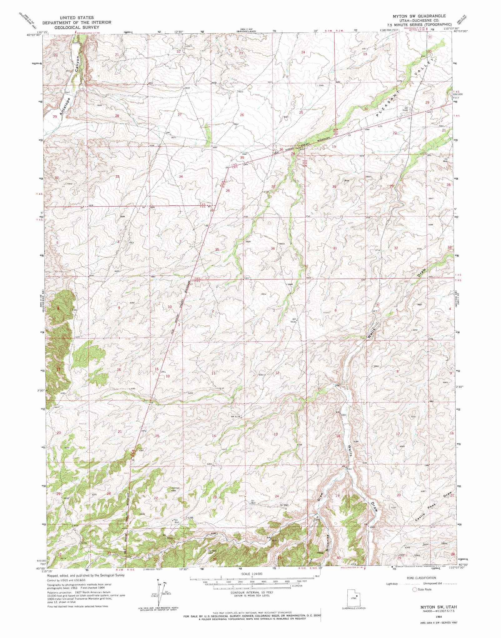
USGS Topo Quad 40110a2 - 1:24,000 scale
| Topo Map Name: | Myton Sw |
| USGS Topo Quad ID: | 40110a2 |
| Print Size: | ca. 21 1/4" wide x 27" high |
| Southeast Coordinates: | 40° N latitude / 110.125° W longitude |
| Map Center Coordinates: | 40.0625° N latitude / 110.1875° W longitude |
| U.S. State: | UT |
| Filename: | o40110a2.jpg |
| Download Map JPG Image: | Myton Sw topo map 1:24,000 scale |
| Map Type: | Topographic |
| Topo Series: | 7.5´ |
| Map Scale: | 1:24,000 |
| Source of Map Images: | United States Geological Survey (USGS) |
| Alternate Map Versions: |
Myton SW UT 1964, updated 1966 Download PDF Buy paper map Myton SW UT 2010 Download PDF Buy paper map Myton SW UT 2014 Download PDF Buy paper map |
1:24,000 Topo Quads surrounding Myton Sw
Talmage |
Altamont |
Bluebell |
Hancock Cove |
Roosevelt |
Duchesne |
Duchesne Ne |
Bridgeland |
Myton |
Windy Ridge |
Duchesne Sw |
Duchesne Se |
Myton Sw |
Myton Se |
Pariette Draw Sw |
Anthro Mountain |
Anthro Mountain Ne |
Gilsonite Draw |
Wilkin Ridge |
Crow Knoll |
Wood Canyon |
Currant Canyon |
Cowboy Bench |
Pinnacle Canyon |
Duches Hole |
> Back to 40110a1 at 1:100,000 scale
> Back to 40110a1 at 1:250,000 scale
> Back to U.S. Topo Maps home
Myton Sw digital topo map on disk
Buy this Myton Sw topo map showing relief, roads, GPS coordinates and other geographical features, as a high-resolution digital map file on DVD: