Termo Topo Map California
To zoom in, hover over the map of Termo
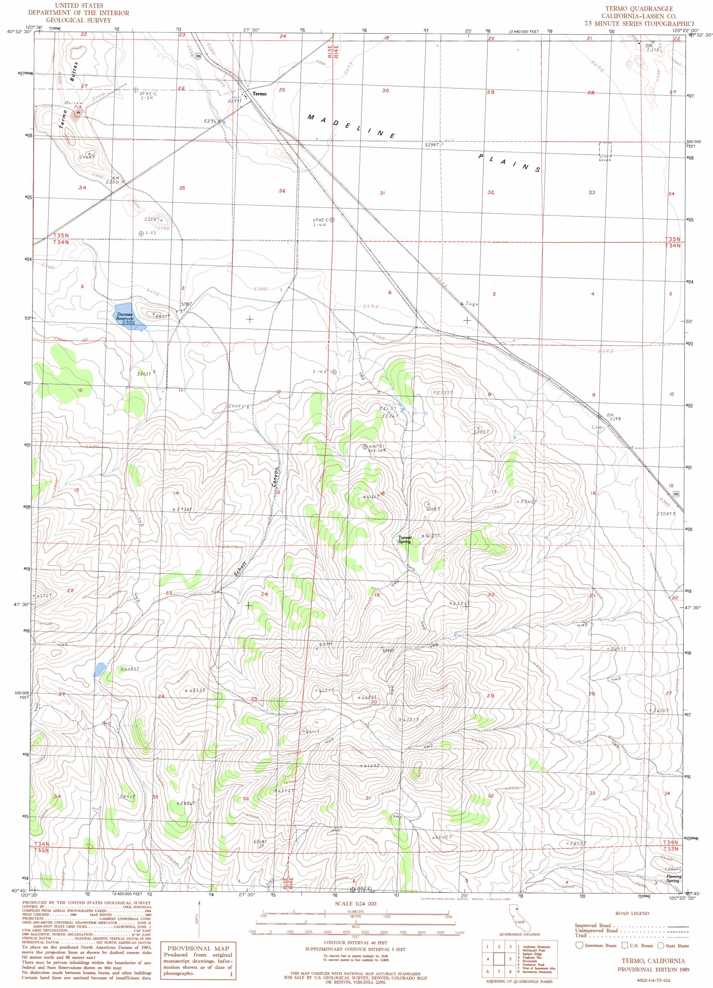
USGS Topo Quad 40120g4 - 1:24,000 scale
| Topo Map Name: | Termo |
| USGS Topo Quad ID: | 40120g4 |
| Print Size: | ca. 21 1/4" wide x 27" high |
| Southeast Coordinates: | 40.75° N latitude / 120.375° W longitude |
| Map Center Coordinates: | 40.8125° N latitude / 120.4375° W longitude |
| U.S. State: | CA |
| Filename: | o40120g4.jpg |
| Download Map JPG Image: | Termo topo map 1:24,000 scale |
| Map Type: | Topographic |
| Topo Series: | 7.5´ |
| Map Scale: | 1:24,000 |
| Source of Map Images: | United States Geological Survey (USGS) |
| Alternate Map Versions: |
Termo CA 1989, updated 1989 Download PDF Buy paper map Termo CA 2012 Download PDF Buy paper map Termo CA 2015 Download PDF Buy paper map |
1:24,000 Topo Quads surrounding Termo
Ash Valley |
Holbrook Canyon |
Madeline |
Cold Spring Mountain |
Boot Lake |
Whitinger Mountain |
Anderson Mountain |
Mcdonald Peak |
Juniper Ridge |
Dodge Reservoir |
Grasshopper Valley |
Cleghorn Flat |
Termo |
Ravendale |
Observation Peak |
Troxel Point |
Fredonyer Peak |
West Of Snowstorm Mountain |
Snowstorm Mountain |
Shinn Mountain |
Gallatin Peak |
Tunnison Mountain |
Petes Valley |
Karlo |
Five Springs |
> Back to 40120e1 at 1:100,000 scale
> Back to 40120a1 at 1:250,000 scale
> Back to U.S. Topo Maps home
Termo topo map: Gazetteer
Termo: Dams
Antelope 1249-003 Dam elevation 1618m 5308′Termo: Plains
Madeline Plains elevation 1615m 5298′Termo: Populated Places
Termo elevation 1617m 5305′Termo: Reservoirs
Ducasse Reservoir elevation 1618m 5308′Termo: Springs
Fleming Spring elevation 1676m 5498′Tunnel Spring elevation 1819m 5967′
Termo: Summits
Termo Buttes elevation 1623m 5324′Termo: Valleys
Schott Canyon elevation 1655m 5429′Termo digital topo map on disk
Buy this Termo topo map showing relief, roads, GPS coordinates and other geographical features, as a high-resolution digital map file on DVD: