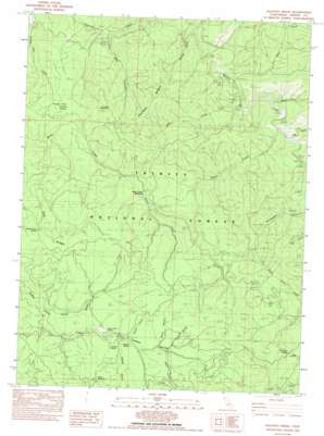
Halfway Ridge Topo Map California
To zoom in, hover over the map of Halfway Ridge
USGS Topo Quad 40123e3 - 1:24,000 scale
| Topo Map Name: | Halfway Ridge |
| USGS Topo Quad ID: | 40123e3 |
| Print Size: | ca. 21 1/4" wide x 27" high |
| Southeast Coordinates: | 40.5° N latitude / 123.25° W longitude |
| Map Center Coordinates: | 40.5625° N latitude / 123.3125° W longitude |
| U.S. State: | CA |
| Filename: | o40123e3.jpg |
| Download Map JPG Image: | Halfway Ridge topo map 1:24,000 scale |
| Map Type: | Topographic |
| Topo Series: | 7.5´ |
| Map Scale: | 1:24,000 |
| Source of Map Images: | United States Geological Survey (USGS) |
| Alternate Map Versions: |
Halfway Ridge CA 1982, updated 1982 Download PDF Buy paper map Halfway Ridge CA 1982, updated 1986 Download PDF Buy paper map Halfway Ridge CA 1998, updated 2003 Download PDF Buy paper map Halfway Ridge CA 2012 Download PDF Buy paper map Halfway Ridge CA 2015 Download PDF Buy paper map |
| FStopo: | US Forest Service topo Halfway Ridge is available: Download FStopo PDF Download FStopo TIF |
1:24,000 Topo Quads surrounding Halfway Ridge
> Back to 40123e1 at 1:100,000 scale
> Back to 40122a1 at 1:250,000 scale
> Back to U.S. Topo Maps home
Halfway Ridge topo map: Gazetteer
Halfway Ridge: Flats
Butter Creek Meadows elevation 1174m 3851′Grassy Flat elevation 1031m 3382′
Springtime Flat elevation 1017m 3336′
Halfway Ridge: Forests
Trinity National Forest elevation 1295m 4248′Halfway Ridge: Ridges
Halfway Ridge elevation 1266m 4153′Oak Ridge elevation 1337m 4386′
Halfway Ridge: Springs
Fir Root Spring elevation 1034m 3392′Jim River Spring elevation 1105m 3625′
Sardine Spring elevation 1223m 4012′
Sheep Camp Springs elevation 1331m 4366′
Vaughn Spring elevation 1208m 3963′
Halfway Ridge: Streams
Bear Creek elevation 618m 2027′James Creek elevation 651m 2135′
Jud Creek elevation 638m 2093′
Little Creek elevation 662m 2171′
Rusch Creek elevation 659m 2162′
Halfway Ridge: Summits
Friend Mountain elevation 1363m 4471′Grassy Mountain elevation 1274m 4179′
Halfway Ridge: Valleys
Big Canyon elevation 613m 2011′Buck Gulch elevation 1233m 4045′
Corral Gulch elevation 1171m 3841′
Cow Gulch elevation 1235m 4051′
Dinner Gulch elevation 626m 2053′
Green Gulch elevation 1209m 3966′
Indian Valley elevation 1180m 3871′
Rail Gulch elevation 1230m 4035′
Sheep Gulch elevation 1210m 3969′
Halfway Ridge digital topo map on disk
Buy this Halfway Ridge topo map showing relief, roads, GPS coordinates and other geographical features, as a high-resolution digital map file on DVD:


