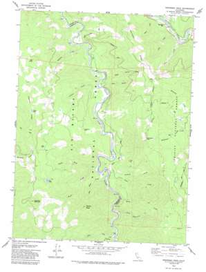
Hennessy Peak Topo Map California
To zoom in, hover over the map of Hennessy Peak
USGS Topo Quad 40123g5 - 1:24,000 scale
| Topo Map Name: | Hennessy Peak |
| USGS Topo Quad ID: | 40123g5 |
| Print Size: | ca. 21 1/4" wide x 27" high |
| Southeast Coordinates: | 40.75° N latitude / 123.5° W longitude |
| Map Center Coordinates: | 40.8125° N latitude / 123.5625° W longitude |
| U.S. State: | CA |
| Filename: | o40123g5.jpg |
| Download Map JPG Image: | Hennessy Peak topo map 1:24,000 scale |
| Map Type: | Topographic |
| Topo Series: | 7.5´ |
| Map Scale: | 1:24,000 |
| Source of Map Images: | United States Geological Survey (USGS) |
| Alternate Map Versions: |
Hennessy Peak CA 1979, updated 1985 Download PDF Buy paper map Hennessy Peak CA 1997, updated 2001 Download PDF Buy paper map Hennessy Peak CA 2012 Download PDF Buy paper map Hennessy Peak CA 2015 Download PDF Buy paper map |
| FStopo: | US Forest Service topo Hennessy Peak is available: Download FStopo PDF Download FStopo TIF |
1:24,000 Topo Quads surrounding Hennessy Peak
> Back to 40123e1 at 1:100,000 scale
> Back to 40122a1 at 1:250,000 scale
> Back to U.S. Topo Maps home
Hennessy Peak topo map: Gazetteer
Hennessy Peak: Bars
Hawkins Bar elevation 221m 725′Hennessy Peak: Lakes
Big Lake elevation 971m 3185′Dry Lake elevation 830m 2723′
Sucker Lake elevation 992m 3254′
Hennessy Peak: Pillars
Castle Rock elevation 1407m 4616′Hennessy Peak: Populated Places
Hawkins Bar elevation 235m 770′Hennessy Peak: Ridges
Hennessy Ridge elevation 779m 2555′Hogback Ridge elevation 1076m 3530′
Hennessy Peak: Streams
Ammon Creek elevation 200m 656′Coon Creek elevation 226m 741′
Cow Creek elevation 224m 734′
Gary Creek elevation 257m 843′
Gray Creek elevation 189m 620′
Hells Half Acre Creek elevation 245m 803′
Icebox Creek elevation 164m 538′
Little Mingo Creek elevation 251m 823′
Mahata Creek elevation 178m 583′
McAlister Creek elevation 258m 846′
Mingo Creek elevation 208m 682′
North Fork Mingo Creek elevation 278m 912′
Pony Creek elevation 178m 583′
Surprise Creek elevation 225m 738′
Hennessy Peak: Summits
Gainor Peak elevation 1043m 3421′Hennessy Peak elevation 1126m 3694′
Oak Knob elevation 934m 3064′
Sugarloaf Mountain elevation 1178m 3864′
Hennessy Peak: Valleys
Deep Gulch elevation 218m 715′Dry Gulch elevation 240m 787′
Hennessy Peak digital topo map on disk
Buy this Hennessy Peak topo map showing relief, roads, GPS coordinates and other geographical features, as a high-resolution digital map file on DVD:


