Overlook Hill Topo Map Wyoming
To zoom in, hover over the map of Overlook Hill
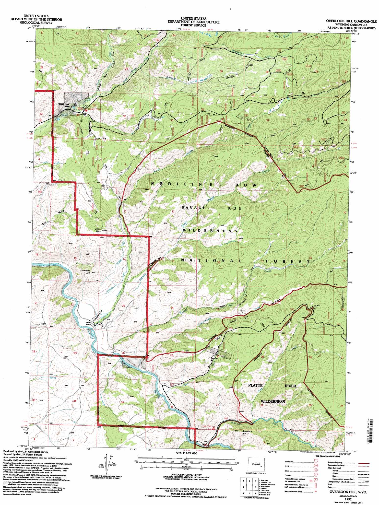
USGS Topo Quad 41106b4 - 1:24,000 scale
| Topo Map Name: | Overlook Hill |
| USGS Topo Quad ID: | 41106b4 |
| Print Size: | ca. 21 1/4" wide x 27" high |
| Southeast Coordinates: | 41.125° N latitude / 106.375° W longitude |
| Map Center Coordinates: | 41.1875° N latitude / 106.4375° W longitude |
| U.S. State: | WY |
| Filename: | o41106b4.jpg |
| Download Map JPG Image: | Overlook Hill topo map 1:24,000 scale |
| Map Type: | Topographic |
| Topo Series: | 7.5´ |
| Map Scale: | 1:24,000 |
| Source of Map Images: | United States Geological Survey (USGS) |
| Alternate Map Versions: |
Overlook Hill WY 1961, updated 1963 Download PDF Buy paper map Overlook Hill WY 1961, updated 1967 Download PDF Buy paper map Overlook Hill WY 1961, updated 1984 Download PDF Buy paper map Overlook Hill WY 1992, updated 1996 Download PDF Buy paper map Overlook Hill WY 2012 Download PDF Buy paper map Overlook Hill WY 2015 Download PDF Buy paper map |
| FStopo: | US Forest Service topo Overlook Hill is available: Download FStopo PDF Download FStopo TIF |
1:24,000 Topo Quads surrounding Overlook Hill
Finley Reservoir |
Kennaday Peak |
Turpin Reservoir |
Sand Lake |
Morgan |
Cow Creek |
Ryan Park |
Phantom Lake |
Medicine Bow Peak |
Centennial |
Gunst Reservoir |
Barcus Peak |
Overlook Hill |
Keystone |
Albany |
Blackhall Mountain |
Trent Creek |
Elkhorn Point |
Horatio Rock |
Foxpark |
Davis Peak |
Pearl |
Independence Mountain |
Northgate |
Kings Canyon |
> Back to 41106a1 at 1:100,000 scale
> Back to 41106a1 at 1:250,000 scale
> Back to U.S. Topo Maps home
Overlook Hill topo map: Gazetteer
Overlook Hill: Canals
Anderson Ditch elevation 2324m 7624′Hubbell Ditch elevation 2377m 7798′
Overlook Hill: Streams
Boat Creek elevation 2255m 7398′Cottonwood Creek elevation 2254m 7395′
Douglas Creek elevation 2266m 7434′
Mullen Creek elevation 2243m 7358′
North French Creek elevation 2377m 7798′
North Mullen Creek elevation 2287m 7503′
Savage Run Creek elevation 2245m 7365′
Sheep Creek elevation 2302m 7552′
Sourdough Creek elevation 2431m 7975′
South French Creek elevation 2378m 7801′
South Mullen Creek elevation 2292m 7519′
Overlook Hill: Summits
Overlook Hill elevation 2478m 8129′Stovepipe Hill elevation 2492m 8175′
Overlook Hill digital topo map on disk
Buy this Overlook Hill topo map showing relief, roads, GPS coordinates and other geographical features, as a high-resolution digital map file on DVD:
Eastern Wyoming & Western South Dakota
Buy digital topo maps: Eastern Wyoming & Western South Dakota