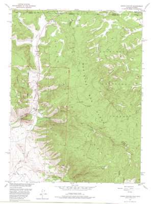
Kings Canyon Topo Map Colorado
To zoom in, hover over the map of Kings Canyon
USGS Topo Quad 40106h2 - 1:24,000 scale
| Topo Map Name: | Kings Canyon |
| USGS Topo Quad ID: | 40106h2 |
| Print Size: | ca. 21 1/4" wide x 27" high |
| Southeast Coordinates: | 40.875° N latitude / 106.125° W longitude |
| Map Center Coordinates: | 40.9375° N latitude / 106.1875° W longitude |
| U.S. States: | CO, WY |
| Filename: | o40106h2.jpg |
| Download Map JPG Image: | Kings Canyon topo map 1:24,000 scale |
| Map Type: | Topographic |
| Topo Series: | 7.5´ |
| Map Scale: | 1:24,000 |
| Source of Map Images: | United States Geological Survey (USGS) |
| Alternate Map Versions: |
Kings Canyon CO 1950, updated 1959 Download PDF Buy paper map Kings Canyon CO 1950, updated 1959 Download PDF Buy paper map Kings Canyon CO 1950, updated 1969 Download PDF Buy paper map Kings Canyon CO 1950, updated 1975 Download PDF Buy paper map Kings Canyon CO 1952 Download PDF Buy paper map Kings Canyon CO 1952 Download PDF Buy paper map Kings Canyon CO 2011 Download PDF Buy paper map Kings Canyon CO 2013 Download PDF Buy paper map Kings Canyon CO 2016 Download PDF Buy paper map |
| FStopo: | US Forest Service topo Kings Canyon is available: Download FStopo PDF Download FStopo TIF |
1:24,000 Topo Quads surrounding Kings Canyon
> Back to 40106e1 at 1:100,000 scale
> Back to 40106a1 at 1:250,000 scale
> Back to U.S. Topo Maps home
Kings Canyon topo map: Gazetteer
Kings Canyon: Canals
Allard Ditch elevation 2598m 8523′Government Ditch Number 2 elevation 2476m 8123′
Hardwork Ditch elevation 2581m 8467′
Terrel Ditch elevation 2669m 8756′
Kings Canyon: Flats
Bluebird Park elevation 2610m 8562′Clayton Park elevation 2553m 8375′
Kings Canyon: Mines
Kings Canyon Mine elevation 2752m 9028′Village Belle Mine elevation 2914m 9560′
Kings Canyon: Populated Places
Kings Canyon elevation 2559m 8395′Kings Canyon: Streams
Heidrich Creek elevation 2627m 8618′Lawrence Creek elevation 2540m 8333′
Little Government Creek elevation 2463m 8080′
Sutton Creek elevation 2836m 9304′
Village Belle Creek elevation 2572m 8438′
Kings Canyon: Valleys
Bear Draw elevation 2622m 8602′Kings Canyon elevation 2500m 8202′
Kings Canyon digital topo map on disk
Buy this Kings Canyon topo map showing relief, roads, GPS coordinates and other geographical features, as a high-resolution digital map file on DVD:


